You've fished at Frosty Hollow Pond in spring. Discover how much fun it can be in fall.
EXETER – Frosty Hollow Pond is a busy spot on opening day of the freshwater fishing season in the spring. Dozens of youngsters line the grassy banks of the tiny pond, where fishing is restricted to kids no older than 14. Many are casting lines for the first time, and the lucky ones will catch their first trout. It’s an exciting place to be.
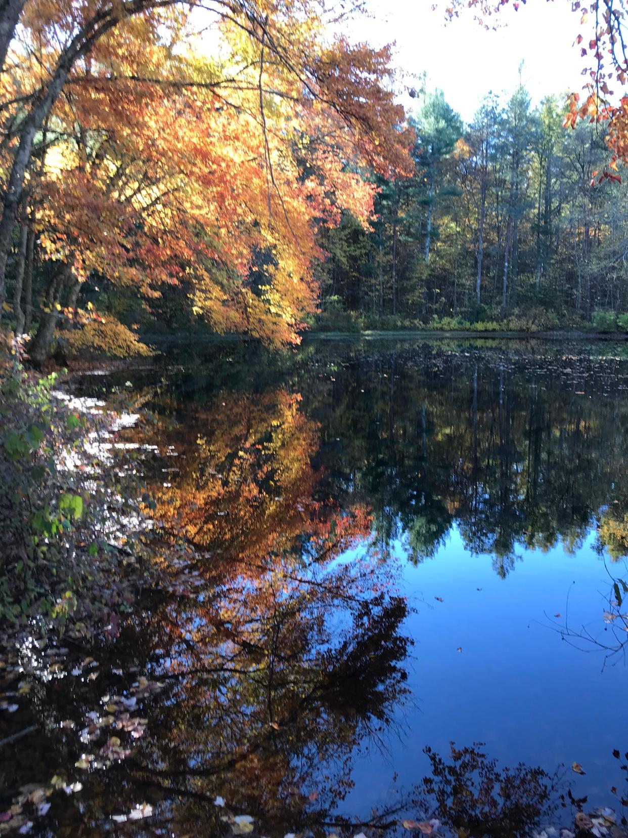
By late fall, however, there’s not a soul around, and there’s not a ripple on the glassy pond, which is dotted with gold, red and yellow leaves that have drifted down from the maple trees.
It’s a good, quiet place to start a walk in the deep woods, catch up with hiking buddies and think about the end of the year and what comes next.
Views of two ponds from well-marked trails
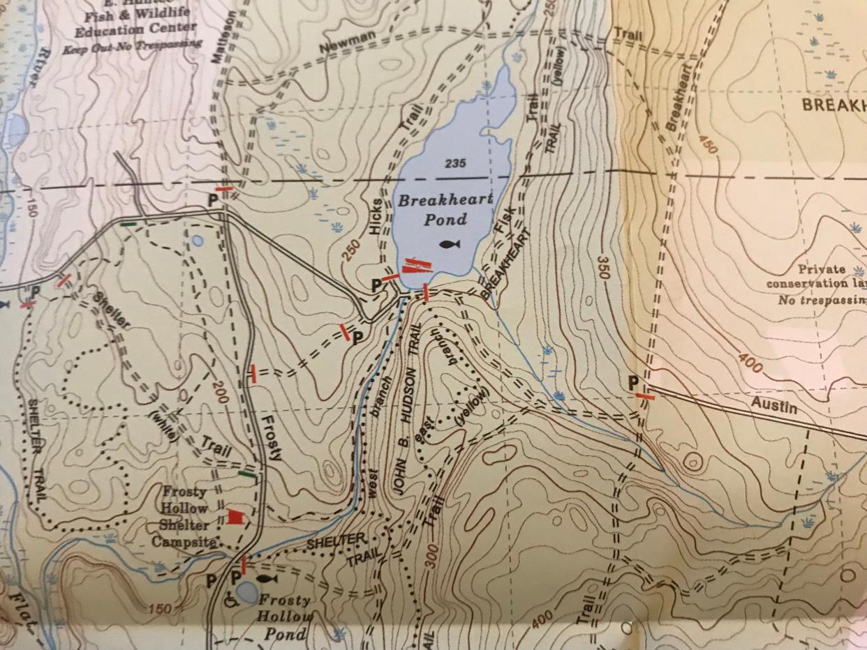
I set out early one weekday morning with George, John and Rick on the white-blazed Shelter Trail that runs through thick pine and oak trees. Below the trail on the left, Breakheart Brook rushes west to the Flat River, which joins the Falls River and forms the Wood River.
The wide, rooted trail gently rises to a junction. The white-blazed River Trail opens through a fence on the left, but we choose the yellow-blazed John B. Hudson Trail, named for the hiking pioneer and trailblazer in the 14,000-acre Arcadia Management Area.
The path widens into what may have been an old farm road and runs along a ridge with small valleys on each side. As the trail sloped downhill, I heard the tumbling brook we had passed earlier and caught my first glimpse of Breakheart Pond through the trees.
When the trail ended at the edge of the pond, we took a slight left to cross a new bridge built over an old, decaying wooden structure. I remembered that, years ago, there was a “Danger” sign on the rotting bridge built on wooden beams that fit into notches in the concrete walls that line the brook.
About a decade ago, Rhode Island Department of Environmental Management workers built the new bridge with structurally engineered beams as an emergency fix before anglers arrived for the start of the fishing season. Handrails were added later.
From the new bridge, I studied the water as it flowed from the pond over a dam and formed the brook. A rusty, mechanical crank with a wheel on the left side of the dam must have once been turned to control water flow through two large holes in the base of the dam.
There also may have been a horizontal board, now long gone, on the top of the dam to hold back the water. On the right side is a 16-step fish ladder made of crumbling concrete. Water no longer flows down it.
How the State of Rhode Island acquired the land
In the 1930s, the State of Rhode Island acquired the land in the surrounding area known as the Beach Pond Purchase, according to the DEM. A dam was proposed on the brook running across the land to create a possible recreation area, but the plan was abandoned.
Later, after the Great Hurricane of 1938, the dam was built to create Breakheart Pond, which old maps refer to as Cranston Pond, and to hold blown-down trees that had been salvaged after the storm. Old photos show the pond behind the dam full of floating logs.
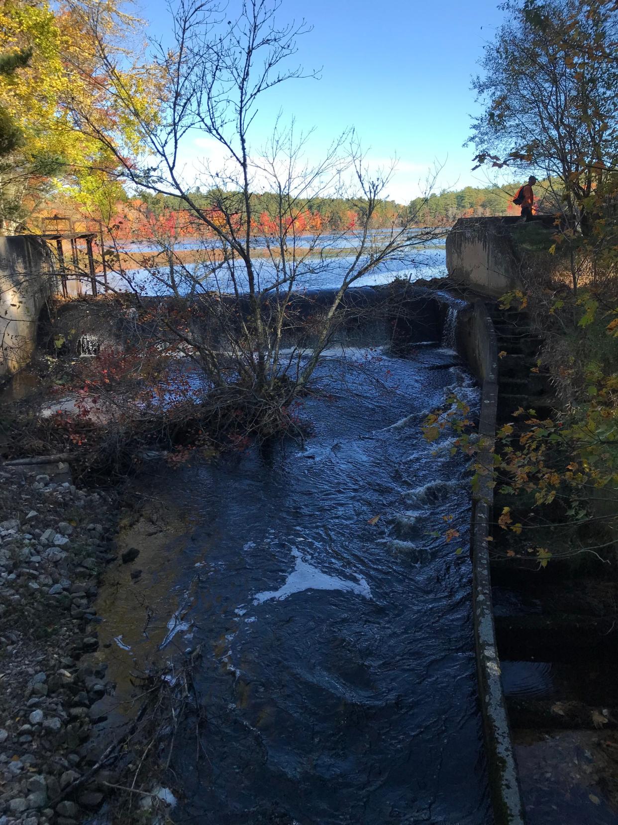
The installation of the fish ladder may have been recommended by the federal government because the brook connects to the Flat-Wood-Pawcatuck river network, which flows to the ocean.
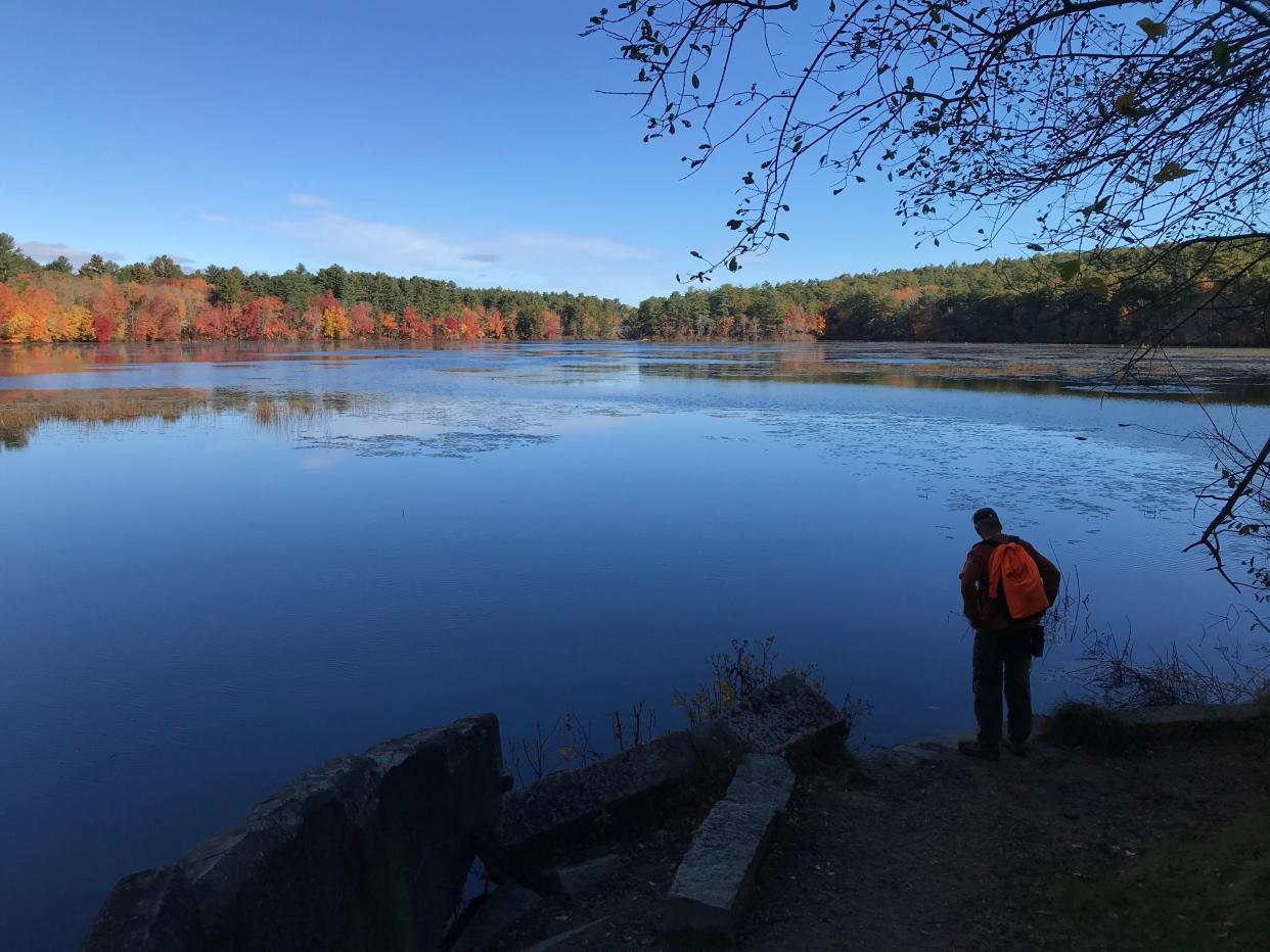
We retraced our steps, climbed a bank on the right side of the dam and scanned the 44-acre Breakheart Pond. The far-away shore was splashed with different-colored leaves from the maples intermingled with oaks and tall white pines. I also spotted a fisherman wetting a line.
Looking to get in the fall spirit? These 14 things to do in RI will put you in the mood
After a good, long look, we walked along an impoundment that must have been built to form the pond and joined the yellow-blazed Breakheart Trail. As we walked counterclockwise around the pond, I heard a blast from the east, a reminder that it’s hunting season and state law requires hikers to wear 200 square inches of fluorescent orange.
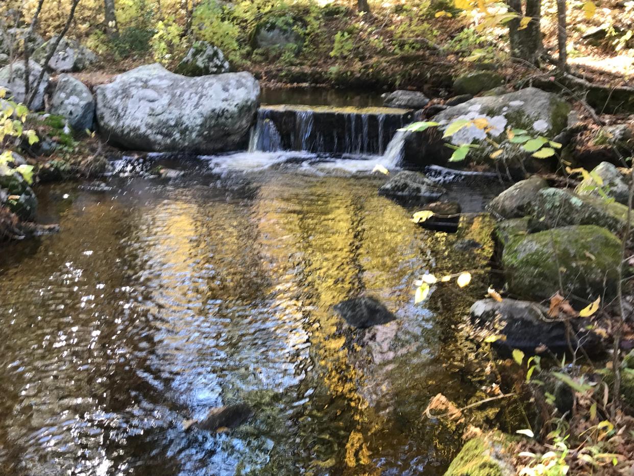
The path passed a gate and a well-built, rectangular, stone-walled cellar hole on the left and took us over a wooden bridge above a brook. Upstream, the water flowed over a rectangular granite block placed to slow the current to prevent the bridge from washing out. We also noted some beaver activity where the water emptied into the pond.
From maps, I noted that the pond, the brook, a road and a hill to the east are all named Breakheart. According to legend, farmers once struggled to drive oxen and horses up the steep grade of the hill. Thus, the name “Breakheart.”
The benefits – and nuisance – of beaver activity
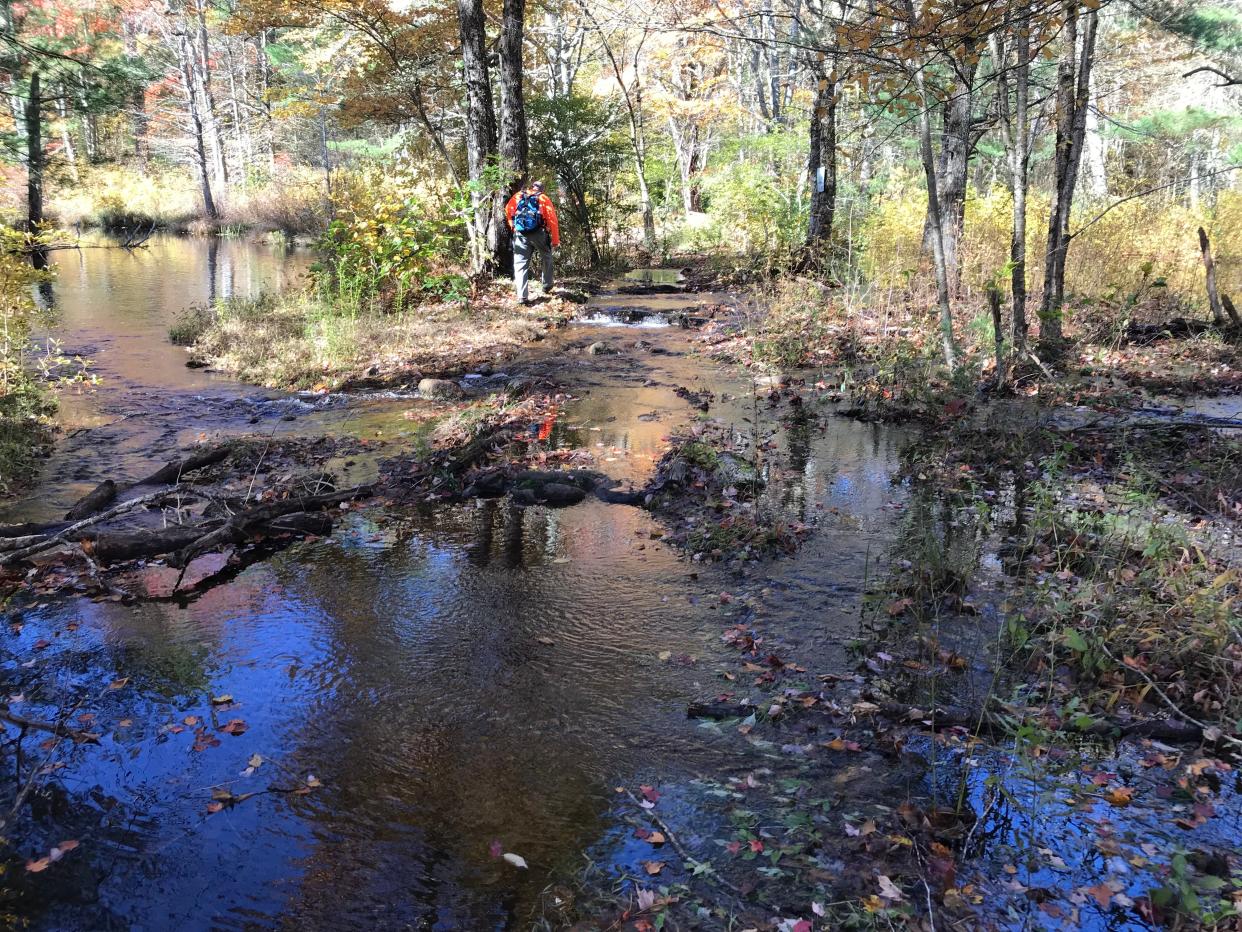
We followed the trail, which crossed into West Greenwich with the pond on the left, for about a mile and then turned west on the Newman Trail. Just ahead, the path we'd planned to take was flooded, and a bridge over Breakheart Brook, which flowed into the northern end of the pond, was underwater. It looked like pine needles, branches and leaves that had washed down the stream were caught under the bridge. There was also a beaver dam downstream that had backed up the water.
Beavers play an important ecological role by creating and enhancing wetlands that benefit a wide variety of wildlife species, according to DEM. But they also can be a nuisance, and DEM conservation stewards regularly clear dams and lodges that cause swamped trails.
“I have battled beavers blocking the river in that spot for over 28 years and spent countless hours removing their dams,” said Jeff Arnold, district resource manager at DEM.
I spotted a hiker with a dog on the far side who'd also planned to cross but thought better of it and turned around. We likewise decided not to soak our boots.
Instead, we bushwhacked upstream in search of a safe crossing but didn’t find one. So we retraced our steps and walked back to the dam with the fish ladder.
We crossed the bridge again. Nearby on the left is a historical cemetery, with gravestones for Whitman Lillibridge (1797-1856), his wife, Mercy, and their infant son.
Continuing on, we walked through a parking lot, passed a boat launch on the right and followed a wide dirt road called the Hicks Trail. A half-dozen members of the Rhode Island Hiking Club approached from the other direction, and we stopped to exchange greetings.
The trail crossed several stone bridges over intermittent streams that carried runoff from the hillside to the pond. At a T-intersection, the path to the right would have taken us back to the flooded northern tip of the pond, so we went left on the western leg of the Newman Trail, a wide road flanked by stone walls.
Interested in booking a shelter in the woods?
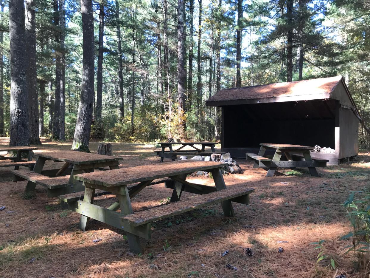
At a junction with the gravel-packed Austin Farm Road, we took a right and then a left onto the white-blazed Shelter Trail. Along the narrow footpath, 6-foot-tall bright green pines sparkled in the sun.
The path reached a three-sided wooden shelter that gave the trail its name. There also was an outhouse with a half-moon window, a large stone fire pit and picnic tables stamped with ARCADIA.
In the late 1930s, the Civilian Conservation Corps, a jobs program created to put unemployed people to work during the Depression, built a log shelter with a wooden shingle roof at the site. After it deteriorated in the late 1990s, DEM workers built the new shelter offsite and hauled it to its current location. The shelter, recently reopened after being closed for most of the last three years because of the COVID pandemic, can be booked by the public at the ReserveAmerica website.
After exploring the shelter and the flat, soft ground covered with needles from tall pines, we picked up the white-blazed trail again, walked to Frosty Hollow Road, crossed a bridge over Breakheart Brook and returned to Frosty Hollow Pond.
In all, we walked 5.4 miles over three hours.
I’ve hiked in Arcadia many times in different seasons and always find something new to explore and think about.
I’m glad that youngsters and other anglers enjoy fishing in Frosty Hollow Pond and Breakheart Pond. It’s even better that everyone – no matter what time of year – can hike the paths around the ponds, get some exercise, learn some history and experience some of the deepest, thickest forests in Rhode Island.
See you on the trails.
More: These 10 Rhode Island trails should be on your bucket list
If you go…
Access: Off Route 3, drive west on Route 165 for 2.5 miles. Turn right onto Frosty Hollow Road to the pond and a parking lot on the right.
Parking: Available for several cars.
Dogs: Allowed but must be leashed.
Difficulty: Easy to moderate on flat, well-marked trails, with some ridges and small hills.
Distance: 5.4 miles
GPS Coordinates: 41.59676, -71.70731
Lectures and signings for 'Walking Rhode Island' book
John Kostrzewa’s new book, “Walking Rhode Island: 40 Hikes for Nature and History Lovers with Pictures, GPS Coordinates and Trail Maps,” is available at local booksellers and at Amazon.com. He’ll sell and sign books after these presentations and slideshows about his hikes:
Monday, Nov. 13 - Louttit Library, West Greenwich, 6:30 p.m.
Wednesday, Nov. 15 – Charlestown Land Trust, Kettle Pond Visitors Center, Charlestown, 5 p.m.
John Kostrzewa’s column runs every other week in the Rhode Islander section of The Providence Sunday Journal. He welcomes email at johnekostrzewa@gmail.com.
This article originally appeared on The Providence Journal: Discover a great fall hike in RI: Frosty Hollow Pond in Exeter
