Wisconsin weather updates: Live snow totals, school closings, road closures and more winter storm updates Tuesday
A winter storm has made its way to Wisconsin. Many schools are closed for the day.
A winter storm warning is in effect all Tuesday through Wednesday morning for much of the state. Snow arrived in the state overnight on Monday from the Central Great Plains and will impact morning and evening commutes.
We'll be updating this file with the latest on the winter storm and the situation around the Wisconsin with totals, school closings, road closures and any power outages given the expected high wind totals.
7:50 a.m.: Heavy, wet snow expected across southern Wisconsin
Relatively light precipitation in the early-morning hours is transitioning to heavier, wetter snow across the state as the morning continues, said Marcia Cronce, meteorologist with the National Weather Service in Sullivan.
Snowfall rates of 1 inch per hour, and even up to 2 inches per hour, will be possible in the storm's bands of heavy snow, with the heaviest snowfall in the afternoon and evening, Cronce said.
"If you don't have to travel this afternoon, I would avoid that," she said.
Wind gusts of 35 mph mean the wet, heavy snow could be blown onto trees. And trees laden with heavy snow could snap, potentially knocking down power lines. Sporadic power outages are possible as well.
The wet snow will turn to lighter, fluffier snow overnight as the storm tapers off. That fluffy snow will easily blow over the road, reducing visibility, Cronce said.
7:45 a.m.: Milwaukee-area road conditions clear so far
No weather-related closures or crashes have stalled morning commute traffic Tuesday in and around Milwaukee.
The Wisconsin Department of Transportation indicates there are some slippery stretches, mostly in southwestern Milwaukee and Waukesha counties, but otherwise road conditions remain good for winter driving as of 7:45 a.m.
However, Highway 18, from Jefferson to the Waukesha County line, is covered with ice, 511 Wisconsin shows. Drivers should proceed with caution there or avoid the area if possible.
6:45 a.m.: Latest forecast predicts strong winds, low visibility, poor driving conditions
As the storm moves east across the state, roads in southwest Wisconsin were snow-covered, according to the Wisconsin Department of Transportation. The National Weather Service reported 3.9 inches of snow had fallen in De Soto, on the border with Iowa, and 2.4 inches in La Crosse.
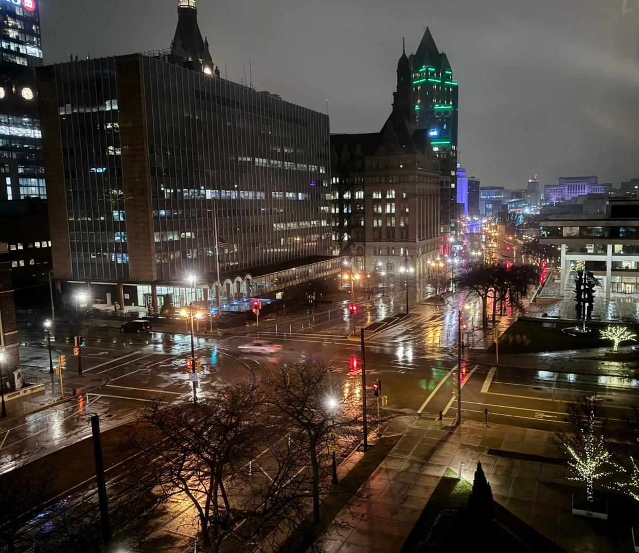
Highways around Madison and east to the Milwaukee area had slippery stretches. Close to the city of Milwaukee, the Wisconsin Department of Transportation said there were good winter driving conditions, as rain was mostly falling near Lake Michigan.
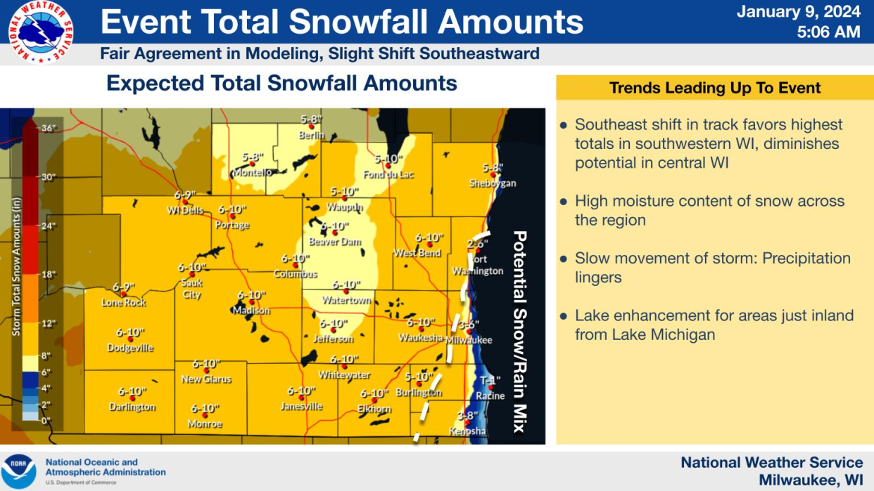
In south-central and southeast Wisconsin, the heaviest snowfall will begin after 9 a.m., the weather service said, with accumulations of 6 to 12 inches. There's the potential for rain and snow to mix along the lakefront.
Travel could be very difficult throughout the day, the weather service said, as patchy and blowing snow will reduce visibility and affect the afternoon and evening commutes especially. Wind gusts up to 35 mph are expected.
Milwaukee's Department of Public Works said its trucks had begun salting the roads overnight. About 100 trucks are expected to be out working throughout the day.
About 2.5 inches of snow had fallen in Elkhorn by 6:30 a.m., according to the weather service.
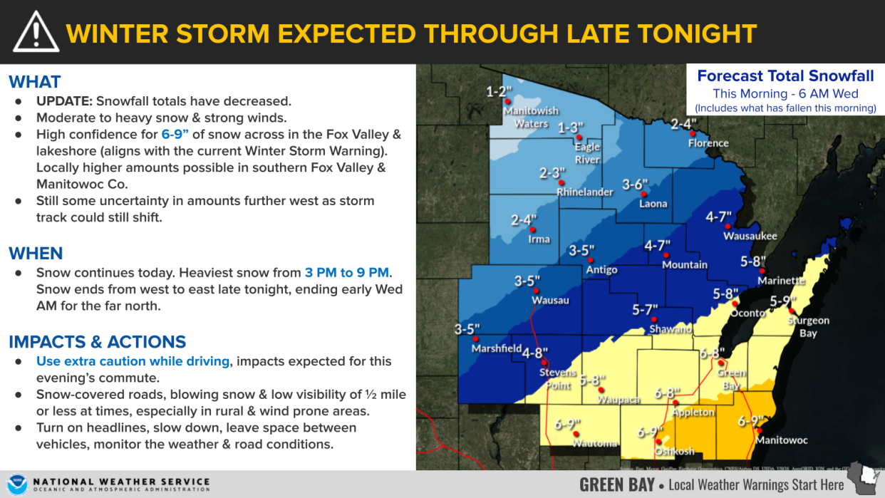
In northeast Wisconsin, weather service meteorologists said they have high confidence in predicting 6 to 9 inches of snow, with higher amounts in the southern Fox Valley and in Manitowoc County. The heaviest snow is expected 3 p.m. to 9 p.m. Snow-covered roads, blowing snow and visibility of a half-mile or less is expected, with poor driving conditions in rural and windy areas.
North-central communities of Wausau and Marshfield are expecting 3-5 inches of snow.
6 a.m.: Milwaukee Public Schools cancels classes
All Milwaukee Public Schools buildings will be closed Tuesday, and all after-school, recreation and athletic programs are canceled. The school board meeting set for Tuesday evening will be held virtually.
Here is a list of Milwaukee-area school closures and a list of Green Bay-area closures.
Wisconsin winter weather road conditions, closures
Check out the the 511 WI website for the latest traffic updates and any road closures across Wisconsin. Stay up to date via their X/Twitter account.
Wisconsin radar
Wisconsin weather warnings
Steven Martinez of the Milwaukee Journal Sentinel staff contributed to this report.
This article originally appeared on Milwaukee Journal Sentinel: Wisconsin live snow updates: forecast, radar, totals, school closings
