Wisconsin weather updates: Power outages, live forecast, snow totals, road conditions, more winter storm updates Friday
It's shaping up to be a snowy Friday in Wisconsin.
After two rounds of snow this week — Tuesday and overnight Thursday — the state is expected to get hit again.
The National Weather Service on Thursday afternoon issued a winter storm warning for Friday as another system is expected to reach southeast Wisconsin starting early Friday morning and last throughout the day. The winter storm warning is in effect until noon Saturday.
9:30 a.m.: New Berlin mayor issues snow emergency
Mayor Dave Ament has declared a snow emergency for the City of New Berlin, according to a news release. The snow emergency started at 9 a.m. Friday and runs through 4 p.m. Saturday.
“The declaration of a snow emergency is to reduce traffic congestion, and to ensure the orderly operation of emergency vehicles, including snow removal equipment and machinery,” the release said.
New Berlin City Hall closed at 9:30 a.m. Friday. The New Berlin Recycling Center will be closed on Saturday.
Street, alley and public parking lot parking is prohibited during the snow emergency, according to the release. Vehicles that may interfere with snow removal operations or emergency vehicles may be removed at the owner's expense.
"Expect travel conditions to be hazardous as you may encounter unplowed or semi-plowed roads in certain areas of the City during and after the storm," the release said.
— Hannah Kirby
8:50 a.m.: Mitchell International Airport will remain open despite reports to the contrary, airport says
Milwaukee Mitchell International Airport will remain open during this winter storm, the airport tweeted shortly before 8:50 a.m. There will just be “brief” closures to clean the runway.
“We do have some cancelations, but other flights are landing and taking off,” the tweet said.
Despite inaccurate reports on @FoxNews and @flightview, MKE is open. We do have some cancelations, but other flights are landing and taking off. MKE will remain OPEN during this winter storm, with brief closures to clean the runway. Don't believe the false news reports!
— MKE - Milwaukee Airport (@MitchellAirport) January 12, 2024
The post was issued in response to “inaccurate reports” from Fox News and FlightView, according to the airport's tweet.
— Hannah Kirby
8:30 a.m.: Power outages affecting thousands in Milwaukee and around Wisconsin
As of 8:30 a.m., 17,347 We Energies customers in Milwaukee County are out of service, according to We Energies’ Outage Map. Of those, 15,432 of those are in Milwaukee.
Another 4,033 We Energies customers are without power in Waukesha County, the map said.
Statewide, there are more than 23,523 We Energies customers without power and 215 outages, according to the map.
8 a.m.: Crash closes northbound lanes along I-43; driving conditions are poor and slippery
Another snowy morning commute for drivers in the Milwaukee metro area has already resulted in at least one major incident. A full highway closure is underway of the northbound lanes on Interstate 43 due to a crash. Traffic is being diverted onto Highway 57.
There is also a disabled vehicle that has closed the ramp from Interstate 94 West to Interstate 41/894 South.
There are other reports of disabled vehicles and slippery conditions, so be sure to take it slow this morning. Snow is expected to fall throughout the day and accumulate several inches. The National Weather Service recommends that you only drive if you have to, and if you do, go slow and give yourself more time to get to your destination.
You can find the most up-to-date road conditions on 511 Wisconsin’s website.
— Drew Dawson
7:50 a.m.: Milwaukee got 2 inches of snow before 7 a.m.; latest forecast predicts strong winds, poor driving conditions
Snow is quickly accumulating Friday morning as two inches fell before 7 a.m. in the Milwaukee area, causing issues on area roadways, according to the National Weather Service.
In Milwaukee and southeastern Wisconsin, snow will continue into Friday with estimated totals between three to six inches. At the lakefront, temperatures hovering around freezing could mean that there will be a mixture of rain and snow.
In Milwaukee, wind gusts are at 20 miles per hour and are expected to pick up to upward of 40 miles per hour as the day goes on.
Greater snow totals and stronger winds are expected in Green Bay and Door County with upwards of a foot of snow.
— Alex Groth
7:45 a.m.: Many airlines flying out of Milwaukee are allowing passengers to change their travel plans for free
“Due to this weekend's winter storm, many of our airlines are allowing passengers to change their travel plans for free,” Milwaukee Mitchell International Airport tweeted Thursday. “Some airlines may delay or cancel flights on Friday or Saturday. Be sure to check with your airline for the latest flight status or to change your itinerary.”
Several Friday flights have been marked as canceled on the airport website's “Departures” page. The morning cancellations alone include:
6:50 a.m. United Flight No. 4803 to Chicago O'Hare.
7 a.m. Southwest Flight No. 952 to St. Louis.
7:15 a.m. Delta Flight No. 3649 to Detroit.
8:25 a.m. United Flight No. 5402 to Chicago O’Hare.
10:02 a.m. United Flight No. 3495 to Newark.
10:15 a.m. Southwest Flight No. 3402 to Denver.
10:27 a.m. JetBlue Flight No. 680 to New York-JFK.
10:40 a.m. Southwest Flight No. 1952 to Kansas City.
10:45 a.m. United Flight 5671 to Chicago O’Hare.
11:05 a.m. Delta Flight No. 897 to Minneapolis.
11:15 a.m. Delta Flight No. 4959 to New York-LGA.
11:26 a.m. Delta Flight No. 816 to Atlanta.
11:44 a.m. Delta Flight No. 5696 to New York-JFK.
To check the status of your flight, visit mitchellairport.com/departures.Many arrivals have also been flagged as canceled. To check those, visit mitchellairport.com/arrivals.
— Hannah Kirby
7 a.m.: Milwaukee snow plow crews will be working continuously through the snow storm, DPW says
“Our goal is to make sure streets are safe and passable and we will be out for the duration of this snow event for that purpose,” the Milwaukee Department of Public Works said in an early morning email Friday.
Crews were out overnight doing some pre-salting, and main streets were being treated with brine, according to the email.
Crews will continue working 24/7, rotating 12-hour shifts until all the snow is cleared. And, all available salt and plow trucks will be actively working.
“This is expected to be a long duration, challenging event,” the email said. “Staff will work as quickly as possible to manage heavy snowfall with high winds and blowing snow before temperatures plummet. Please be patient.”
With snow expected to be falling during the morning commute, DPW asked that:
Drivers be safe and drive for conditions.
Give space to salt and plow trucks when you encounter them.
The department also shared these other tips to be helpful during a snow operation:
Be patient and understanding as snow and ice operations take time. All streets will be cleared.
Drive carefully and stay on main transportation routes as much as possible.
Only travel if “absolutely necessary.”
Slow down and provide more space for braking.
Park legally and follow alternate side parking rules. Parking farther away from driveways, alleys and intersections allows DPW’s equipment to get through.
Don’t shovel, blow or plow snow back into the streets.
Shovel your sidewalk and corners within 24 hours after the snow has stopped falling. And, assist neighbors who need help.
Clear fire hydrant near your property of snow and ice.
Clear snow and ice around and on top of your garbage and recycling carts.
— Hannah Kirby
6:35 a.m.: Milwaukee County, Franklin issue snow emergencies
Milwaukee County and Franklin have both declared a snow emergency ahead of the impending snowfall.
Working with the Milwaukee County Office of Emergency Management, County Executive David Crowley declared a snow emergency for Friday, according to an email from his office.
That means all non-essential departments will be closed Friday, which include several county facilities, such as the Milwaukee County Courthouse, Vel Phillips Detention Center and the Marcia P. Coggs Building (except for the Behavioral Health Mobile Crisis Teams).
According to the email, certain departments and positions are essential to performing duties during the snow emergency, and will resume work as usual. Non-essential “Telework Able” employees should telework.
Unsheltered residents are to call 211 for info on the closest warming center and for help accessing a shelter through a coordinated intake process, the email said.
Franklin’s snow emergency, which began shortly before 5:30 a.m. Friday, will go through 6 p.m. Saturday, according to an email from Franklin Police. No street parking is allowed during this period, the email said.
— Hannah Kirby
How much snow is the Friday storm expected to bring to the Milwaukee area?
"It's gonna be another tricky storm," National Weather Service meteorologist Ben Miller said Thursday. "Not similar to the last one, but given the warm Lake Michigan temperatures and the warm December we had, it could impact snow totals again near the lakeshore."
With temperatures around freezing during the day, the lakeshore communities, especially to the south, could see a wintry mix or even rain during the day.
Areas along the lakeshore, though, should still see 3 to 6 inches on the ground.
We'll update this file with the latest on the winter storm and the situation around Wisconsin with snowfall totals, school closings, road conditions and any power outages.
For those farther away from the lake, even by just a few miles, temperatures also around freezing could create wintry-mix conditions during the day, but they should see snow even into the afternoon. He said any wintry mix will change back to snow quickly. The inland communities are forecasted to get 5 to 10 inches with some pockets getting 10 to 12, Miller said.
How much snow will the rest of Wisconsin get?
Eastern, northeastern and central Wisconsin are expected to get between 6 and 12 inches of snow from the storm, according to the National Weather Service in Green Bay.
The areas along the Lake Michigan shoreline are expected to get the most snow, closer to 8 inches.
Further north and in north central Wisconsin, the snowfall amount tapers off.
Some of the biggest snow totals in the state are expected in south central and southwest Wisconsin. The National Weather Service in La Crosse projects much of the area, including Madison, to get between 11 and 18 inches. La Cross is expected to get 9 to 15 inches.
The snow Friday will bring an arctic blast and below zero temperatures
The snow will bring with it the first arctic blast and below-zero temperatures of the season. That weather comes into the area Friday night and into Saturday. Temperatures will slowly drop on Saturday and into Sunday when they fall below zero, Miller said.
Sunday, Monday and Tuesday will see highs in the single digits and lows below zero. That could be the case on Wednesday and Thursday. Regardless, temperatures are expected to be in the high teens or lower single digits or below zero the rest of the week.
"It's going to come in and stick around for a while," Miller said. "The longer we go into the season with above-normal temperatures, the bigger the shock it's going to feel like when it finally decides to dip."
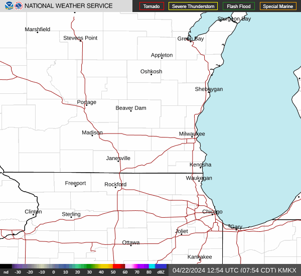
Take a look at Wisconsin's weather radar
Where can I find the latest Wisconsin winter weather road conditions?
Check out the the 511 WI website for the latest traffic updates and any road closures across Wisconsin. Stay up to date via their X/Twitter account.
Wisconsin weather warnings
This article originally appeared on Appleton Post-Crescent: Wisconsin live snow updates: power outages, forecast, road conditions
