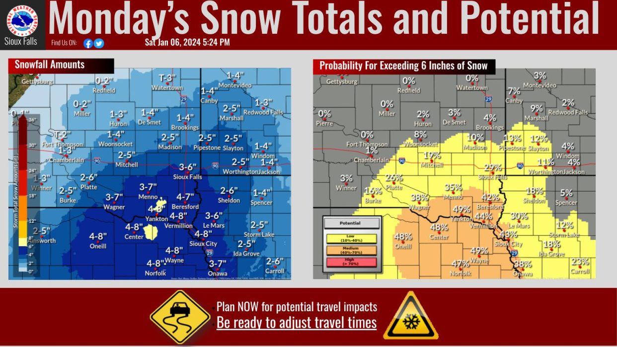
Winter storm could bring 3-7 inches of snow Monday to Sioux Falls, NWS says
Southeastern South Dakota, including Sioux Falls, is now under a winter storm watch, according to the National Weather Service.
The watch, which runs from Sunday evening through late Monday night, comes as a winter system is expected to bring anywhere from 3 to 7 inches of accumulating snowfall to the area, the alert reads.
The storm could affect travel, with slippery roads and hazardous conditions expected for morning and evening commutes, the NWS of Sioux Falls states.
When will the storm hit?
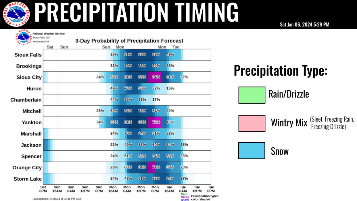
The heaviest snowfall is expected to hit Sioux Falls at about 6 a.m. Monday and will continue through midnight and into the early hours Tuesday, the NWS of Sioux Falls stated in a weather briefing Saturday evening.
How can I stay informed?
Keep refreshing this page for the latest, or visit the National Weather Service in Sioux Falls website.
Also, check www.sd511.org for road condition updates.
What will conditions look like the rest of the week?
After the storm, temperatures are expected to plummet during the evenings throughout the week, with a few nights reaching single-digits or below-zero Temps. Here's a closer look, according to the NWS of Sioux Falls.
Sunday: Partly sunny, with a high near 26. Calm wind becoming southeast around 5 mph in the afternoon.
Sunday night: Snow likely, mainly after 3am. Cloudy, with a low around 21. East southeast wind 5 to 15 mph, with gusts as high as 20 mph. Chance of precipitation is 60%. New snow accumulation of around 2 inches.
Monday: Snow. High near 32. East wind 10 to 15 mph, with gusts as high as 20 mph. Chance of precipitation is 90%. New snow accumulation of around 2 inches.
Monday night: Snow likely, mainly before midnight. Mostly cloudy, with a low around 15. North wind 10 to 15 mph, with gusts as high as 25 mph. Chance of precipitation is 70%. New snow accumulation of less than one inch possible.
Tuesday: Partly sunny, with a high near 21. Blustery, with a north wind 10 to 20 mph, with gusts as high as 25 mph.
Tuesday night: Mostly cloudy, with a low around 9.
Wednesday: A 30% chance of snow. Mostly cloudy, with a high near 27.
Wednesday night: Mostly cloudy, with a low around 1. Blustery.
Thursday: Mostly sunny, with a high near 7.
Thursday night: Mostly cloudy, with a low around -7.
This article originally appeared on Sioux Falls Argus Leader: Live: Heavy snowfall expected Monday for southeastern South Dakota, per NWS
