Winter storm brings snow to most of Missouri as it cuts across state. How much did KC get?
A winter storm that cut across Missouri overnight brought snow to most of the state Wednesday, including Kansas City, according to the National Weather Service.
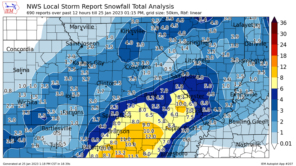
The Kansas City metro area was on the northern side of the storm, which pushed its way across the Missouri Ozarks. Roughly one to three inches of snow fell in the metro, said the National Weather Service in Kansas City.
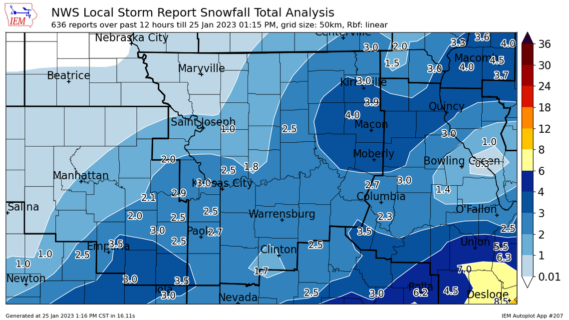
The heaviest snowfall was along and south of Interstate 44 in southern Missouri, where as much as a foot of snow fell, according snowfall maps generated by the Iowa Environmental Mesonet at Iowa State University.
Although snowfall totals in the Kansas City area might seem a meager to other parts of the state, it was enough to create a messy morning commute, as well as convince many schools in the area to delay the start of school, hold virtual learning or cancel classes.
Kansas City Public Schools, Kansas City, Kansas, Public Schools, Shawnee Mission School District, DeSoto Unified School District and Independence School District were among the districts that canceled classes.
The winter weather also created slick conditions across the metro.
Weather may have been a factor in a crash about 3:30 a.m. where a Kia is believed to have slid through a red light, struck the trailer of semi-truck and got trapped underneath the trailer. The truck dragged the Kia with its driver inside about eight miles before police stopped it along westbound Interstate 435 and Lackman Road.
The driver, a 28-year-old Kansas City woman, was taken to a hospital for evaluation.
At the start of the morning commute, there were several reports of crashes and slide-offs on area roads, the weather service said on social media.
“Light snow is reducing visibilities and road conditions are still slick,” the weather service said.
Pockets of rain began falling across the metro about 7 p.m. Tuesday and later switched over to all snow. Snow started accumulating on the grass at the weather service’s offices in Pleasant Hill about 11 p.m. The bulk of the snow fell between midnight and 6 a.m.
A winter storm advisory for the Kansas City area was canceled about 7:30 a.m.
“Snow has ended across northeast Kansas and northeast Missouri,” the weather service said.
However, slick spots remained on some highways, city streets and parking lots. People were urged to be careful as they headed out.
“Majority of the roads are clear and fairly dry now,” Trooper Tiffany Bush, a spokeswoman for the Kansas Highway Patrol, said on social media. “As temperatures drop during the evening, though, be mindful of that runoff that could cause possible slick spots!”
Temperatures are expected to tumble overnight in the Kansas City area, falling into the teens. They will rebound slightly, but remain below freezing on Thursday.
It will be much warmer on Friday and Saturday, with temperatures climbing into the mid- to upper 40s.
A cold snap arrives on Sunday, with morning temperatures in the single digits and climbing into the teens and possibly 20s during the day. The bitter cold is expected to stick around for a couple days with another round of winter weather possible mid-week.
