Wind chill drops Whatcom into minus territory as roads remain slippery. When does it end?
This is a developing story. Check back to bellinghamherald.com for updates.
To sign up for breaking news alerts, click here.
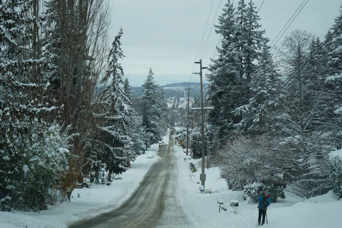
Snow from earlier in the week continued to make Whatcom County roads slippery Wednesday, Dec. 21, with very cold temperatures overnight.
At 5 a.m. it was 14 degrees, with a wind chill that made it feel like -3 at Bellingham International Airport and 11 degrees that seemed like -1 at Ferndale, according to the National Weather Service.
How are the roads?
Interstate 5 between Blaine and Arlington looked OK, the Washington State Department of Transportation noted on social media about 7 a.m., warning travelers should expect icy spots. Pay particular attention to on- and off-ramps, bridges, overpasses and intersections, it said. “We see some residual compact snow and ice on several state routes.”
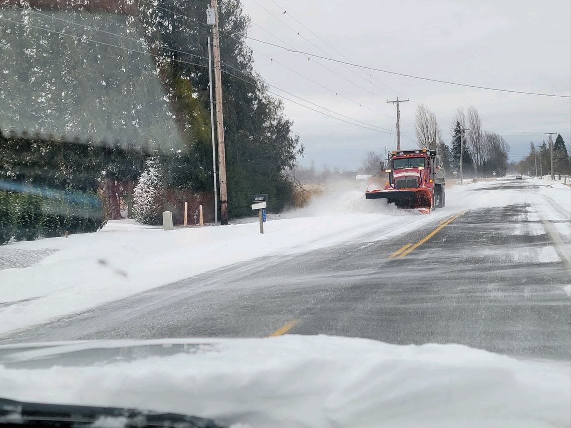
Whatcom County maintenance and operations staff reported that almost all of the county’s priority 1, 2, and 3 roads have been plowed at least once. Some priority 4 roads have been plowed, but most of the staff is still working to keep priority 1-3 roads open through the blowing snow drifts. The wind is causing whiteout conditions with this dryer type of snow.
“Roads continue to be very slick,” the county noted in an email to The Bellingham Herald. “Vehicles getting stuck on the road are hampering plowing efforts. Vehicles that block roadways could be towed at the owner’s expense if they are blocking travel lanes. We encourage people to stay home and off the roads to avoid these hazardous conditions.”
Most major arterials and priority travel routes are in decent condition, but unnecessary travel should continue to be avoided and drivers should be extremely cautious, according to morning statement from the city of Bellingham. “Plows started on some steeper side streets overnight and efforts to clear all streets will continue today.”
The Department of Transportation noted that with freezing temperatures, roads will be icy. “We’ll continue to plow and put down product but that doesn’t mean it’s going to be clear sailing. Drivers still need to slow down,” the DOT Tweeted.
How cold will it get?
The temperature Wednesday at Bellingham International Airport reached 13, with a wind chill that felt like -7, just before noon. It topped out at 20, briefly, at 1:55 p.m. Tuesday, Dec. 20. Wind speeds in the low teens made it feel 7-9 degrees during the day. Ferndale stayed at 15 degrees all day Tuesday, meaning it felt like single digits all day with wind chill.
Thursday morning, Dec. 22, will feature the coldest morning lows of the week and afternoon-evening rain has increased the odds for freezing rain overnight into Friday morning, the weather service reported Wednesday noon.
The Whatcom County Emergency Management briefing Tuesday afternoon said to not travel unless you must, even if there is some sunshine Wednesday.
Our Maintenance & Operations team is hard at work! Crews have been on 24-hour shift coverage since Sunday. We so appreciate them.
We also appreciate YOU for giving them patience and the space they need to help you navigate Whatcom County safely. pic.twitter.com/mz7Je4BLBo— Whatcom County Public Works (@WhatcomCoPWA) December 21, 2022
“Public Works is out cleaning roads with the highest priority roads being worked first. Secondary roads will take more time,” the briefing said, noting:
▪ Weather will continue to be a factor with lows overnight in the teens and wind chills making it feel like it’s below zero.
▪ The northern part of the county will continue to see drifting snow in some places.
▪ More clouds roll into the area late Wednesday night and there’s a chance of 1-3 inches of snow in the lowlands and 2-4 inches in the foothills Thursday.
The Bellingham Severe Weather Day Use Warming Center will be open 9:30 a.m. to 5:30 p.m. Wednesday and Thursday inside the Bellingham Central Library lecture room. The County’s overnight severe weather shelter at Civic Field will operate through the end of the week.
Services limited
Many city services will continue to be closed or limited on Wednesday in Bellingham.
Bellingham said to report any issues in parks or stranded vehicles on roadways on the SeeClickFix app or at cob.org/fix.
Snow removal efforts in Bellingham will continue to focus on the primary snow removal routes when needed, such as clearing drifted snow, and assisting Sanitary Services Company with access for garbage collection.
The city noted that SSC has advised customers that if their collection is missed due to snow and ice, they will take additional garbage, recycling, and FoodPlus on their next service day at no charge, or materials can be brought to the transfer station at F Street and Roeder. For information about garbage collection, call SSC at 360-734-2051.
Parks maintenance staff are clearing parking lots and bathroom access as quickly as possible, but access is still limited to many parks. Bayview Cemetery, Big Rock Garden, Civic Stadium (except restrooms), Arne Hanna Aquatic Center, all Bellingham Public Library branches and all Whatcom Museum facilities are closed Wednesday.
Whatcom Transportation Authority will not offer flex or zone service Wednesday due to snow. However, all of its buses are running, including paratransit minibuses that serve people with disabilities.
Western Washington University closed the campus Wednesday due to the accumulation of snow and ice. Frigid temperatures are slowing cleanup efforts and there will be no on-campus activities, according to a campus email.
Due to the danger of falling branches, pedestrians should also avoid the Sehome Arboretum, WWU noted.
We are so thankful to our transit operators, dispatch, and fleet & facilities team for keeping us moving today! From shoveling paths and clearing snow to chaining tires and replacing parts, many essential things need to happen to get our buses on the road. pic.twitter.com/t6FkSObUrW
— WTA (@ridewta) December 21, 2022
Whatcom forecast
Snowfall probabilities in Whatcom County are just 5% for 6 inches or more from 10 a.m. Thursday to 10 a.m. Friday. But there’s a 50% chance for 1 inch of snow in that period.
However, there is a greater than 5% chance for freezing rain in Whatcom County from Thursday through Friday night.
Blended forecast models of ice accumulation from Bellingham to Arlington show a probability of 35% to 55% for 0.10 of an inch.
Ice loading could cause tree and powerline damage and result in power outages.
While freezing rain cannot be ruled out anywhere in western Washington, the weather service said, temperatures will continue to warm after freezing rain falls, so ice cover will be temporary in nature.
A persistent series of storms may impact the region Friday through New Year’s Day, with river flooding likely. This pattern, along with King Tides will increase the risk of coastal flooding/erosion, according to the weather service.
Night Sledding at Squalicum Creek Park with the field lights!
Snow days are the best, why end after dark?
Tonight from 5 - 8 p.m.
Have fun and be safe! pic.twitter.com/fKUVnOAgYy— Bellingham Parks & Recreation (@BellinghamParks) December 20, 2022
