Why isn’t it storming every afternoon like usual? We explain Miami’s change in the air
Many people in South Florida set their watches to afternoon summer storms.
If it’s 3 p.m., sure enough, here comes the rain and thunder.
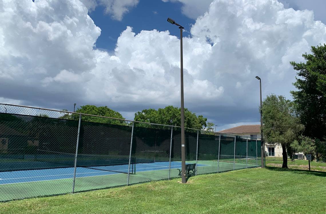
But Mother Nature must be using a new clock these days. Our summer afternoons in South Florida are more likely to be blistering hot than filled with ominous clouds.
9/6, 2PM: It's feeling HOT, HOT, HOT across most of South FL. The interior and west coast should get some relief as isolated showers develop thru the afternoon. If you're outdoors, please exercise caution and stay hydrated! #FLwx pic.twitter.com/8nQX041SdR
— NWS Miami (@NWSMiami) September 6, 2022
Reddit chatter
“Is it just me ... or does it just not rain anymore?” a Palm Beach County resident posted Tuesday in a Reddit discussion. “I spend a lot of time outside, so I’m generally in tune with Florida’s climate patterns. Typically, we’ll get large bouts of rain for a couple weeks in early spring and weeks worth of rain in August - October. So far, my mother has a ton of plants dying because it just hasn’t been raining and I can only stop by so often to water them for her. Is this just in my head, or is anyone else noticing this?”
People are noticing.
“I’d say the most noticeable thing for me here in South Florida is the afternoon thunderstorms. Like clockwork around 2 p.m. or so you’d see them roll in during the summertime and be gone by 5 p.m. or so. This year, I hardly remember seeing any storms,” read a post in that Florida Reddit thread.
There’s been plenty of rain in Tallahassee, Daytona Beach and Orlando, readers responded. Just not in South Florida. “Broward has been crazy dry this summer.”
We’ve had some rain, and the forecast calls for some weekend storms, but when we do get them they aren’t falling when they used to, as afternoon rush hour begins.
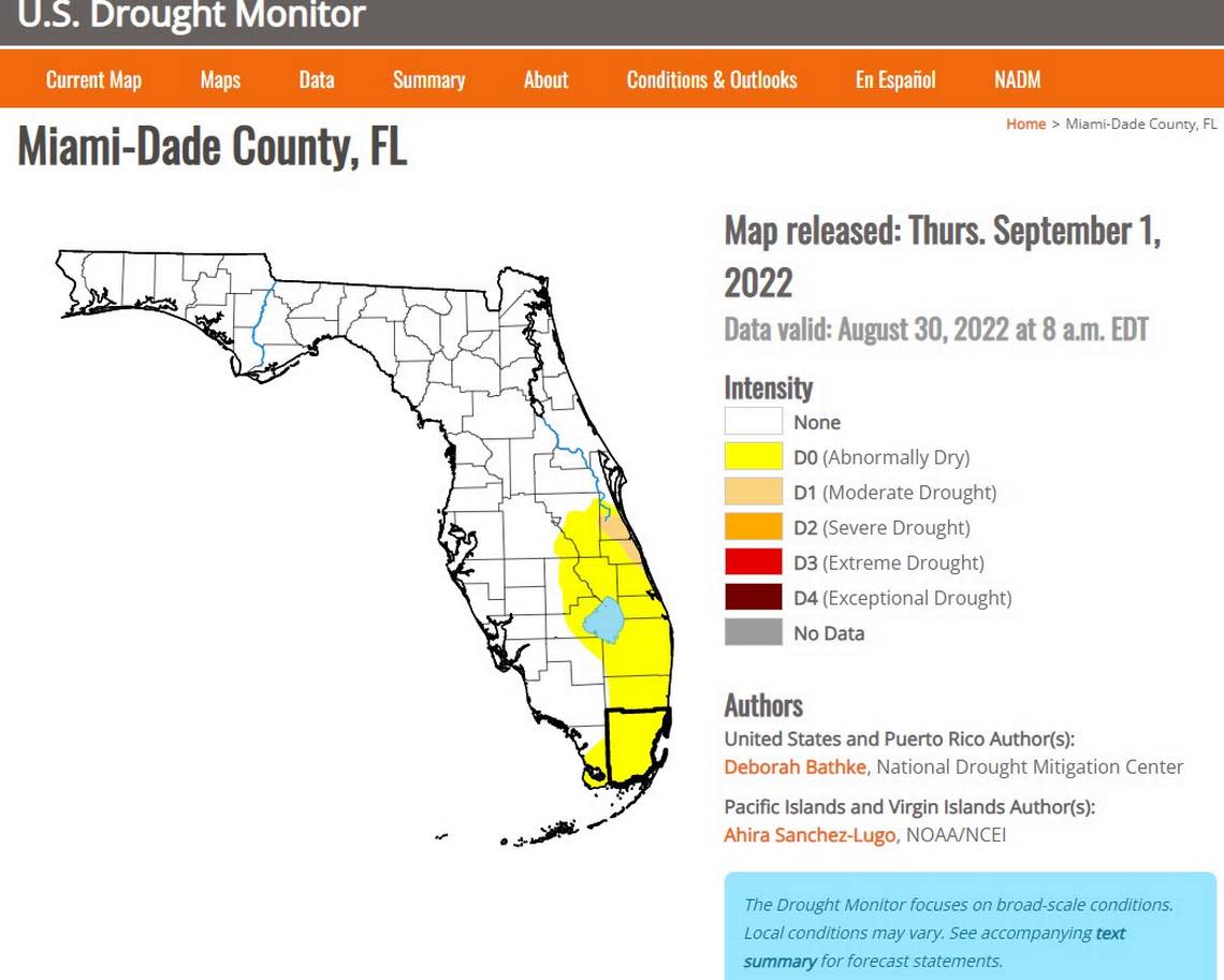
And the rain South Florida is getting is below normal, agrees the National Weather Service; weather experts like Brian McNoldy, a senior research associate at the University of Miami Rosenstiel School; and the U.S. Drought Monitor from the Nebraska-based National Drought Mitigation Center.
Why is South Florida drier than usual?
Robert Garcia, a senior meteorologist and lead forecaster with the National Weather Service in Miami, says two things are going on this summer.
The winds aren’t working the way they normally do to bring us afternoon storms.
And the Bermuda high, a high-pressure system over the Atlantic Ocean that influences the movement of tropical systems in the Atlantic, hasn’t steered storms to South Florida this summer.
So far.
The wayward winds
Garcia explains: “Normally, when we did see storms in the afternoon there’s one of two things that can be going on. One is we have some semblance of westerly flow so it brings the sea breeze up somewhere against the east coast metro. And then you get the collision with the Gulf breeze that crosses in the afternoon.”
He continues: “We haven’t had a ton of that this summer. We don’t have the westerly flow to have the Atlantic sea breeze on the other coast. And we don’t have a late enough easterly flow to keep the Atlantic sea breeze around. So what ends up moving inland and crashing into the Gulf breeze happens somewhere to the west of our area.”
The Bermuda high
Garcia again: “The second thing is sometimes we’ll have the Bermuda high kind of sitting over the region for a couple of months. And we haven’t really had a very strong Bermuda high sitting over us.
“We’ve actually had a trough of low pressure across the eastern United States for a good amount of the summer. And so that is probably the bigger disruptor because what ends up happening is without that high pressure over us, you don’t have light wind flow, and so the Atlantic sea breeze is able to advance inland and the Everglades and Naples end up getting most” of the thunderstorms.
Lacking a storm starter
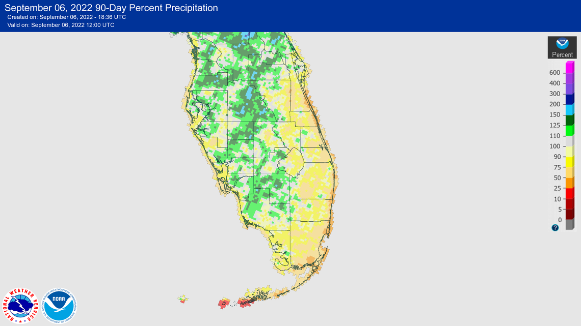
This all could explain why both the U.S. Drought Monitor and the weather service’s adjustable percent precipitation chart shows normal rainfall totals for much of Florida along the west coast, central and Panhandle but abnormally dry conditions from Monroe through Miami-Dade, Broward and Palm Beach counties. These counties are accumulating only about 50% of the rainfall expected from the start of the summer in June through Sept. 6, near summer’s end, according to NOAA’s graphic when looking back at the last 90 days.
But why are the winds and the Bermuda high not syncing to soak South Florida in the afternoons?
Consider our old friend Saharan dust that has wafted over the region several times this summer.
READ MORE: What is Saharan dust? And what’s good and bad about it?
Saharan dust is an extremely dry, dusty air mass, containing about 50% less moisture than the typical tropical atmosphere, according to the National Hurricane Center. The warm temperatures in the Saharan dust layer riding above relatively cooler, denser air stabilizes the atmosphere, which can suppress the formation of clouds, meteorologists say.

Could this weekend bring a change?
“It’s been unusually dry here,” weather expert McNoldy told the Miami Herald, citing rainfall totals from July 1 to Sept. 6:
▪ Miami: 10.32’’
▪ Fort Lauderdale: 3.67”
▪ West Palm Beach 5.29”
Will these numbers that are down between 50% and 75% from the norm, according to NOAA, fill in a bit given that the National Weather Service in Miami is forecasting a 60% chance of thunderstorms through Friday and on Monday, and a 50% chance on Saturday and Sunday?
Some of these scattered thunderstorms could bring heavy downpours, gusty winds and potential waterspouts, according to the service’s hazardous weather outlook.
“That trough of low pressure over the eastern United States may amplify a bit closer into our area and a plume of moisture could potentially cause our shower and thunderstorm chances to increase,” Garcia said.
But even with that activity, you still may not be able to set your watch for the afternoon bangers again in South Florida.
“That might look a little different than the thunderstorm days that we’re used to where we’re going to wake up in the morning, things are fairly sunny, clouds are kind of minimal, and then you have a build-up,” Garcia said.
He’s forecasting a “sloppier pattern where more widespread rains are through the day and even into the overnights.”
The predictable heat
If the high in #Miami reaches 90°F+ today (likely), August 2022 will tie the monthly record high for August (tied with 2017 at 85.7°), but more impressively, it would end up as Miami's second-hottest month ever, slightly behind July 2020 (85.9°). This is some serious #MiamiHeat. pic.twitter.com/CKH8FimeDf
— Brian McNoldy (@BMcNoldy) August 31, 2022
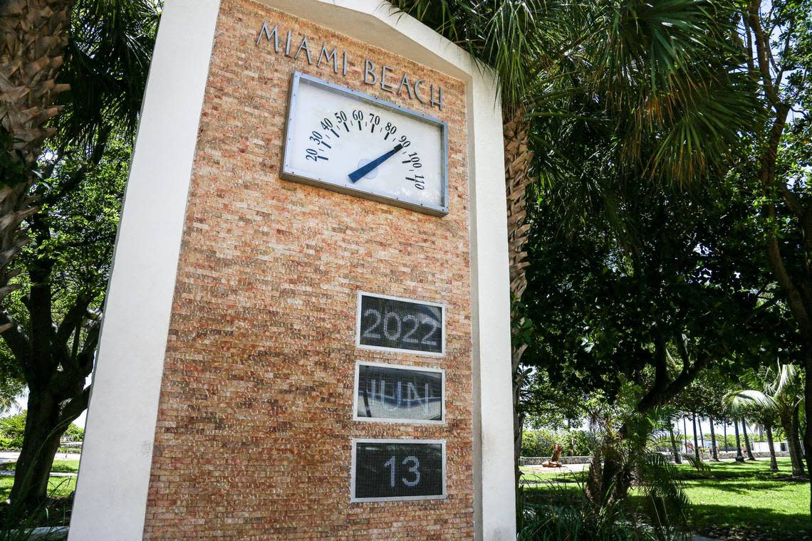
One thing you can count on, however: the heat. Temperatures will remain around 90 with heat indices in the triple digits over the interior with the temperature your body feels potentially topping 105 degrees.
Heat alerts are triggered when the index hits 108.
So with that kind of heat, do you miss the rain?
Hurricane season heats up earlier and earlier. New study suggests climate change is why