Why Boise keeps getting hit by strong, isolated thunderstorms — and what’s still to come
As the workday wrapped up Tuesday evening and Boiseans swapped their work clothes for loungewear and laptop screens for downtown views, it seemed like a typical Treasure Valley afternoon: clear skies, warm weather and a light breeze flowing through the city streets.
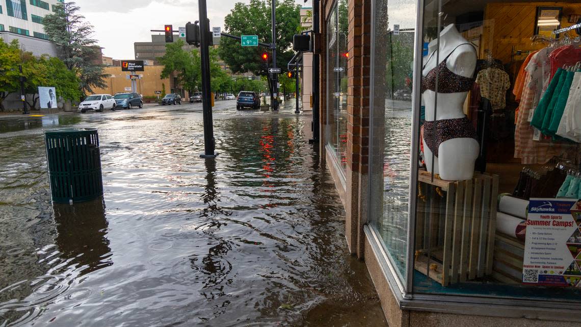
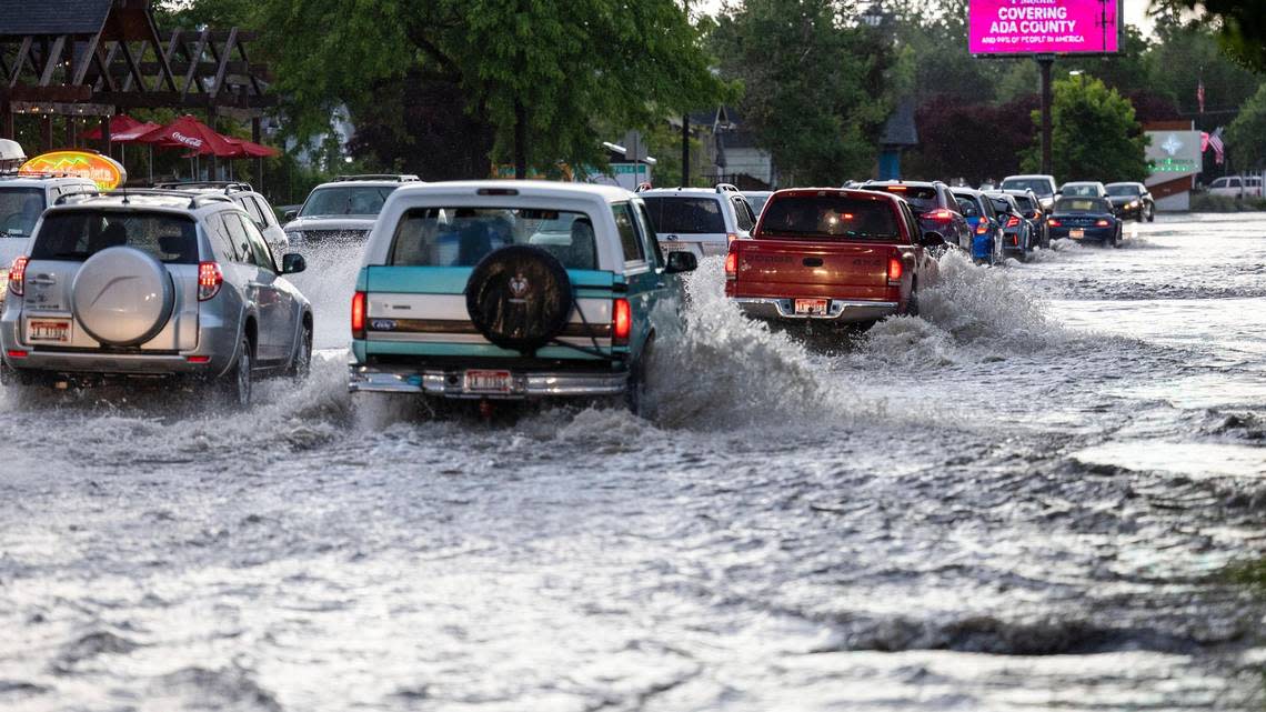
Then chaos hit. Streaks of lightning, rumbling thunder and some of the heaviest rain and hail Boise has seen in recent years suddenly spawned over the city at around 6:45 p.m. Several downtown roads — including the I-184 Connector — suffered heavy flooding, while Mountain Home witnessed an apocalyptic-looking storm that whipped winds of over 50 mph.
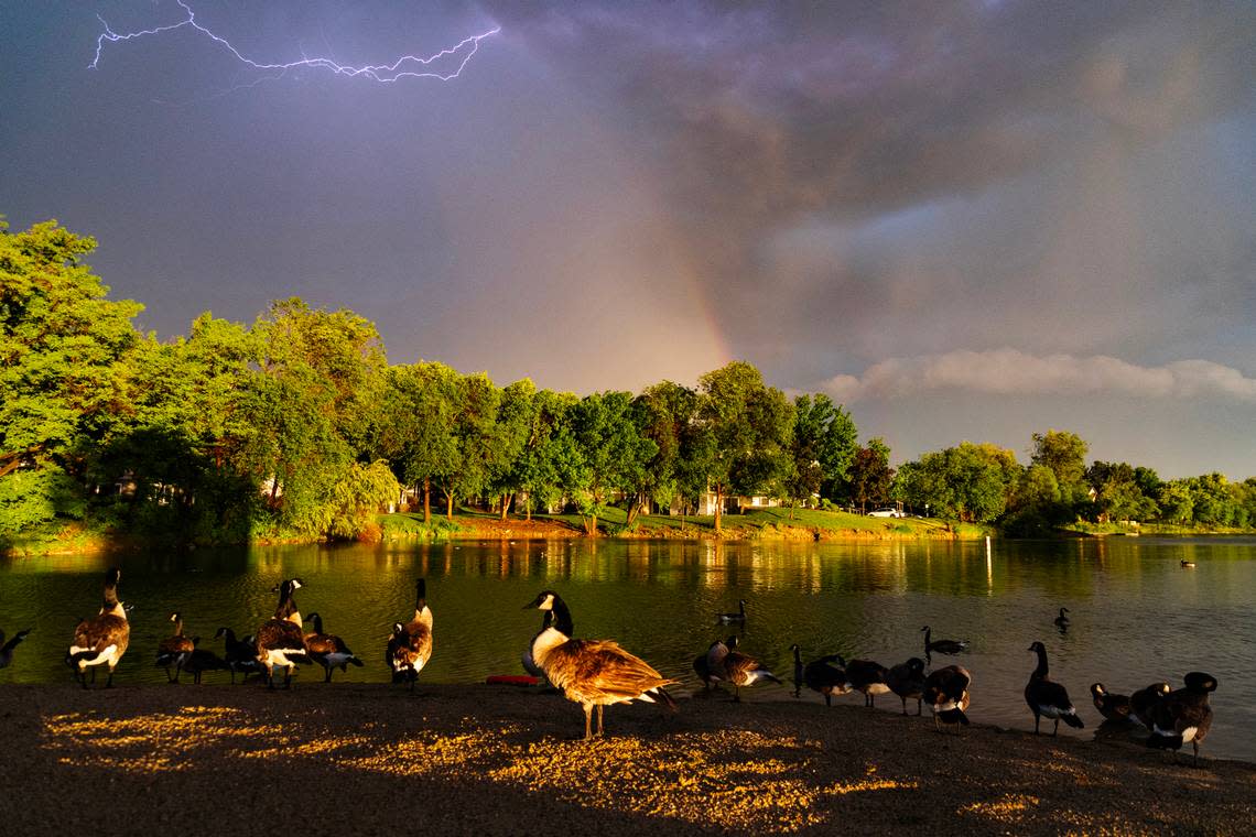
After about three hours of meteorological carnage, the storms finally dispersed, leaving behind a golden-orange sunset across the valley. Most of downtown Boise received between 1 and 2 inches of rain, the city saw nearly 1,500 lightning strikes and three-quarter inch hail was reported to the National Weather Service.
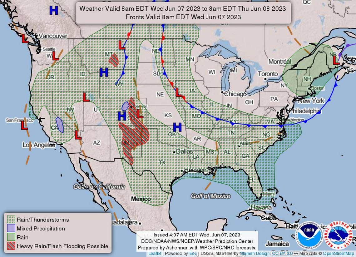
Yesterday, Ada County had the most lightning strikes of any day on record since 2000. The map shows precipitation estimates and lightning strikes, data courtesy of Earth Networks. #IDwx pic.twitter.com/RS6NBxM0XG
— NWS Boise (@NWSBoise) June 7, 2023
Severe thunderstorm warnings are becoming a regular thing of late in the Treasure Valley. Tuesday night’s storms come just a week after similar small-cell thunderstorms rapidly dropped over an inch of rain and caused flooding in West Boise. And the Weather Service is forecasting storms to continue barraging the city each night for at least another week.
So many days of thunderstorms within a short period is unusual for Boise, Weather Service meteorologist Bill Wojcik told the Idaho Statesman on Wednesday.
But why is Boise getting so many severe thunderstorms, and how much longer will they last?
The root cause of all these storms
As with many weather events, Boise’s recent thunderstorms are due to a weather system not even based in Idaho.
A low-pressure system — which rotates air in a counterclockwise direction — is sitting over California, Wojcik said, which is pulling warm, moist air from the southwest up toward the Gem State.
Warm, moist air is one of the three key ingredients needed for severe thunderstorms, along with atmospheric instability and lift. Moist air and instability often go hand-in-hand, while lift results from air being forced upwards by the Boise Foothills, which helps develop clouds for thunderstorms.
“(Tuesday) night, what happened was we had storms develop along the Foothills,” Wojcik said. “And so they weren’t moving much because weak winds aloft mean thunderstorms come in and will not move much, or they can redevelop.
“So in the case on (Tuesday), the storms redeveloped,” Wojcik continued. “So we had one storm kind of weaken and maybe move a little bit toward the Foothills, and then another one south of that developed and kind of hit the Boise area really hard. Everything came together just for the right conditions for that to happen here.”
Why have the storms been so localized?
When heavy storms flooded parts of West Boise in late May, downtown Boise barely received a drop of rain. A week later, when floodwater inundated the streets of downtown, West Boise and beyond barely saw a drop of rain.
Weather Service meteorologist Dave Groenert described Tuesday evening’s system as a “train” because of the continued development of storms across the same path over several hours.
This type of weather pattern is because of an outflow boundary: thunderstorm-cooled air that stands apart from the surrounding air around it. Outflow boundaries are associated with particularly strong storms — when you feel the temperature drop and cold wind ahead of a storm, that’s often associated with an outflow boundary.
The cooler air that rises higher into the atmosphere — otherwise known as lift — helps spawn other thunderstorms.
“That outflow boundary acts as a lifting mechanism as well,” Wojcik said. “So when you push those winds and lift up that moisture that’s already in the atmosphere, then you’re going to have more showers and storms form along that.”
That happened on Tuesday when multiple storms hit the downtown Boise area but avoided most of the area westward — the outflow boundary helped form storms behind the initial one, creating a train effect.
How much longer will Boise see this pattern?
It’s unusual for Boise to see such an extended period of severe weather. The Weather Service forecasts rain and thunderstorms every day until at least next Tuesday.
When warm, moist air is pulled into the Gem State from the south, it’s typically flushed out by colder airflow from the Pacific Ocean; this happens when there’s a change in wind direction, such as via a cold front or a shift in the jet stream.
“The change in wind pattern just kind of pushes everything out of here and creates different conditions where we don’t have the moisture and instability,” Wojcik said. “We don’t have the heat anymore to create those conditions for thunderstorms.”
As of Wednesday afternoon, the Weather Service forecasts at least a 40% chance of rain every day until Tuesday, with chances reaching as high as 80% on Friday night. Wojcik said the main focus for thunderstorms would be in the evenings, with lightning and high winds posing the most severe threats.