Week starting with another chance of severe weather. What are the threats?
More thunderstorms and severe weather are expected to make an appearance in Iowa on Monday evening.
The National Weather Service in Des Moines said that storms will move from Nebraska into western Iowa on Monday evening and across the state overnight. Damaging winds are the primary threat, but heavy rain and some tornadoes are possible, mainly in western and southwestern Iowa.
Thunderstorms will move from Nebraska into western Iowa this evening, then across the state tonight. Damaging winds, heavy rain, and a few tornadoes will all be possible, mainly over the western and southwestern half of Iowa. Please stay weather aware later today and tonight! pic.twitter.com/WW31j4AfmA
— NWS Des Moines (@NWSDesMoines) May 6, 2024
What severe weather is possible in Iowa for Monday?
NWS said heavy rain is possible as storms move through the state.
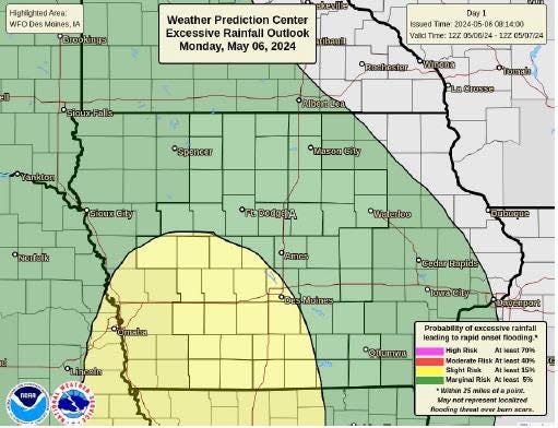
In western Iowa 0.75 to 1.5 inches of rain could fall in some areas. Rivers and streams may rise, possibly resulting in minor flooding.
Chances of severe weather are highest in western Iowa between 7 and 8 p.m. Monday evening and between 11 p.m. Monday night and 12 a.m. Tuesday in central Iowa. Eastern Iowa won't see storms until 1 a.m. Tuesday.
Victoria Reyna-Rodriguez is a general assignment reporter for the Register. Reach her at vreynarodriguez@registermedia.com or follow her on Twitter @VictoriaReynaR.
This article originally appeared on Des Moines Register: Iowa faces thunderstorms and severe weather to start the week
