Hurricane watches, storm warnings as Tropical Storm Ophelia approaches
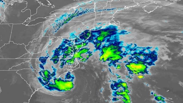
Tropical Storm Ophelia gained some strength on Friday as it moved north toward an expected landfall on North Carolina's eastern coast.
As of Friday evening, the storm had sustained winds of 70mph, just shy of the 74mph threshold that defines a Category 1 hurricane. It was located about 90 miles south of Cape Lookout in North Carolina, moving largely north at about 12mph.
A Hurricane Watch was in effect for the areas North of Surf City, North Carolina to Ocracoke Inlet, North
Carolina.
A Tropical Storm Warning was in effect for Cape Fear, North Carolina to Fenwick Island, Delaware; Albemarle and Pamlico Sounds; Tidal Potomac south of Cobb Island and Chesapeake Bay south of North Beach.
A Storm Surge Warning was in effect for Bogue Inlet, North Carolina to Chincoteague, Virginia; Chesapeake Bay south of Colonial Beach, Virginia; Neuse and Pamlico Rivers and portions of Pamlico and Albemarle Sounds.
A Storm Surge Watch was in effect for Surf City, North Carolina to Bogue Inlet, North Carolina and the remainder of Pamlico and Albemarle Sounds.

Tropical storm conditions were forecast to arrive in listed areas by Friday, while hurricane conditions were forecast to be possible within the watch area by Saturday. A storm surge of as much as six feet was forecast for parts of the Neuse, Bay, Pamlico and Pungo Rivers.
"Heavy rainfall from this system could produce locally considerable flash, and urban flooding impacts across portions of the Mid-Atlantic states from North Carolina to New Jersey through Sunday," the National Hurricane Center wrote.
The storm was expected to lose intensity quickly once it moved over land. The system and its remnants are expected to move northeast over mid-Atlantic states over the next 48 hours.
