Flood evacuation warnings in Fresno, Madera, Tulare as atmospheric river arrives
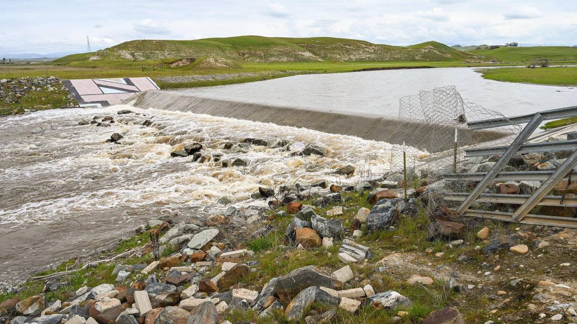
An excessive rainstorm headed to the San Joaquin Valley that could flood streams, rivers and storm drains led officials in Fresno, Madera and Tulare counties to announce evacuation warnings.
The latest atmospheric river was expected to bring heavy rainfall starting Thursday in a storm too warm for much of the precipitation to turn to snow, according to the National Weather Service in Hanford.
The Sierra Nevada was blanketed in the past couple of months in snowfall that doubled the normal precipitation in some areas, and others saw even more.
The service issued a flood watch for all of the San Joaquin Valley below 4,000 feet from Thursday afternoon to Sunday morning.
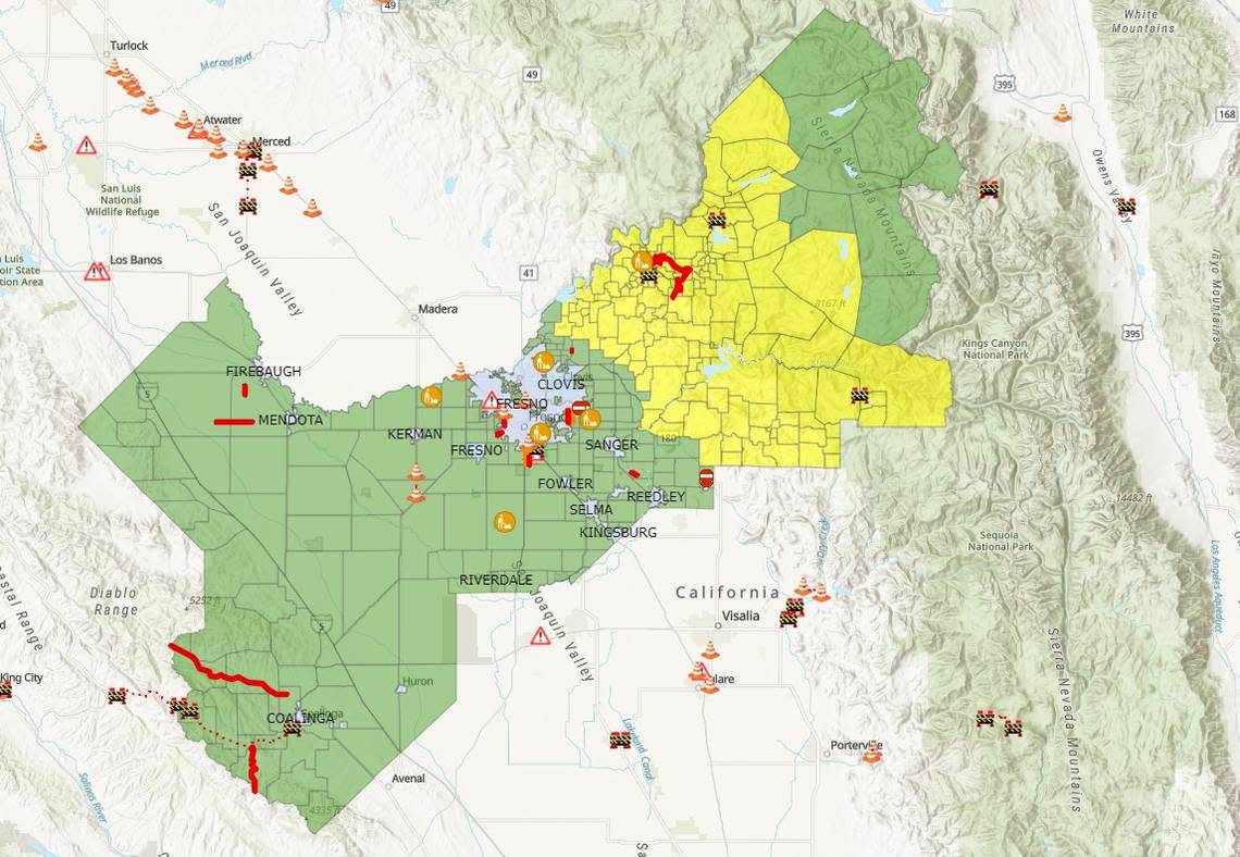
Which Fresno roads are most likely to flood during major storms? See our interactive map
Fresno County evacuation warning
The Fresno County Sheriff’s Office created a real-time map of the eastern part of the county that could be subjected to evacuations if conditions become hazardous.
As of Thursday morning, that included mostly any area east of the Friant-Kern Canal.
“During a warning, residents are encouraged to begin gathering belongings and be prepared for an evacuation order,” the office said on social media.
The county announced Thursday that it was relocating its emergency shelter from Reedley College to the Sanger Community Center, 700 Recreation Ave. The new shelter was set to open at 3 p.m. Thursday.
Madera County evacuation warning
The Madera County Sheriff’s Office issued warnings to:
Cascadel Woods subdivision, MDC-E061-B, east of Whiskey Creek. Impacted areas include east of the bridge, as well as Cascadel Drive North, Cascadel Lane, Waterfall Way, Gertrude Creek Drive, Cascadel Drive, Cascadel Drive South, Cascadel Road.
Bass Lake Mobile Home Park (North Fork), MDC-60B-A. The impacted zone includes large swaths of the North Fork Recreation Area Memorial Park and is located north of Road 225, south of Roads 274 and 230, east of Road 230, and west of Road 230.
Church Street along Willow Creek (North Fork), MDC-88A-B. The impacted zone is located between North Fork Town Hall and North Fork Elementary School. The impacted zone is north of Road 222, east of Road 222, south of Road 225, Willow Creek Drive, and Amber Lane, and west of Willow Creek Drive.
Wildwood Mobile Home Park, MDC-E129A. Impacted areas include north of Burgundy Lane, east of Highway 41, south of Redwood, and west of Cottonwood. The mobile home park is located just north of the San Joaquin River.
Tulare County evacuation warnings
Ponderosa in Tulare County was under evacuation warning as on Wednesday, the Sheriff’s Office said.
The warning includes all businesses, homes and structures within the community, and all roadways, Forest Service Roads, access ways attached to Mountain 107 (also known as the Western Divide Highway) north of Mountain Road 50, and south of Highway 190.
Later in the day, the office extended the warning to any homes and businesses along the Kings River from the Fresno County line to the Kings County line.
“The Kings River water flow is expected to increase to dangerous levels,” the sheriff’s office said on social media.
How to be prepared in a flood zone
Tulare County officials said those in areas under warning should be prepared to leave in a hurry.
To prepare:
•Stock up on several days worth of food, water, medications and other necessary supplies.
•Refill home propane tanks and/or secure adequate firewood for heating.
•Refill primary and backup fuel supplies for generators and vehicles.
•Charge backup batteries for your electronic devices.
•Sandbag vulnerable structures in low-lying areas and near creeks, streams, rivers, canals or other waterways.
•Keep an emergency kit in your vehicle with food, water and blankets in case you become stranded. Do not leave your vehicle, if stranded, in the snow.
Here are general safety tips around flooded or snowed-in areas:
•Never drive into flood waters because they are deeper, colder and faster-moving than they appear.
•Do not operate electrical equipment in standing water.
•Operate generators only in well-ventilated areas.
•Do not use ovens, ranges or barbecues for home heating.
•When you’re safe, call your relatives after evacuation.
Emergency info by county
•Fresno County: fresnosheriff-cofgisonline.hub.arcgis.com and fresnocountyemergency.com
•Madera County: MaderaAware.com and mcalert.org
•Tulare County: tularecounty.ca.gov/emergencies, register for AlertTC at alerttc.com
Each county and sheriff’s office also has a Facebook page with updates.