'Under the gun.' Damaging winds, large hail and tornadoes possible in Mississippi
Severe weather is expected to race across Mississippi Thursday night into Friday morning and Central Mississippi is in the thick of it.
"Generally speaking, we're expecting a big wind event," said Mike Edmonston, senior meteorologist with the National Weather Service in Jackson. "Wind is the primary threat.
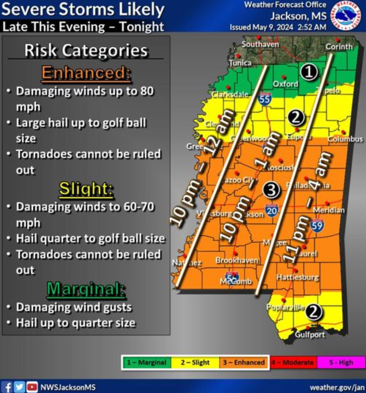
"This is a threat that could see in excess of 70 to 80 mile per hour winds. That's a very enhanced threat. Central Mississippi looks under the gun the most."
Edmonston said winds like that during winter don't pose quite as much of a threat because most trees don't have leaves on them and offer less resistance. Now they are at greater risk of toppling.
"We're into May now," Edmonston said. "Just about all the trees are in full foliage."
Pine trees that were killed by complications of last year's drought also pose a risk. Edmonston said while they may not have needles on them, they are decaying and could easily be knocked down by strong winds.
More: Mississippi bans squatted vehicles, but what are they and why are they banned?
Hail, heavy rain and tornadoes possible
The second biggest risk is hail. Edmonston said hail as large as golf balls may be associated with the coming storm which could damage unprotected vehicles and break windows.
Locally heavy rainfall is also a concern. Edmonston said areas may see 1 to 2 inches of rain which could create runoff issues on roads. Tornadoes can't be ruled out, either.
The good news is the threat is expected to move across the state quickly. Edmonston said Vicksburg should start seeing impacts around 9 p.m. to 10 p.m. and the storm should exit the state to the east by 3 a.m.
The greatest risk is from US 82 and south to below Hattiesburg. Coastal counties are at slight risk. Areas north of US 82 are at slight risk up to Tupelo and Clarksdale with areas above that being at marginal risk and little risk closer to the Tennessee state line.
Weather Radar in Mississippi

Do you have a story idea? Contact Brian Broom at 601-961-7225 or bbroom@gannett.com.
This article originally appeared on Mississippi Clarion Ledger: Weather in Mississippi may produce tornadoes, damaging winds, hail
