UK weather: New warnings for strong winds as heavy rain and showers end Easter in washout
Power cuts and travel delays loom as forecasters warn of strong winds in the coming days.
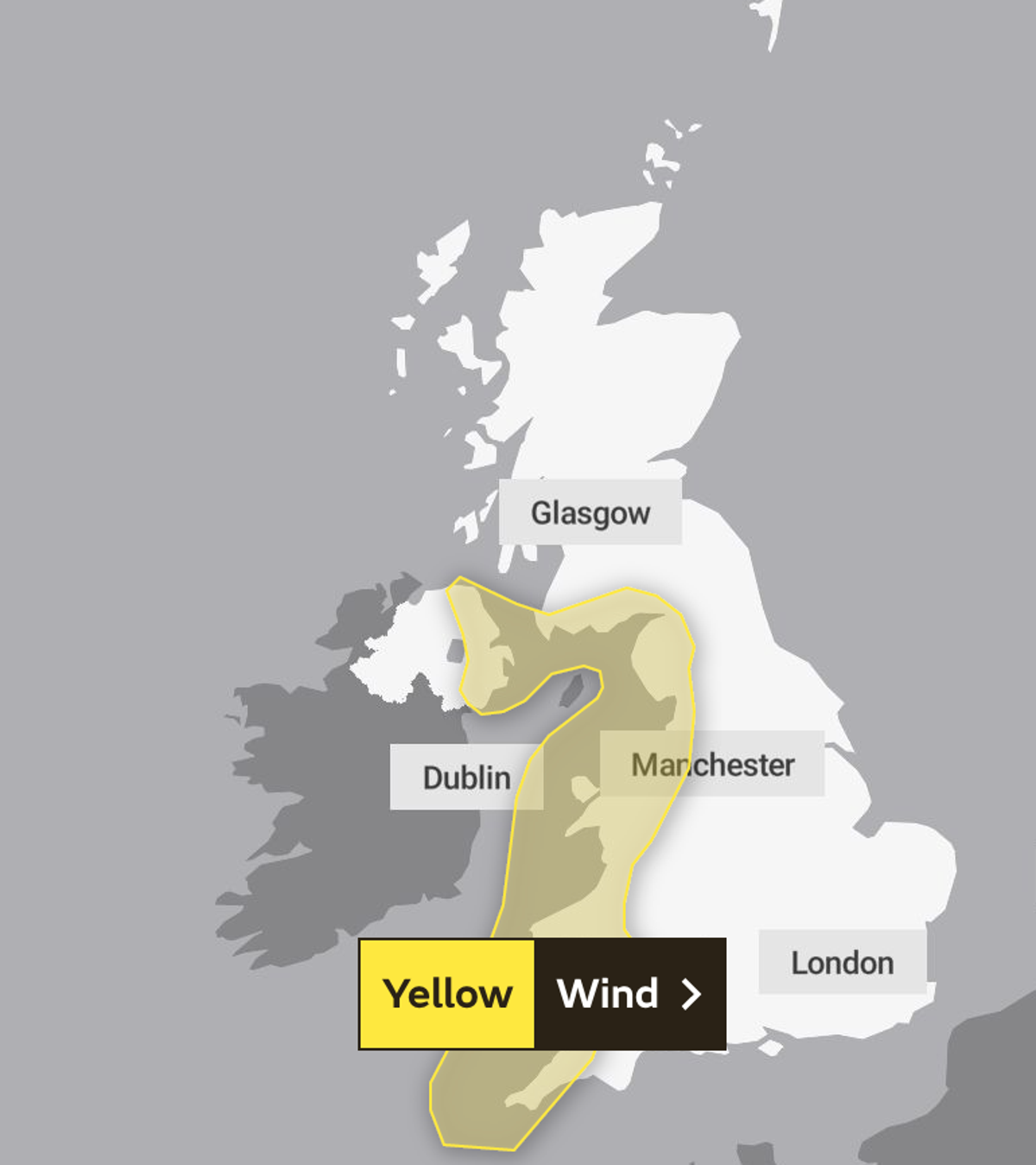
The Met Office has issued two weather warnings for wind following a warm, sunny and settled Easter weekend for many.
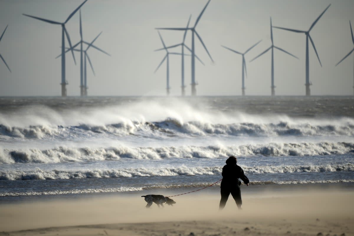
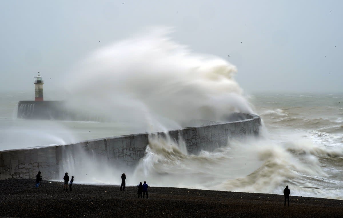
Gusts could exceed 40mph and transport delays are likely, particularly in coastal areas.
Temperatures are also liekly to drop on Tuesday and Wednesday, when they are not set to top 13C.
Easter Sunday’s heat had been expected to top this year’s record of 17.8C but instead fell just short, hitting 17.3C in Chertsey, Surrey.
The first of the two warnings runs from 3pm on Tuesday to 3am on Wednesday, and covers much of the western flank of the country — from Cornwall in the south up to Belfast, Dumfries and Carlisle in the north.
The Met Office said the potential disruption was most likely to strike in the early hours of Wednesday, though Britons should also ready themselves for disturbance later on Tuesday.
Forecasters warned of some delays to road, rail, air and ferry transport, with longer journey times also expected on some bus and train services.
High-sided vehicles have been urged to exercise particular caution, especially when travelling on exposed routes and bridges.
The Met Office says there might also be some “short term loss of power and other services”, while coastal communities will likely be affected by spray and large waves.
The second alert has been issued between 6am and 11.59pm on Wednesday as a swathe of strong winds threatens to pile on more disruption.
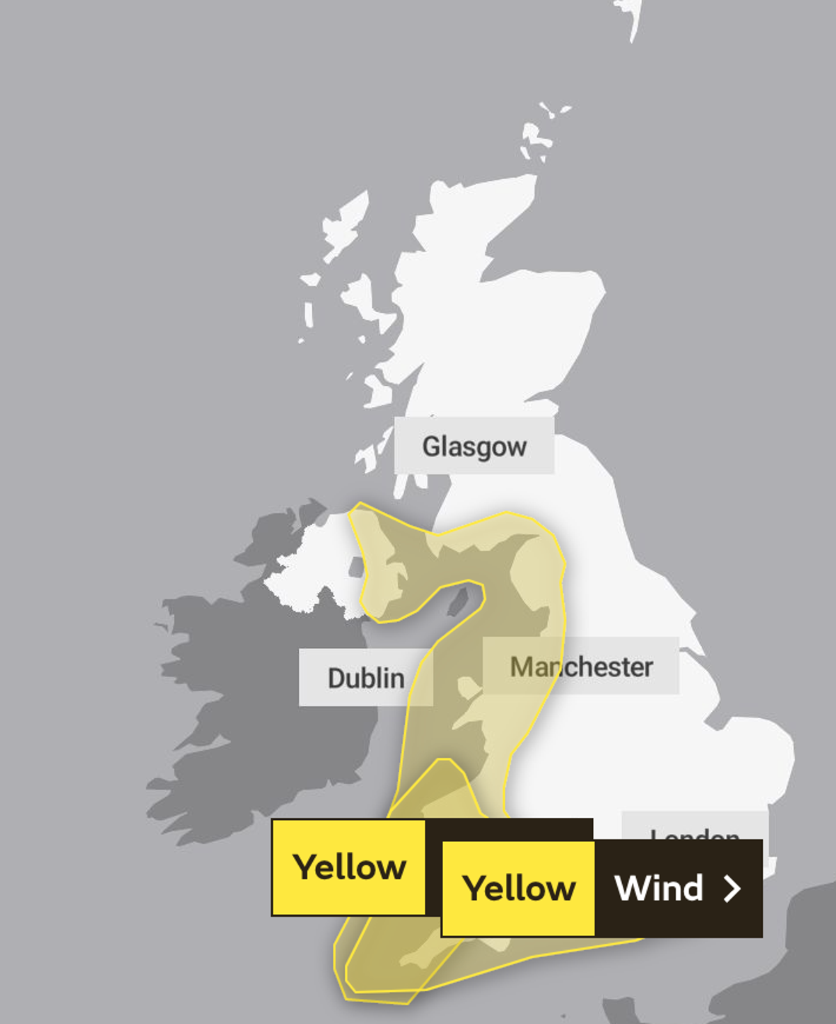
The warning covers most of the south coast and large parts of the west and southwest of both England and Wales.
Forecasters have issued near identical disruption warnings for the second alert, which stretches as far as Brighton in the southeast and Cornwall in the southwest, with Cardigan marking its northern point.
It's turning unsettled as we end the Easter weekend and move into the new week ☔
Find out what to expect from the weather over the next five days below ⤵️ pic.twitter.com/nUPryQjAFM— Met Office (@metoffice) April 9, 2023
It will follow Easter Monday’s sunshine and blustery showers, with some areas experiencing hail and thunder quickly east across parts of northern England.
Met Office five-day forecast
Monday:
Spells of locally heavy rain clear eastern England through the morning; blustery showers following for most. Showers at times organised, with risk of hail and thunder, and lasting well into the evening. Temperatures near normal, but tempered by brisk winds.
Monday evening:
Showers continuing in places, but becoming less widespread away from the southwest. Winds slowly easing, leading to a chilly night with frost in places.
Tuesday:
Showers for some southern areas early, but more widespread, locally heavy rain will push north across England, Wales and Northern Ireland by late morning. Becoming windy, with gales developing.
Outlook for Wednesday to Friday:
Unsettled and often windy on Wednesday, with rain or showers for most. Showers and wind gradually easing through Thursday. Rain in the south Friday, scattered showers elsewhere. Cold.
