UK weather: Met Office issues warnings as heavy gales and downpours expected
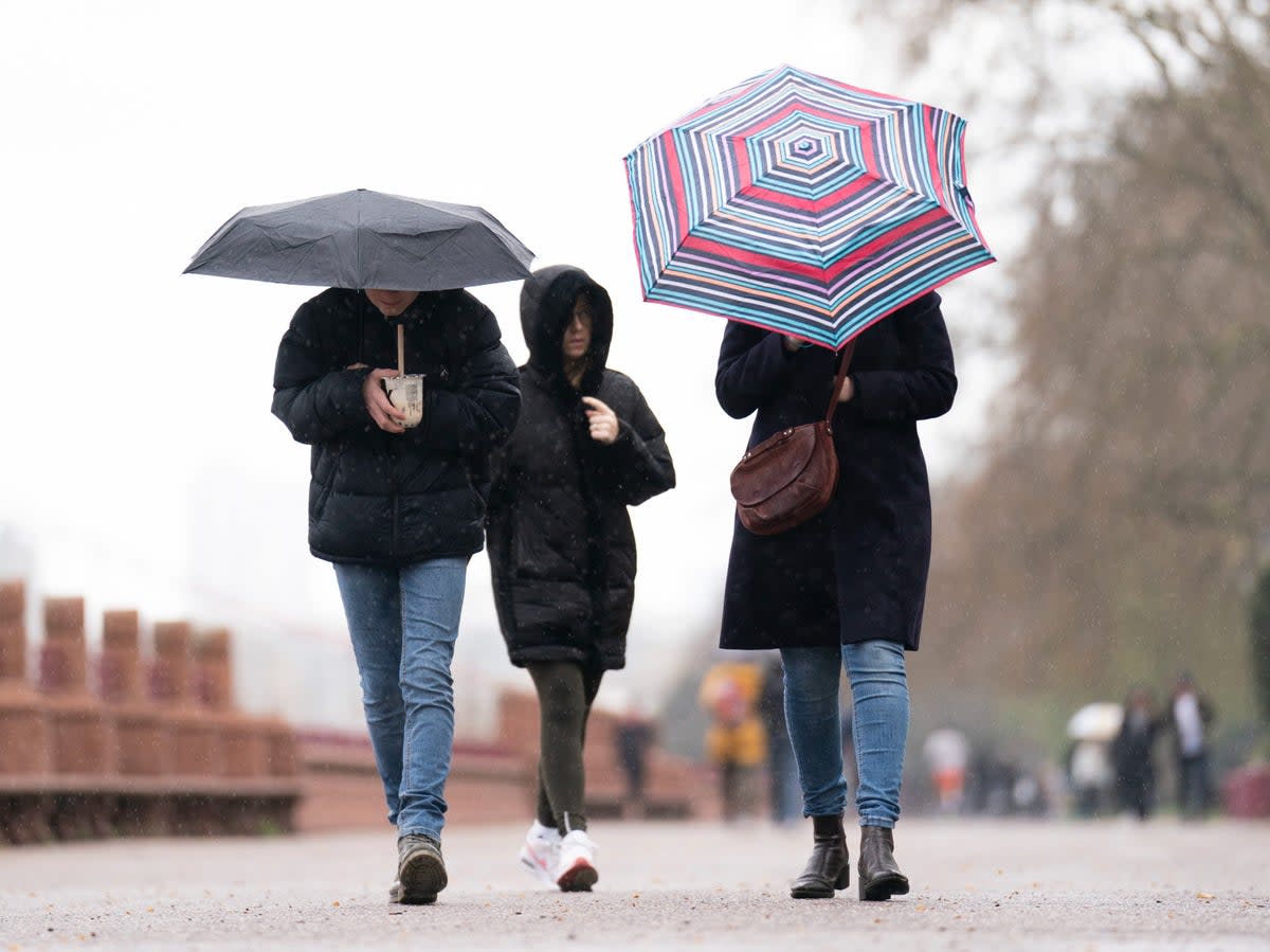
The UK is bracing for unsettled weather as heavy gale and downpours are expected in several parts of the country following a sunny and settled Easter weekend for many.
The Met Office has issued two yellow weather warnings, alerting people to potential disruption to transportation and other services.
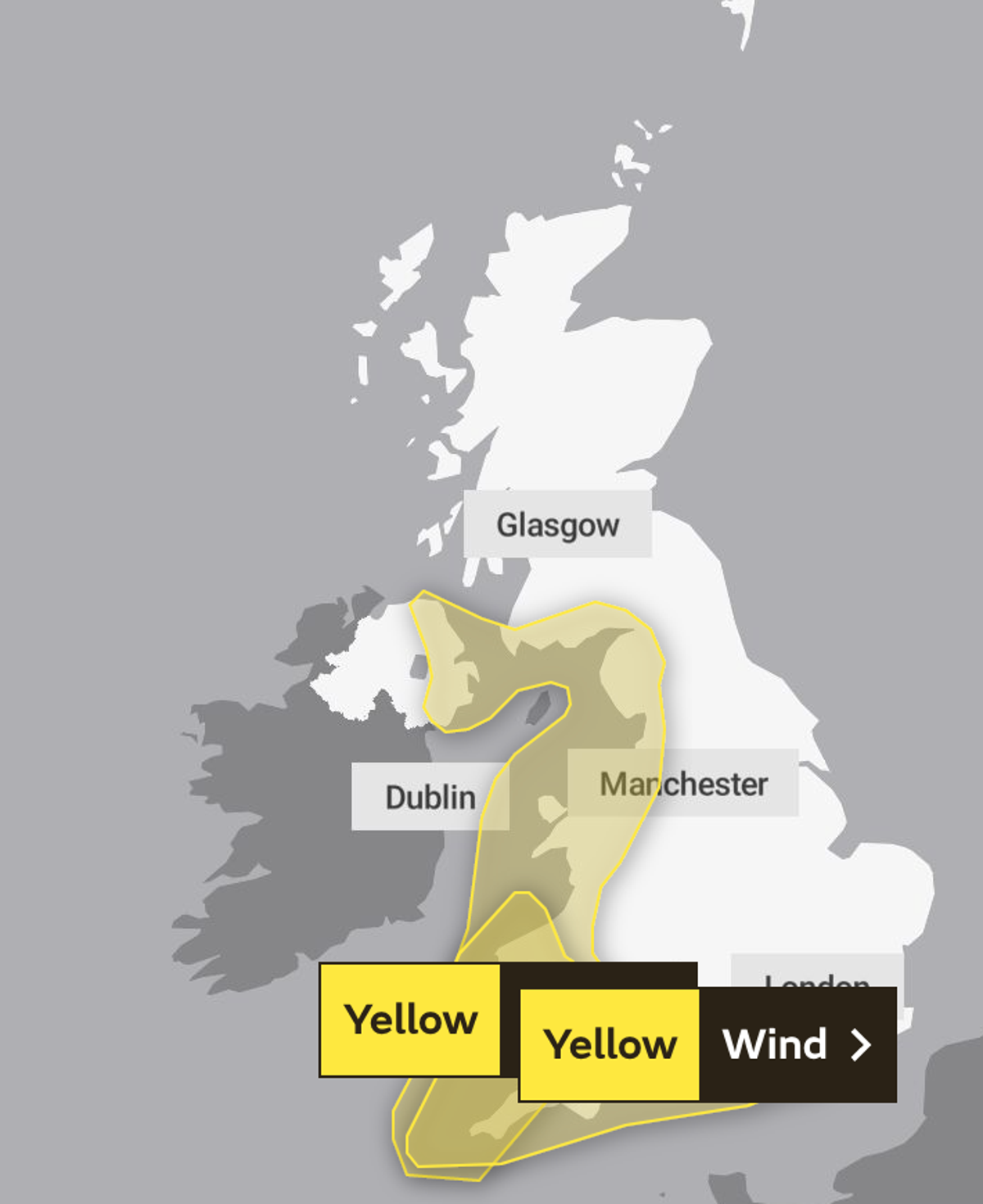
The first warning is in effect from Tuesday at 3pm until Wednesday at 3am and covers much of the western flank of the country, from Cornwall in the south up to Belfast, Dumfries and Carlisle in the north.
It covers a period of strong winds that may cause delays to road, rail, air, and ferry transport. Bus and train services could be affected and high-sided vehicles on exposed routes and bridges may face delays.
Some short-term loss of power and other services is also possible, and coastal routes, sea fronts and coastal communities may be affected by spray and/or large waves.
On Tuesday, sunny spells with scattered showers can be expected in some areas, but more widespread rain is expected to push northeast across all regions throughout the day.
The north may experience slow-moving rain and gales that are forecast for exposed coasts and hills. Despite windy conditions, temperatures are expected to be near normal.
Moving into Tuesday night, further spells of rain are expected for parts of Scotland, with snowfall over mountains. Many other areas may experience rain or showers, some of which could be heavy with thunder. Eastern Scotland is also expected to face gales.
The second yellow weather warning is in place from Wednesday at 6pm until midnight. It highlights the possibility of rain or showers for all regions, with snowfall expected in the northern mountains.
A period of gales or severe gales is also likely for parts of the west and southwest. Temperatures are expected to be below normal during this period.
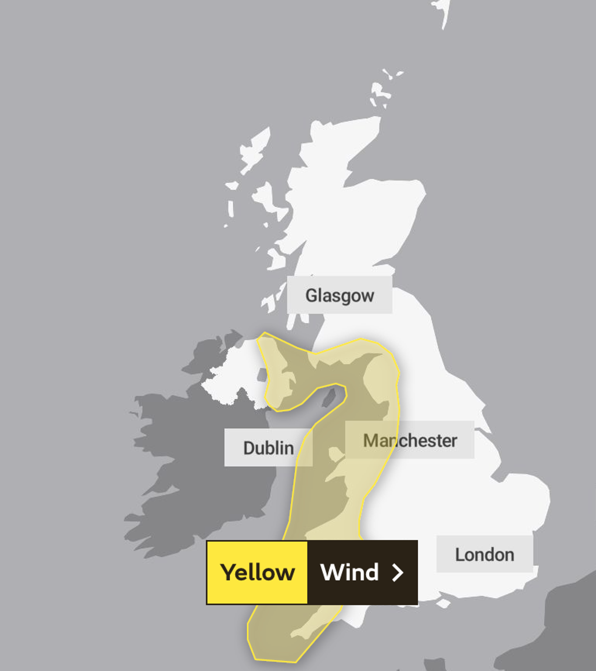
The warning covers most of the south coast and large parts of the west and southwest of both England and Wales.
Forecasters have issued near identical disruption warnings for the second alert, which stretches as far as Brighton in the southeast and Cornwall in the southwest, with Cardigan town marking its northern point.
Showers and wind will gradually begin easing through Thursday. Rain is, however, expected again in some southern areas on Friday with scattered showers elsewhere as temperatures remain cold.
