UK weather: Major incident as heavy rain causes flash flooding with more thunderstorms on the way
Thunderstorms could hit parts of the UK for a second day after flash flooding saw a major incident declared in Somerset.
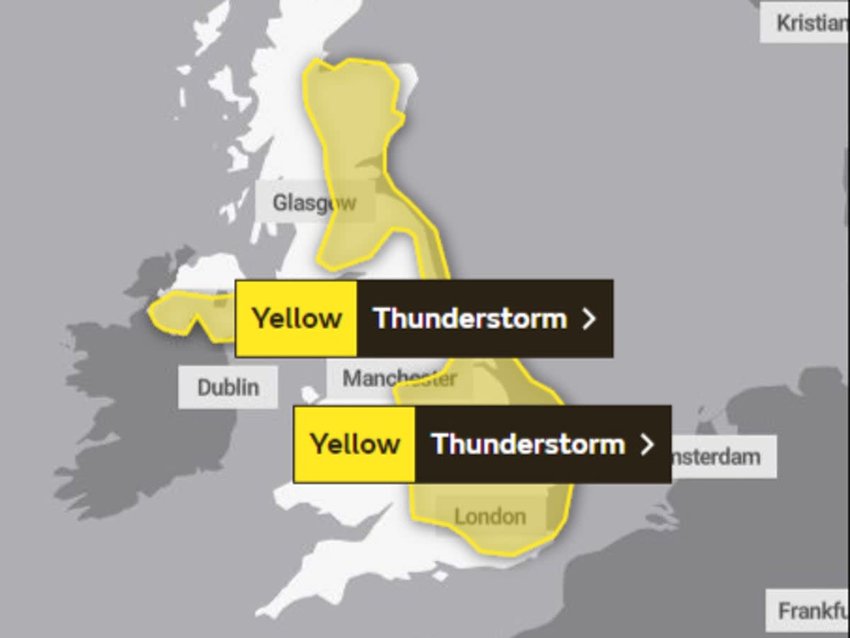
Swaths of the UK have been told to brace themselves for further downpours on Wednesday evening, with the Met Office issuing a warning for all of the east of Britain, from Kent to Aberdeenshire, including the Midlands.
The Environment Agency has also issued 36 “expected or possible” flood alerts across the south and East Anglia.
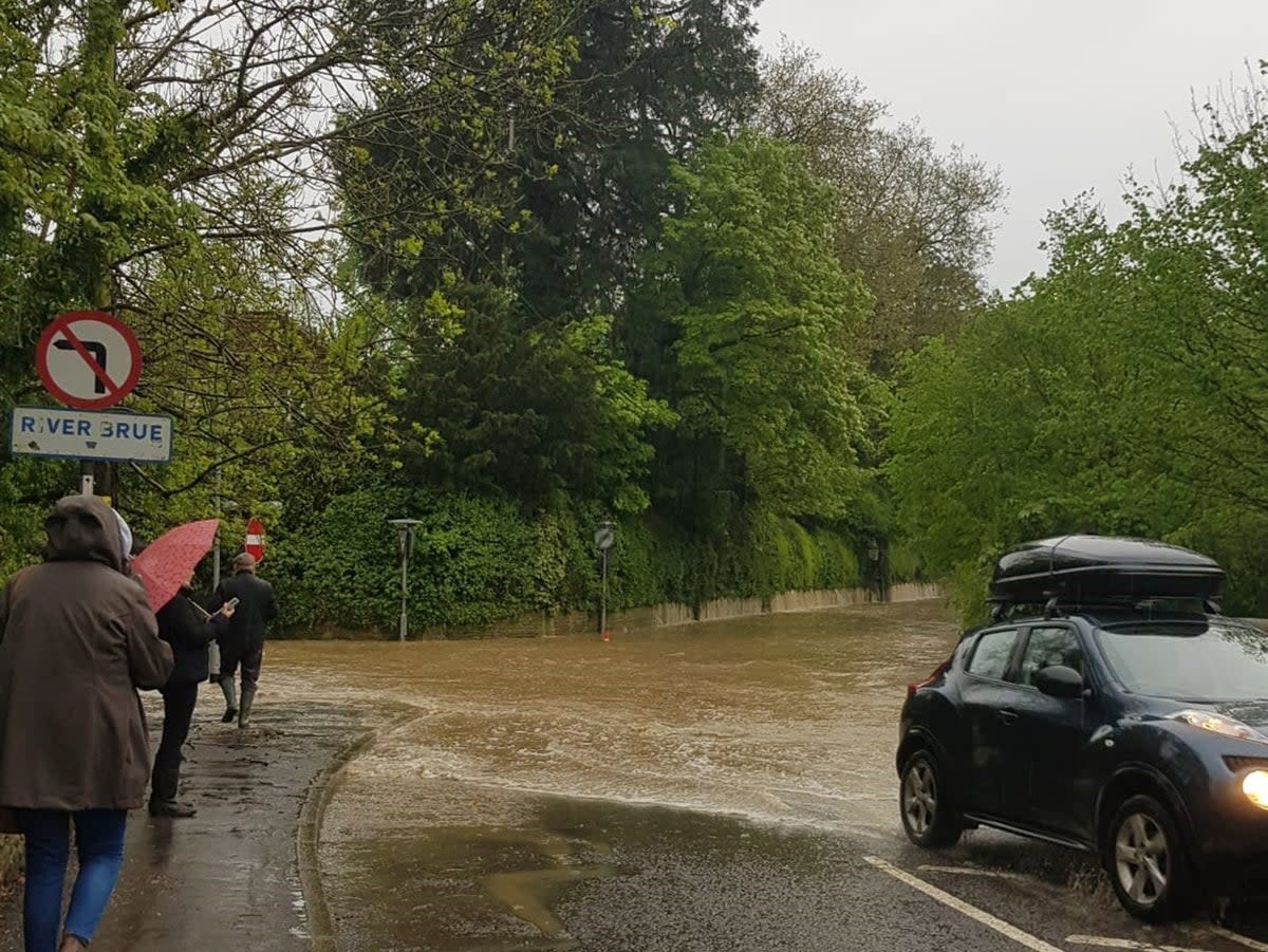
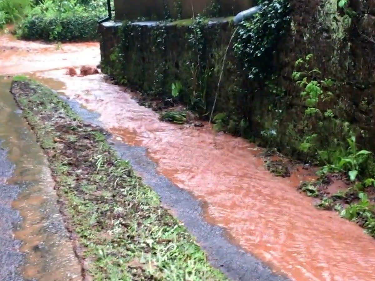
It comes after more than two weeks’ worth of rainfall fell in just a few hours in some areas of Somerset, and homes were evacuated amid mudslides. The major incident was declared just before midnight.
The Environment Agency issued several red “act now” flood warnings in Somerset, although waters later receded somewhat.
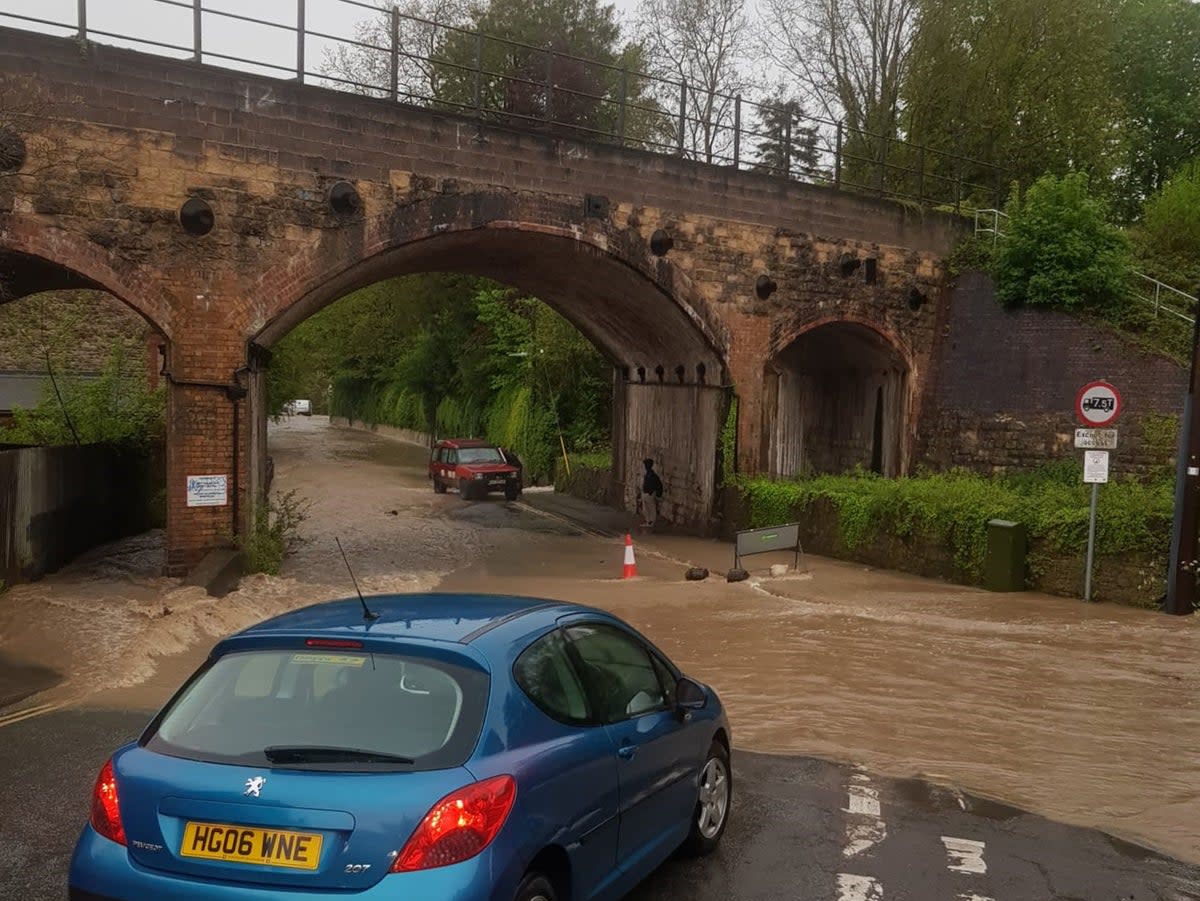
Roads became impassable and cars were stranded in muddy water in places such as North Cadbury, Galhampton and Queen Camel, following Tuesday’s torrential rain.
Avon and Somerset Constabulary worked through the night with Devon and Somerset Fire and Rescue Service and Somerset Council to ensure people were safe.
People were warned against driving through flood waters after fire crews said they had received calls from drivers stranded in their cars.
Water levels around the River Cam at Weston Bampfylde were the highest on record, SomersetLive reported, reaching 2.83m, beating the previous record of 2.09m set in 2008.
Climate scientist Prof Bill McGuire said the UK could expect a lot more of such conditions as hotter summers “drive ever more powerful convective storms that spawn extreme flash floods”. A major incident after flooding in Somerset was declared just four months ago, in January.
Elsewhere, heavy rain in Devon damaged homes and businesses and made driving dangerous. In Hertfordshire, Northamptonshire and Essex downpours blocked roads and delayed rail services.
Basingstoke was battered by hailstorms, with one resident fearing for the safety is car in the deluge.
George Dibley said: “It was crazy to see and hear. It sounded like someone was knocking on our window.
“We got worried at one point that if the hail got any bigger it might damage our car but thankfully it only lasted a few minutes.”
Further heavy showers and thunderstorms are expected to develop through Wednesday afternoon – across central and eastern areas of Scotland, parts of central, eastern and southeastern England and southern areas of Northern Ireland – before the weather eases during the evening.
Some 25-30 millimetres of rain are predicted to fall within two to three hours in areas where heavy rain develops.
According to the Met Office, there will be some sunshine on Thursday, with rain, hail and thunder breaking out before the weather is “widely settled” from Friday through to Sunday.
MET OFFICE OUTLOOK
Wednesday evening
Daytime showers mostly dying out through this evening, though some persisting in the north and west through the night. Winds easing and turning chilly where cloud breaks, with some patchy mist and fog developing.
Thursday:
Any early mist clearing. Some sunshine, but showers breaking out quite widely, potentially heavy and slow-moving in places with hail and thunder. Light winds, and near average temperatures.
Outlook for Friday to Sunday:
Widely settled, perhaps patchy rain and drizzle for eastern coasts Friday, showers in the south. Rain arriving in far northwest on Sunday, pushing slowly southeast. Temperatures around average, light winds.
