UK weather: Heavy snow and blizzard to hit Britain as Arctic blast hits
The UK is preparing for blizzard conditions as heavy snowfall is set to hit central and northern England on Thursday.
The Met Office issued an amber weather warning for the area between Stoke-on-Trent and Durham, warning of strong winds and blizzard conditions.
The warning will remain in place for 21 hours from 3pm on Thursday until 2pm on Friday.
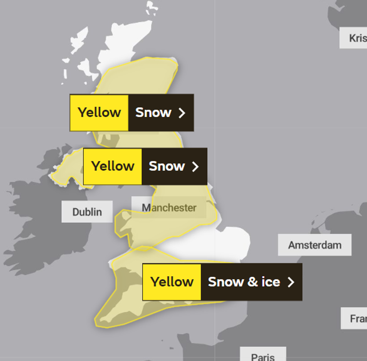
Another yellow warning for snow and ice covers north-east England and south-east Scotland from 5pm on Wednesday until 7am on Thursday.
A fourth yellow warning for snow covers all of the UK north of Birmingham, spanning from 7am on Thursday until 2pm on Friday.
Temperatures are expected to be around 0C or below in the north and central UK, with some sunshine expected in Scotland.
Snowfalls of 10-20cm in most places and up to 30-40cm in the worst-affected areas could combine with strong winds to cause “significant disruption”, the Met Office warned.
The combination of heavy snow and strong winds could result in travel delays on roads, cancellations and delays to rail and air travel, and power cuts.
Rural communities could also become cut off, while other services such as mobile phone coverage may be affected.
The warnings come after Tuesday marked the coldest night of the year so far, with temperatures at Kinbrace in the Highlands dropping to this year’s low of minus 15.4C. More sub-zero overnight temperatures are expected in all four UK nations in the coming days. The UK Health Security Agency has issued a level three cold alert for the whole of England.
Several milder yellow weather warnings for snow have also been issued, covering much of the nation from Wednesday to Friday.
More than 100 schools across Wales have already closed due to snow, and all schools in Shetland have also closed.
At least 27 flights from Bristol Airport have been suspended due to the weather.

Met Office spokesperson Nicola Maxey said although the cold temperature recorded was the lowest since 2010, it is not unusual to see snow in March. Despite this, the impending blizzard conditions and heavy snowfall remain a cause for concern, and the public is advised to take precautions and stay updated on the latest weather warnings.
The outlook for Friday to Sunday indicates that snow and rain will clear east through Friday, with snow showers persisting in northern Scotland. Very cold temperatures are expected to start on Saturday before further rain and snow move northeastwards through the weekend.
