Tropical storm warning issued as North Carolina coast braces for Ian’s wind and rain
A tropical storm warning is in effect for a large part of the North Carolina coast as Hurricane Ian remains on track to bring a deluge of rain and 50 mph gusts, according to the National Weather Service.
Dangerous storm surge warnings and a coastal flood advisory are also in effect for part of the coast North Carolina.
Ian began Thursday as a tropical storm but returned to Category 1 hurricane status late in the afternoon. It is expected to make landfall in South Carolina Friday with winds of 75 mph, forecasters say.
Coastal counties under the tropical storm warning include: Duplin, Greene, Jones, Lenoir, mainland Dare, Martin, Northern Craven, Pitt, Tyrrell, and Washington.
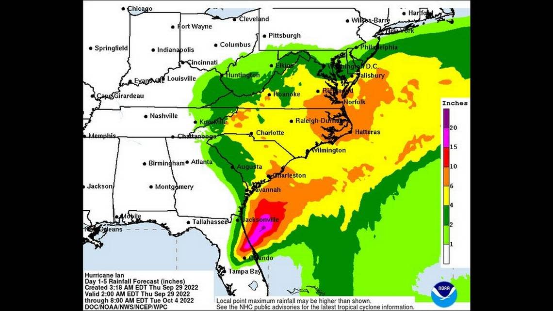
“Regardless of the exact track of Ian, there is the potential for extensive impacts to eastern North Carolina,” the National Weather Service says.
“Heavy rain bands will bring rainfall amounts up to 5 to 8 inches, which will bring the threat of localized flooding, especially in low-lying, urban, and poor drainage areas. Life-threatening storm surge inundation of 2 to 4 feet above ground is possible along much of the coast.”
Downed trees, power outages, rip currents and possible tornadoes are also in the forecast.
No major changes in our impacts. Our biggest concern is flooding, so if you live near the water be sure to know the difference between a Storm Surge Watch and a Storm Surge Warning. Have multiple ways to receive warnings today! #ncwxhttps://t.co/CAZ6pXICRr pic.twitter.com/DJKzxwqclw
— NWS Newport/Morehead (@NWSMoreheadCity) September 30, 2022
The storm was atop Florida early Thursday and moving north at about 9 mph. It is expected to exit into the Atlantic Thursday, then make landfall again near Charleston, South Carolina, forecasters said.
Tropical force winds of 20 to 30 mph will be felt along the coast, with gusts to 45 mph. Isolated spots like Bald Head Island could see winds near 60 mph, experts say.
The storm’s impacts remains large and are being felt up to 415 miles from the center, the National Hurricane Center says.
Ian created “widespread, life-threatening catastrophic flooding” in Florida, and could do the same in southeastern Georgia and eastern South Carolina, forecasters say.
“Some slight re-intensification is forecast, and Ian could be near hurricane strength when it approaches the coast of South Carolina on Friday,” the National Hurricane Center reports.
“Weakening is expected Friday night and Saturday after Ian moves inland.”
Watch chaos within Category 4 Hurricane Fiona as aquatic drone faces 100 mph winds
Extremes hit Eastern US as snow falls in New England and Hurricane Ian nears Florida
Two Outer Banks homes collapse into ocean and more could fall at any time, park says
