While tropical storm warning remains, calm is slowly returning to Beaufort County
Rain, winds die down in Beaufort County
6 p.m. Friday
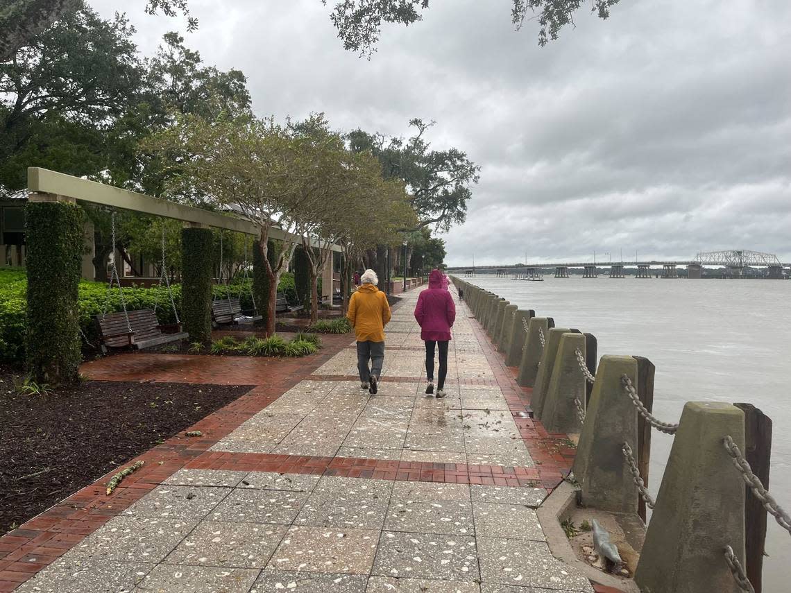
In stark comparison to 12 hours earlier, light winds replaced cool gusts felt earlier and constant showers have turned into sprinkling in Beaufort. Some boats were gathered in Battery Creek and the tide was moving out. There was no clear local flooding in Port Royal, only a smattering of palm fronds along Ribaut Road.
While Friday remained overcast and in the 60s, temperatures will climb considerably Saturday and the sun will make an appearance. Saturday is forecast to be sunny, with a high near 79 and southwest winds between 7 and 13 mph.
By 5:30 p.m., the National Weather Service had removed the storm surge and hurricane warnings for Beaufort County. It did, however, issue a tropical storm warning for South Carolina’s coastal waters, including Beaufort County.
“Conditions will continue to improve this evening,” Meteorologist Ron Morales said around 5:50 p.m. Friday.
-Sarah Haselhorst, shaselhorst@islandpacket.com
County’s solid waste and recycling convenience centers to reopen
5:20 p.m. Friday
Beaufort County’s solid waste and recycling convenience centers will reopen Saturday morning. Hours will be extended one hour beyond regular operating time Saturday, and they will open one hour early and extend one hour later Sunday, according to a county news release.
On Saturday and Sunday, decal requirements to use the centers will be suspended. Decal requirements will go back into effect beginning Monday.
Saturday convenience center hours: 7:30 a.m. to 7 p.m.
Sunday convenience center hours: 6:30 a.m. to 7 p.m.
-Sarah Haselhorst, shaselhorst@islandpacket.com
Hurricane Ian becomes a post-tropical cyclone
5 p.m. Friday
After hitting just south of Georgetown as a Category 1 hurricane and rattling Myrtle Beach and Pawleys Island, Ian became a post-tropical cyclone at 4:44 p.m, according to the National Hurricane Center. However, the center cautioned that storm surge, flash flooding and high winds continue for some parts of South Carolina.
Ian was moving northward into North Carolina and Virginia.
A post-tropical cyclone describes a cyclone that no longer possesses sufficient tropical characteristics to be considered a tropical cyclone, the National Oceanic and Atmospheric Administration said. Post-tropical cyclones, however, can continue carrying heavy rains and high winds.
-Sarah Haselhorst, shaselhorst@islandpacket.com
Beaufort County remains under NWS advisories, watches
4:45 p.m. Friday
About 2 1/2 hours after Ian made landfall just south of Georgetown, South Carolina, Beaufort County remained under four alerts issued by the National Weather Service, including a high surf advisory, a rip current advisory, a hurricane warning and a storm surge warning.
Earlier Friday, a flood warning, which was poised to last until midnight Saturday, was lifted. A gauge in Bluffton showed the area got about 1.23 inches of rain in 24 hours and Hilton Head Island saw about 1.18 inches, according to the National Weather Service. The amounts are far different than the 6-8 inches that were forecast earlier this week.
Here’s when the advisories are set to expire:
High surf advisory until 8 a.m. Saturday
Rip current advisory until 8 p.m.
Hurricane warning
Storm surge warning
-Sarah Haselhorst, shaselhorst@islandpacket.com
Sheriff’s office resumes normal operations
4 p.m. Friday
After the Beaufort County Sheriff’s Office operated in OPCON2 — an “enhanced awareness” status when a disaster or emergency is likely to affect a county — for over 24 hours to brace for Hurricane Ian, it returned to normal operations about two hours after the storm hit.
According to a nixle, the office said it had received nearly 40 storm-related calls for service. Concerned callers reported downed power lines, fallen trees or tree debris.
“While Beaufort County was not significantly impacted by Hurricane Ian, it serves as a reminder to always be prepared,” the alert said.
-Sarah Haselhorst, shaselhorst@islandpacket.com
Hilton Head warned of ‘still dangerous’ wind gusts
3 p.m. Friday
Over the past 36 hours of residual effects from Ian, Hilton Head Island said trees in the area were likely weakened. The town cautioned residents to be wary when walking outside and especially around trees, as dangerous wind gusts continue to blow through the area.
“There is an increased risk of more downed trees today into tonight,” the town’s Twitter cautioned.
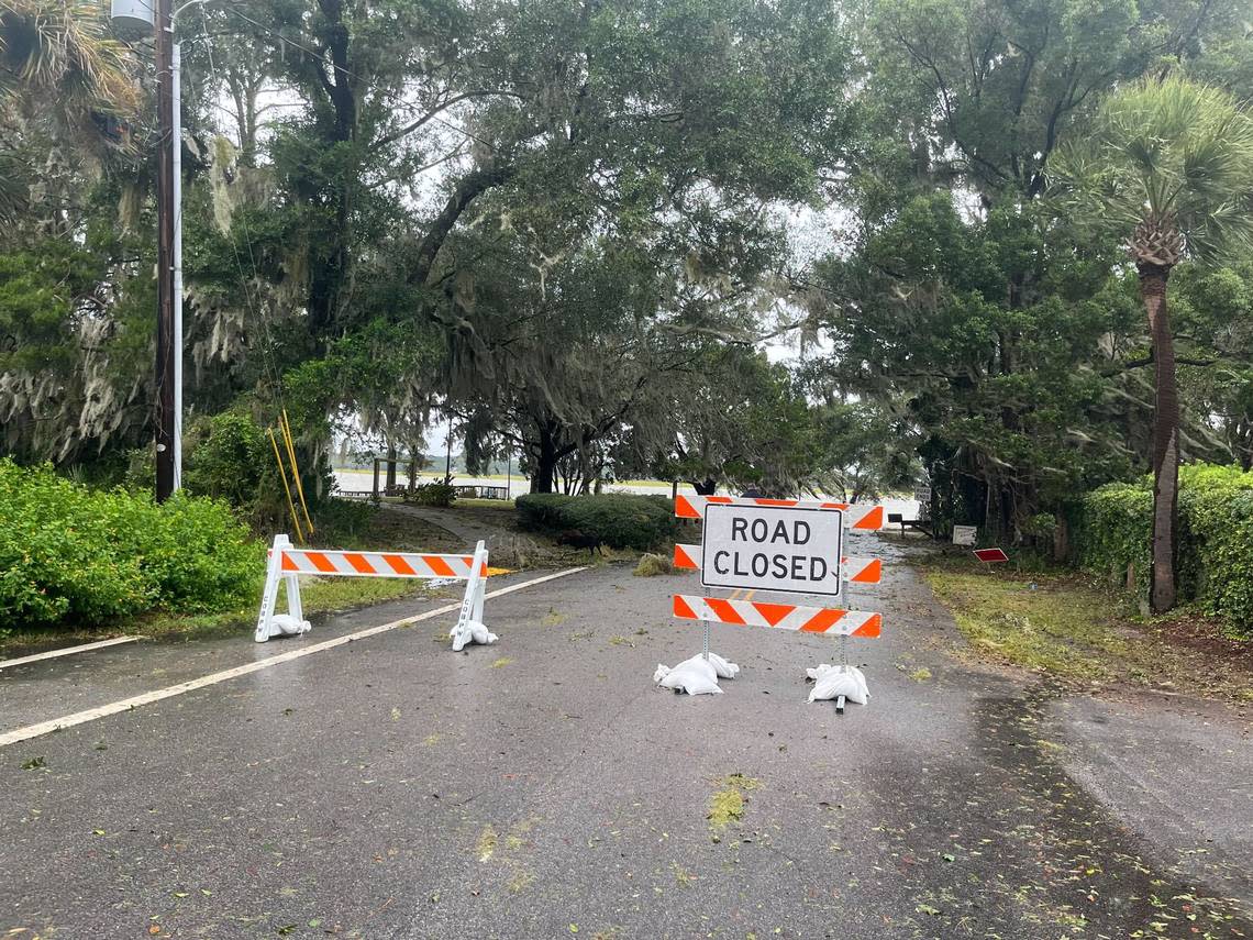
Due to some storm damage, the Bristol Skate Park and the kayak launch at the Rowing and Sailing Center at the Squire Pope Community Park will be closed until further notice, according to a town news release.
-Sarah Haselhorst, shaselhorst@islandpacket.com
Hurricane Ian makes landfall
2:05 p.m. Friday
The center of Hurricane Ian, as Category 1 storm, made landfall near Georgetown with maximum sustained winds of 85 mph, according to the National Hurricane Center.
Georgetown is about 135 miles north of Beaufort.
-Sarah Haselhorst, shaselhorst@islandpacket.com
Daufuskie Island ferry will run round trip at 4 p.m.
2:05 p.m. Friday
The Daufuskie Island ferry service will restart this afternoon. A boat will depart Buckingham Landing at 4 p.m. and the returning boat will leave Melrose Landing at 5:30 p.m.
There will not be late night Friday runs at 9 p.m. and 10:15 p.m.
The ferry will return to normal operations starting Saturday.
-Sebastian Lee, slee@islandpacket.com
Vehicle driven into water, boat ramp closed
2 p.m. Friday
The boat ramp at Pigeon Point in Beaufort was closed after a person drove their vehicle off the ramp and into the water, according to the Beaufort Police Department.
Mayor Stephen Murray said the driver is safe, but the vehicle remains in the water. It was not visible Friday afternoon during high tide.
The vehicle will be removed, Murray said. The reason the vehicle ended up in the water was not immediately available.
-Karl Puckett, kapuckett@islandpacket.com
Downed trees, no significant damage on Hilton Head
1:30 p.m. Friday
On Hilton Head Island, its fire rescue team responded to six downed trees with no injuries or significant damages, according to a town news release Friday afternoon. At the time, there were no other storm-related calls for service and an assessment of the island’s beaches had not been completed, due to the threat of storm surge.
Sustained winds of 38 mph and gusts of 52 mph were recorded on Hilton Head Island during the storm.
The town’s release said as of noon Friday, no major impacts from Hurricane Ian had been reported.
-Sarah Haselhorst, shaselhorst@islandpacket.com
Storm mostly misses Beaufort County
1 p.m. Friday
People are beginning to return to downtown Beaufort and the waterfront in Hurricane Ian’s wake.
The area is fortunate that Ian’s track changed, Beaufort Mayor Stephen Murray said, but the storm was a good drill to test hurricane plans. Murray said he’s pleased with the city’s preparations.
In a call with Beaufort County emergency management officials and local leaders, Murray said, it was reported that countywide, power outages were limited and about 10 trees were reported down.
-Karl Puckett, kapuckett@islandpacket.com
Warnings expected to be lifted late Friday
Noon Friday
Hurricane Ian had maximum sustained winds of 85 mph and was moving 14 mph north as of noon Friday.
While an exact time and location could not be nailed down, Ian was expected to make landfall around the Santee River in Georgetown, between Charleston and Myrtle Beach, Meteorologist Ron Morales said during a a National Weather Service briefing.
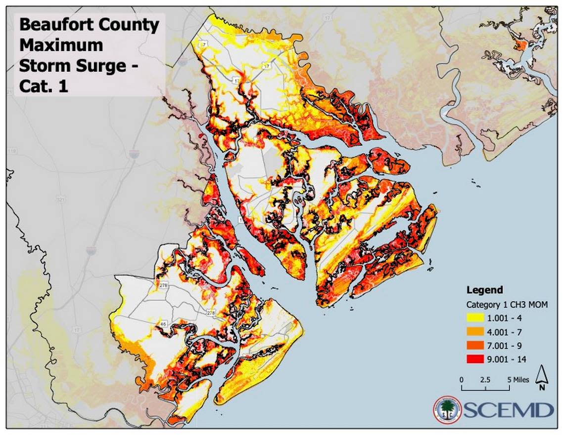
For areas south of the Isle of Palms, which includes Beaufort County, the threat of high storm surge, up to 4 feet, is a “conservative” measure, Morales said.
Hilton Head Island and Beaufort may see some tropical storm-force winds and the potential for moderate flooding throughout the afternoon, but Morales noted the greatest threats from Ian will be around the Charleston tri-county area.
“Improving conditions, really, for all hazards is expected later this afternoon,” Morales said, adding that he anticipated warnings would be lifted later Friday.
-Sarah Haselhorst, shaselhorst@islandpacket.com
3,000 without power in Beaufort County
11:30 a.m. Friday
Almost 3,000 Beaufort County residents are without power as Hurricane Ian continues to scrape past the Lowcountry.
Many of the local outages are centered on Daufuskie Island, according to Dominion Energy’s live outage map. Daufuskie had 483 customers without power as of 9:30 a.m. Friday.
In an email from Beaufort County, Dominion Energy announced the outages on Daufuskie Island will continue until the company can safely run boats across the water.
-Blake Douglas, bdouglas@islandpacket.com
‘God was good to us this time’

11:15 a.m. Friday
The Coligny True Value Hardware on Hilton Head Island is boarded up because of Hurricane Ian, but across the street, Roller’s Wine and Spirits is open for business.
Proprietor John Kelsey said, “It’s a little slow but were doing OK.”
Hiliton Head Mayor John McCann said, despite the fact that Ian was headed north, people should still respect its power and stay inside if they can.
“God was good to us this time,” McCann told CNN.
-Drew Martin, dmartin@islandpacket.com
Boaters getting off the water in Beaufort
11 a.m. Friday
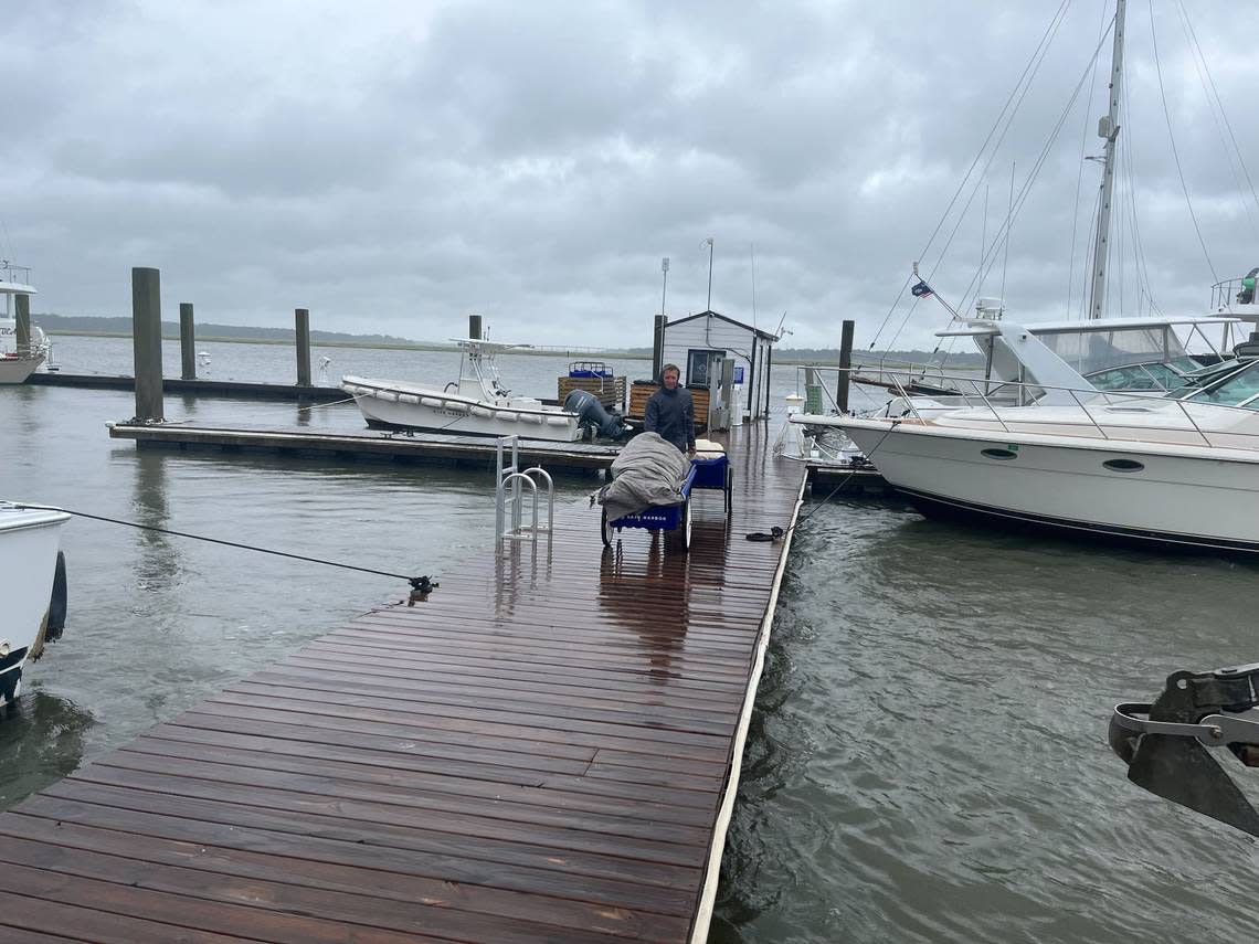
Boat owners at the Beaufort Marina were hauling valuables off their boats as Ian approached.
Earl Luttner and his crew were unloading items from his boat Perfect Sense. As the rain and wind began to pick up, he said he planned to drive back to Florida.
The Beaufort County Sheriff’s Office reported sustained winds of 28 mph and gusts of 47 mph.
The area remains under a hurricane warning.
-Karl Puckett, kapuckett@islandpacket.com
Little traffic on Hilton Head bridges
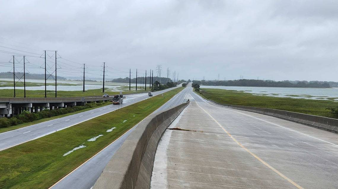
10:45 a.m. Friday
Normally bustling with traffic, U.S. 278 was nearly empty Friday morning near the Hilton Head bridges and the Bluffton Parkway Flyover.
An advisory from the Beaufort County Sheriff’s Office said that, although it appears we are out of the danger zone, flooding and wind damage are still concerns.
High tide will peak today at approximately 1 p.m.
-Drew Martin, dmartin@islandpacket.com
Downtown Beaufort quiet Friday morning

10 a.m. Friday
Beaufort’s Bay Street is usually bustling with locals and tourists but it was a ghost town Friday morning as winds were beginning to pick up and rain was falling.
Beaufort business owners have been through this before. The names of past hurricanes, with lines drawn through them, were painted on a board that one store owner had placed over a window: Matthew, Irma, Florence and Dorian. The final name written: Ian.
Sand bags were placed in front of the door.
Another message was written on the boarded up window: Shop online.
-Karl Puckett, kapuckett@islandpacket.com
State officials plan midday briefing
9:24 a.m. Friday
South Carolina Gov. Henry McMaster and other state officials will speak at a briefing beginning at 12:30 p.m. Friday to update the public on Hurricane Ian’s impact.
SCETV will provide coverage via television and its website, scetv.org.
-Lisa Wilson, lwilson@islandpacket.com
Daufuskie Island without power or ferries
8:52 a.m. Friday
The Daufuskie Island Ferry service is suspended until further notice, excluding emergency medical evacuations.
The management team will continue to monitor the situation and adapt as conditions allow.
One resident told The Island Packet that power was off and on all night.
The island is currently without power, according to Dominion Energy’s live outage map.
-Sebastian Lee, slee@islandpacket.com
Ian approaches South Carolina coast
8 a.m. Friday
Ian is approaching South Carolina’s coast and is expected to make landfall Friday afternoon as a Category 1 hurricane, according to the latest from the National Weather Service.
Risk of storm surge for Georgia and South Carolina coastal communities south of Edisto Beach, including those in Beaufort County, still exists but continues to diminish given Ian’s eastward shift in the forecast, the Weather Service said.
Travel is not recommended Friday in the hurricane warning area, which includes Beaufort County.
The highest threat for tropical storm force winds — 39-73 mph — is for areas stretching from Savannah to Charleston, including the Beaufort and Port Royal, Bluffton and Hilton Head areas. But the biggest threat of strongest winds falls in the Charleston Tri-County area, where hurricane force winds of more than 74 mph are possible.
The most threatening storm surge of 6 feet or more is likely to occur from Edisto Beach northward, particularly between Charleston and McLellanville, the Weather Service said. Edisto Beach is north of Hunting Island.
The potential for life-threatening storm surge south of Edisto Beach, including Beaufort County, has decreased to an estimated 3-5 feet. The biggest risk will fall at mid-day high tide.
Peak rainfall of 4-8 inches is expected but isolated amounts of 12 inches are possible.
-Karl Puckett, kapuckett@islandpacket.com
Hilton Head Island, Beaufort Executive airports closure
7 p.m. Thursday
Due to increasing winds and with no more scheduled flights Thursday, Hilton Head Island Airport and Beaufort Executive Airport were closed in “the interest of public safety,” according to a news release.
The airports are scheduled to reopen 10 a.m. Saturday. The release noted that the closure times are subject to change depending on the weather and any damage that might occur from Hurricane Ian and airline flight schedules.
-Sarah Haselhorst, shaselhorst@islandpacket.com
Ian gains strength, now a Category 1 hurricane
5 p.m. Thursday
After spending the majority of Thursday as a tropical storm, the National Hurricane Center announced Ian had strengthened to a Category 1 hurricane.
Ian is expected to take “aim at the Carolinas and Georgia with life-threatening flooding, storm surge and strong winds,” the center said around 5 p.m. Thursday.
Ian was 275 miles south of Charleston on Thursday afternoon, said John Quagliariello, meteorologist with National Weather Service’s Columbia office, during a press conference. If Ian makes landfall in South Carolina, it would be the first to do so since Hurricane Matthew. It is expected to make landfall sometime Friday.
-Sarah Haselhorst, shaselhorst@islandpacket.com
Storm surge’s effect on dunes
4:41 p.m. Thursday
A new U.S. Geological Survey coastal change forecast released Thursday indicates sandy beaches and dunes along South Carolina’s coast are likely to see significant effects from Ian.
Researchers are forecasting the waves and storm surge are likely to cause 11% of South Carolina’s dunes along sandy beaches to be inundated, meaning continuously covered by ocean water, and 99% of the dunes to face some level of erosion.
-Lisa Wilson, lwilson@islandpacket.com
Hilton Head Hospital and Beaufort Memorial Pratt Emergency Center remain open
4 p.m. Thursday
Naval Hospital Beaufort will be closed Friday. Elective and outpatient services for Hilton Head and Beaufort Memorial hospitals on Friday have been rescheduled. A Thursday advisory for Beaufort Memorial details services not available.
The hospitals are prepared for weather-related issues like outages or road conditions making it difficult for staff to get to work.
-Mary Dimitrov, mdimitrov@islandpacket.com
Beaufort County officials urge ‘stay home’ Friday
3 p.m. Thursday
During a press conference held by Beaufort County officials, Sheriff P.J. Tanner compared Tropical Storm Ian to past hurricanes that had rattled the Lowcountry. He said winds seen during Matthew and flooding from Irma were likely to be similar to what residents will experience with Ian.
Tanner urged residents to stay home all day and through the evening Friday, when Ian is expected to have its greatest impacts on the county.
“Refrain from driving on any roads Friday and Friday evening,” Tanner said. “Reducing the amount of traffic throughout the county makes it easier for us to do our job and it’s safer for you.”
Officials said residents should also avoid walking in floodwaters as they can often be littered with trash, critters and other potentially health-harming bacteria and toxic substances.
Tanner reiterated the county is “ready, willing and able” to address Ian’s potential impacts. As of Thursday afternoon, there were no evacuation orders in place for Beaufort County.
No evacuations were ordered for the county as of Thursday afternoon.
-Sarah Haselhorst, shaselhorst@islandpacket.com
Shellfish beds statewide to close at sunset
2:50 p.m. Thursday
The South Carolina Department of Health and Environmental Control is closing all shellfish harvesting beds statewide due to Tropical Storm Ian and expected rainfall.
“This closure goes into effect at official sunset today,” said Mike Marshall of DHEC on Thursday. “The harvesting areas will be reopened once post-storm assessments are performed and water quality monitoring indicate bacteria levels are once again suitable for shellfish harvesting.”
-Lisa Wilson, lwilson@islandpacket.com
Hunting Island State Park closed
2:15 p.m. Thursday
A statement posted on the Hunting Island State Park website said officials were in the process of evacuating campers and overnight guests due to the storm on Thursday.
The park was closed to all visitors.
The same message was posted on the website of Edisto Beach State Park.
-Lisa Wilson, lwilson@islandpacket.com
Walmart announces closings
2 p.m. Thursday
All Walmart locations in Beaufort and Jasper counties will close at 5 p.m. Thursday and plan to reopen at 7 a.m. Saturday.
If you still need hurricane essentials — non-perishable foods, water, portable chargers — consult our list of local grocery store shortages.
-Evan McKenna, emckenna@islandpacket.com
Hilton Head bridges remain open
1:35 p.m. Thursday
The town of Hilton Head announced Tropical Storm Ian won’t close bridges connecting Hilton Head Island to the mainland, but urged drivers not to use them unless necessary.
The bridges become unsafe as high-speed sustained winds enter the area, the town tweeted, and residents should stay indoors until the weather has passed if possible.
-Blake Douglas, bdouglas@islandpacket.com
‘Calm before the storm’
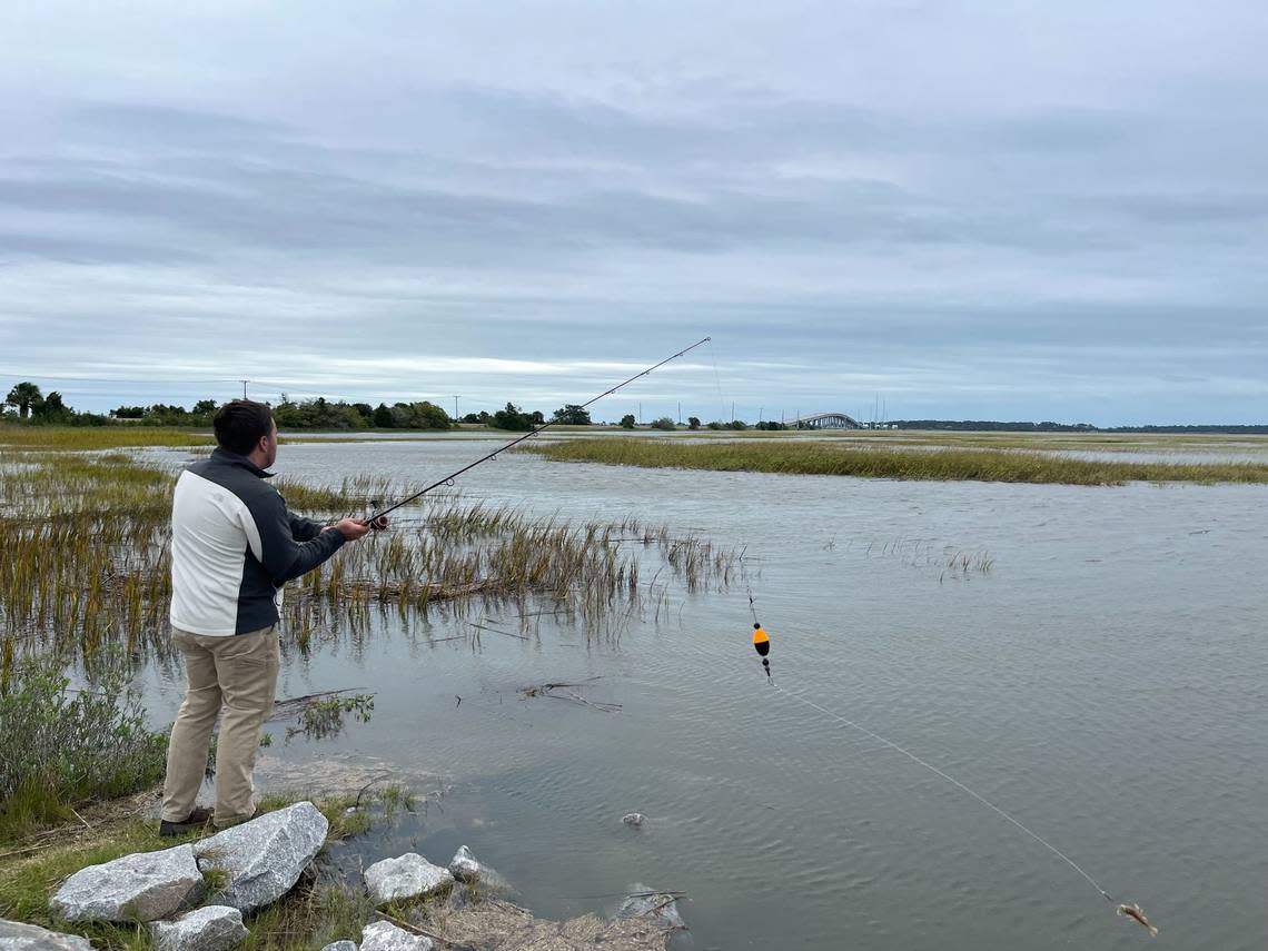
Noon Thursday
As winds whipped up Thursday afternoon, it was time for Matthew Melvin of Beaufort to take a break.
At Butcher’s Island Boat Landing on St. Helena Island, the heating and air conditioning business owner who said he’s been “slammed” was casting his line before storm conditions set in.
”The calm before the storm,” he said, is a chance to relax. “Just enjoy it while you can,” he said.
-Karl Puckett, kapuckett@islandpacket.com
Filling up before Tropical Storm Ian hits
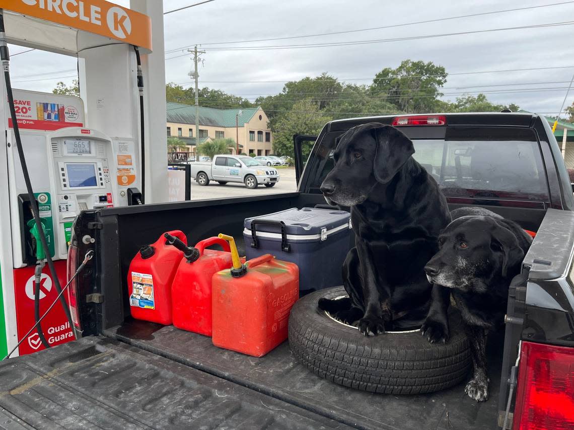
11:30 a.m. Thursday
Black labs Moose — the big one and “the talker” — and Dash waited patiently Thursday morning in the back of a pickup as Louis Tracy filled up containers with gas for his generator at the Circle K in Port Royal “that hopefully I don’t need.“
Tracy’s family is new to the area and owns Links Landscaping.
“Luckily I know a lot of locals who have lived here forever,” he said, as his phone beeped with an alarm that Ian had been upgraded to a hurricane warning.
After the storm passes he will be working on the cleanup, he said.
-Karl Puckett, kapuckett@islandpacket.com
Entire SC coast under hurricane warning
11 a.m. Thursday
The National Weather Service issued a hurricane warning for the entire South Carolina coast Thursday morning.
A hurricane warning is issued when hurricane-force winds are expected within 24 hours, according to FEMA. It can remain in effect when dangerously high water or a combination of dangerously high water and exceptionally high waves continue, even though winds may be less than hurricane force, the agency said.
Currently, Tropical Storm Ian has max sustained winds of 70 mph.
-Sarah Haselhorst, shaselhorst@islandpacket.com
Creating more water storage ahead of expected flooding
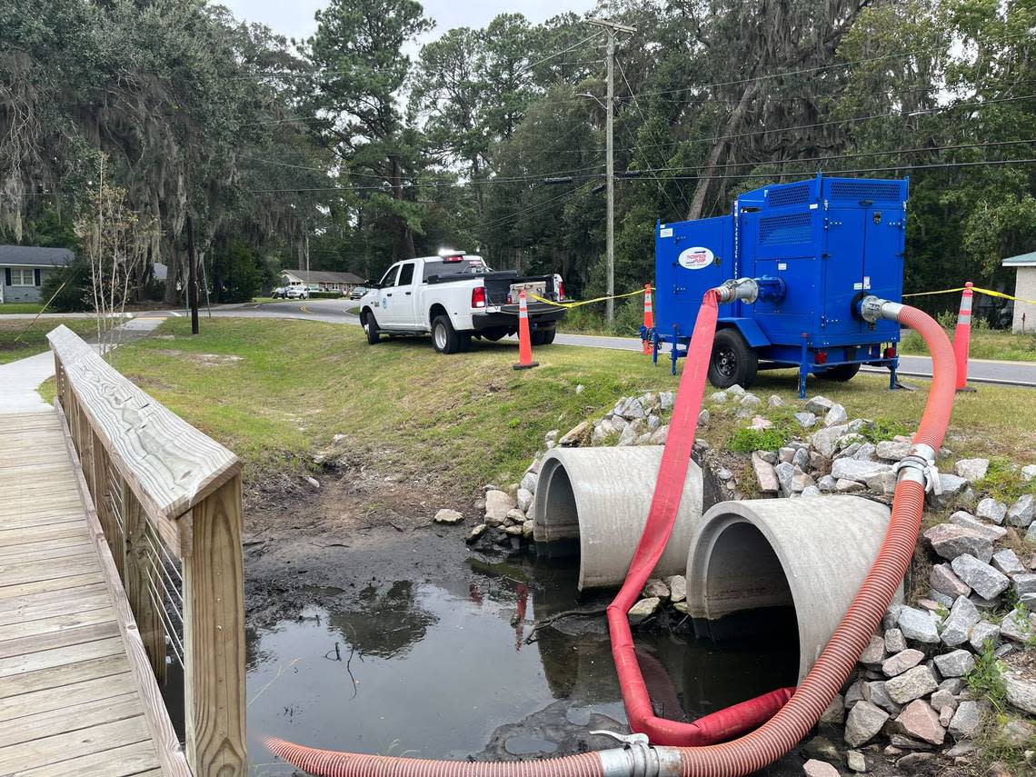
10:45 a.m. Thursday
To make room for expected flooding during high tide that will come from Tropical Storm Ian’s deluge, the city of Beaufort was drawing down water at the Duck Pond at First Boulevard and Battery Creek Road to create more water storage, said Neal Pugliese, who manages storm drainage projects as a consultant with the city.
Tidal gates also have been shut to prevent Battery Creek from backing up into neighborhoods. Local municipalities are working with Beaufort County to address that ongoing threat.
-Karl Puckett, kapuckett@islandpacket.com
Beaufort County preparing to assist in disaster response operation
11 a.m. Thursday
Over 130 essential Beaufort County Public Works personnel will provide aid across the county, but if weather conditions worsen, they may remain on call or in place.
The county has 75 pickup trucks, five dump trucks and other heavy equipment split between Public Works North in Beaufort and Public Works South in Bluffton ready to support operations.
Residents can use the Beaufort County Connect App to report non-emergency damage like debris, fallen trees, damaged traffic signals or street signs, clogged ditches and flooding to the county.
The county has $2 million in contracts to assist with cleanup and response operations, depending on the severity of damage.
-Sebastian Lee, slee@islandpacket.com
Port Royal issues State of Emergency
10 a.m. Thursday
Following state of emergencies issue by Gov. Henry McMaster and Beaufort County Council Chairman Joe Passiment on Wednesday afternoon, the Town of Port Royal is now also under one as of Thursday morning.
Mayor Joe DeVito declared that the order “authorizes the Town Manager to take such steps as may be determined to be necessary for the protection of life, property, and community services.”
-Sarah Haselhorst, shaselhorst@islandpacket.com
Taking it ‘hour by hour’
10 a.m. Thursday
Down on Beaufort’s Bay Street, as the winds were beginning to pick up and under an overcast sky, Cherimie Weatherford, the owner of women’s clothing store Sugar Belle had not yet closed her store.
“As of right now, we’re taking it one hour at a time,” Weatherford said Thursday morning.
Armed with sandbags, the store owner is prepared. Other stores dotted along the downtown’s main drag had closed their doors, some with taped-on signs noting their closure due to Ian’s anticipation.
-Karl Puckett, kapuckett@islandpacket.com
Savannah bridge still open despite previously announced closure
9 a.m. Thursday
The Georgia Department of Transportation announced Thursday the Talmadge Memorial Bridge between Savannah, Georgia and South Carolina is still open to motorists.
The agency had previously planned to shut down vehicle traffic across the bridge starting Thursday at 9 a.m. due to potential for hazardous wind from Hurricane Ian. Due to favorable weather and an updated forecast of Hurricane Ian’s track, GDOT rescinded the closure and traffic will continue as normal.
-Blake Douglas, bdouglas@islandpacket.com
