Florida braces for Ian: DeSantis declares state of emergency as storm poised to reach ‘hurricane strength’
Florida Gov. Ron DeSantis declared a state of emergency for the entire state on Saturday as the National Hurricane Center warns that tropical storm Ian could hit Florida’s west coast “at or near major hurricane strength” next week.
“This storm has the potential to strengthen into a major hurricane and we encourage all Floridians to make their preparations,” DeSantis said in a statement early Saturday afternoon. “We are coordinating with all state and local government partners to track potential impacts of this storm.”
With his declaration, DeSantis frees up emergency protective funding and also activates members of the Florida National Guard, his office said.
Ian, the ninth tropical storm of this year’s Atlantic hurricane season, is expected to “rapidly strengthen later his weekend” and is forecast to move near or over western Cuba and then approach the west coast of the Florida peninsula early next week, “where there is increasing confidence in multiple life-threatening hazards,” the NHC said in an update Saturday morning.
That includes storm surges, hurricane-force winds, as well as flooding.
11 AM EDT: #Ian expected to rapidly intensify later this weekend. Here are the Key Messages on Tropical Storm #Ian. For more information, visit https://t.co/tW4KeFW0gB pic.twitter.com/OwCJ4K1sLw
— National Hurricane Center (@NHC_Atlantic) September 24, 2022
The storm, which formed across the central Caribbean Sea, was moving toward the west at around 15 miles per hour, as of 11 a.m. Saturday.
Officials with the National Weather Service Miami-South Florida said that, while it’s still unclear what Ian’s path will be, people in the area should be on high alert.
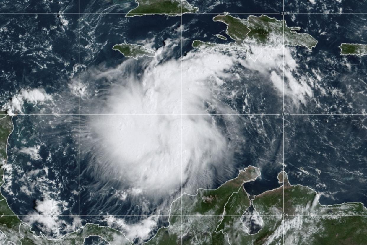
This satellite image provided by the National Oceanic and Atmospheric Administration shows Tropical Storm Ian over the central Caribbean on Saturday, Sept. 24, 2022.
“It is too soon to determine the exact tract and magnitude of the impacts of Ian,’ the NWS Miami said in a tweet. “However, it is time those in Florida ensure their hurricane plan is in place and continue to monitor the forecast.”
Jamaica is under a tropical storm watch — which means that “tropical storm conditions are possible within the watch area, generally within 48 hours.”
At its 2 p.m. update, the NWC said the government of the Cayman Islands had upgraded its hurricane watch to a hurricane warning for Grand Cayman.
A warning is typically issued 36 hours before the anticipated first occurrence of tropical-storm-force winds, conditions that make outside preparations difficult or dangerous. According to the National Ocean Service, when a hurricane warning is issued, people should “complete storm preparations and immediately leave the threatened area if directed by local officials.”
Conditions at Little Cayman and Cayman Brac have been lowered from a hurricane watch to a tropical storm watch.
Keeping an 👁️ on the storm. https://t.co/QzOrU47tHp & https://t.co/gP886cNKC9 pic.twitter.com/hHt7lNATtC
— NWS Miami (@NWSMiami) September 24, 2022
“The NHC track forecast has been raised from the previous one, showing Ian becoming a hurricane by late Sunday and approaching western Cuba at or near major hurricane strength by Monday night,” the NHC said in its 11 a.m. update.
“Limited land interaction is expected as the cyclone quickly passes over western Cuba, and Ian is forecast to be a major hurricane over the eastern Gulf of Mexico on Tuesday and Wednesday as it approaches the west coast of Florida,” the update added.
If Ian strengthens to a Category 3 or higher before reaching the U.S. it would be the first major hurricane to make landfall in the area since October 2018, when Hurricane Michael made landfall in the Florida Panhandle region as a Category 5 Hurricane, with maximum sustained wind speeds of 160 miles per hour.
Hurricane season in the Atlantic Ocean began June 1 and will continue through Nov. 30, with peak hurricane possibilities remaining through September.
With News Wire Services
