Tropical Storm Ian bears down on Florida, could become major hurricane by Monday night
KATE FELDMAN, Peter Sblendorio
Florida Gov. Ron DeSantis on Sunday warned of “broad impacts across the state” as Tropical Storm Ian ripped through the Caribbean and bore down on the southeastern U.S.
Ian is likely to become a hurricane by Monday morning and could reach major hurricane status that night or by early Tuesday, according to the National Hurricane Center. The storm is expected to be a hurricane by the time it reaches Cuba.
It remains unclear when the storm could make landfall in the U.S., but DeSantis declared a state of emergency Saturday.
“I would also say to other Floridians, even if you’re not necessarily right in the eye of path of the storm, there’s going to be pretty broad impacts throughout the state,” DeSantis said during a Sunday press conference. “You’re going to have wind. You’re going to have water. There could be flooding on the east coast of Florida because of this. It’s a big storm. So just prepare for that.”
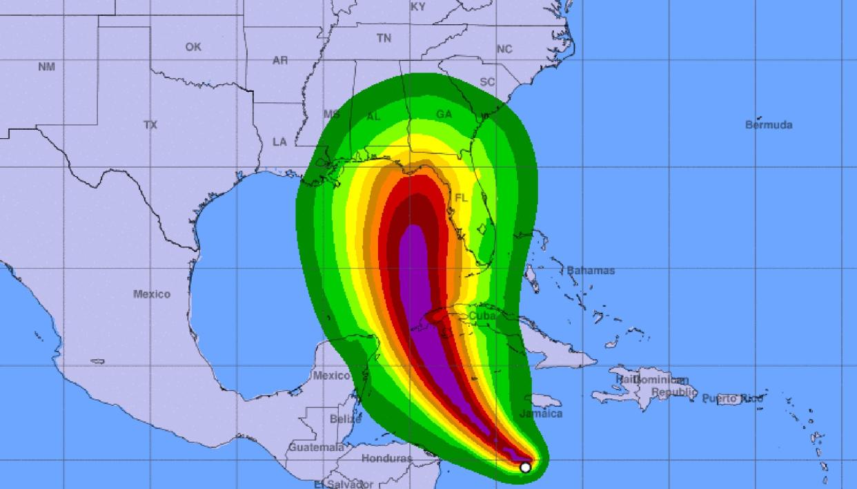
Tropical Storm Ian
Tropical Storm Ian
Models have Florida in the eye of the storm, but it’s still unclear where exactly Ian will hit: several show the storm making landfall in west-central Florida while others predict the hurricane will shift farther west and hit in the central or western panhandle of the state.
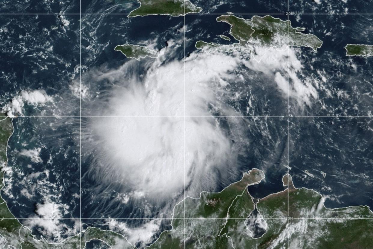
Ian sat about 265 miles south-southeast of Grand Cayman and about 540 miles southeast of the western tip of Cuba with winds swirling up to 50 mph when the National Hurricane Center gave an update at 2 p.m. Sunday.
“Regardless of Ian’s exact track and intensity, there is a risk of dangerous storm surge, hurricane-force winds, and heavy rainfall along the west coast of Florida and the Florida Panhandle by the middle of the week, and residents in Florida should ensure they have their hurricane plan in place, follow any advice given by local officials and closely monitor updates to the forecast,” the NHC said Sunday.
A hurricane warning is in place for Grand Cayman and the Cuban provinces of Isla de Juventud, Pinar del Rio and Artemisa, a tropical storm warning for the Cuban provinces of La Habana, Mayabeque, and Matanzas and a tropical storm watch for Little Cayman and Cayman Brac.
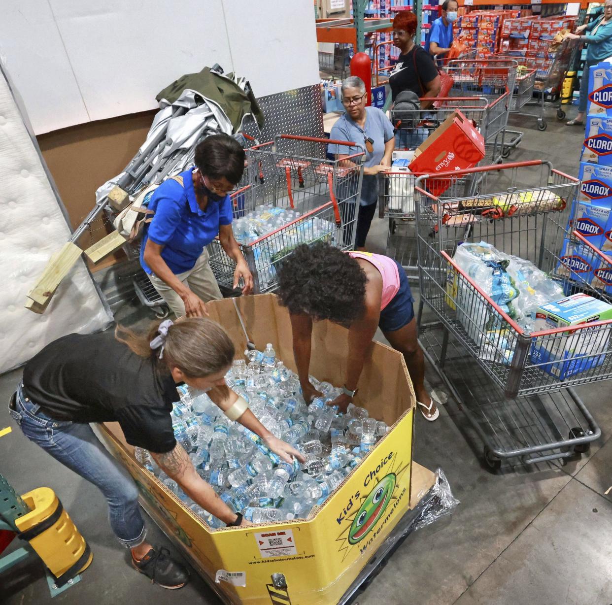
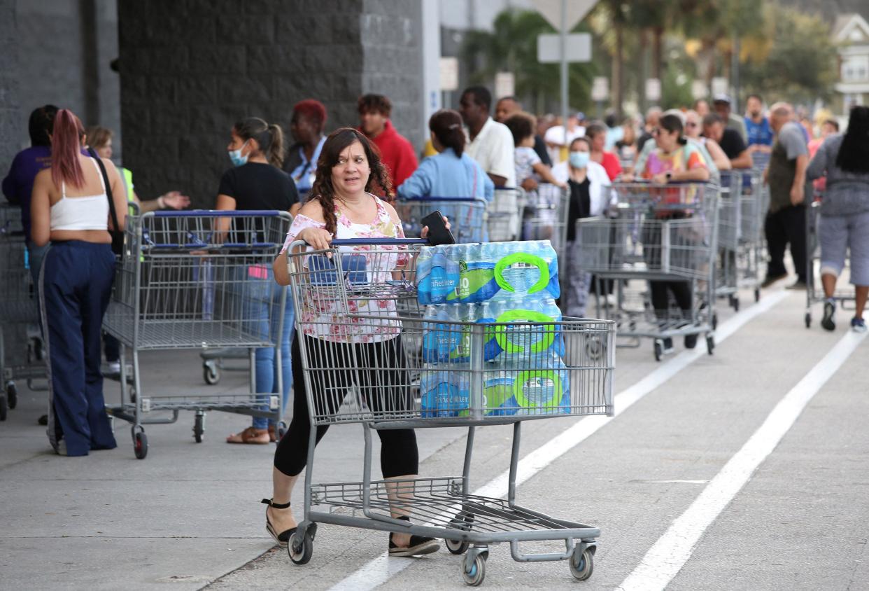
Shoppers at the Costco store in Altamonte Springs, Fla. grab bottles of water from the last pallet in stock on Monday, Sept. 26, 2022, as Central Floridians prepare for the impact of Hurricane Ian.
Resident and maintenance technician Scott Keeler tosses a pool chaise in the pool to store underwater to George Shukis, president of the Sunrise Owner's Association at Harbourside Condominiums, in preparation for the arrival of Hurricane Ian, Monday, Sept. 26, 2022, in South Pasadena, Fla. Ian was growing stronger as it approached the western tip of Cuba on a track to hit the west coast of Florida as a major hurricane as early as Wednesday.
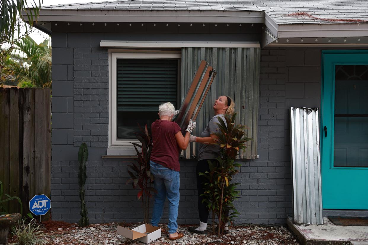
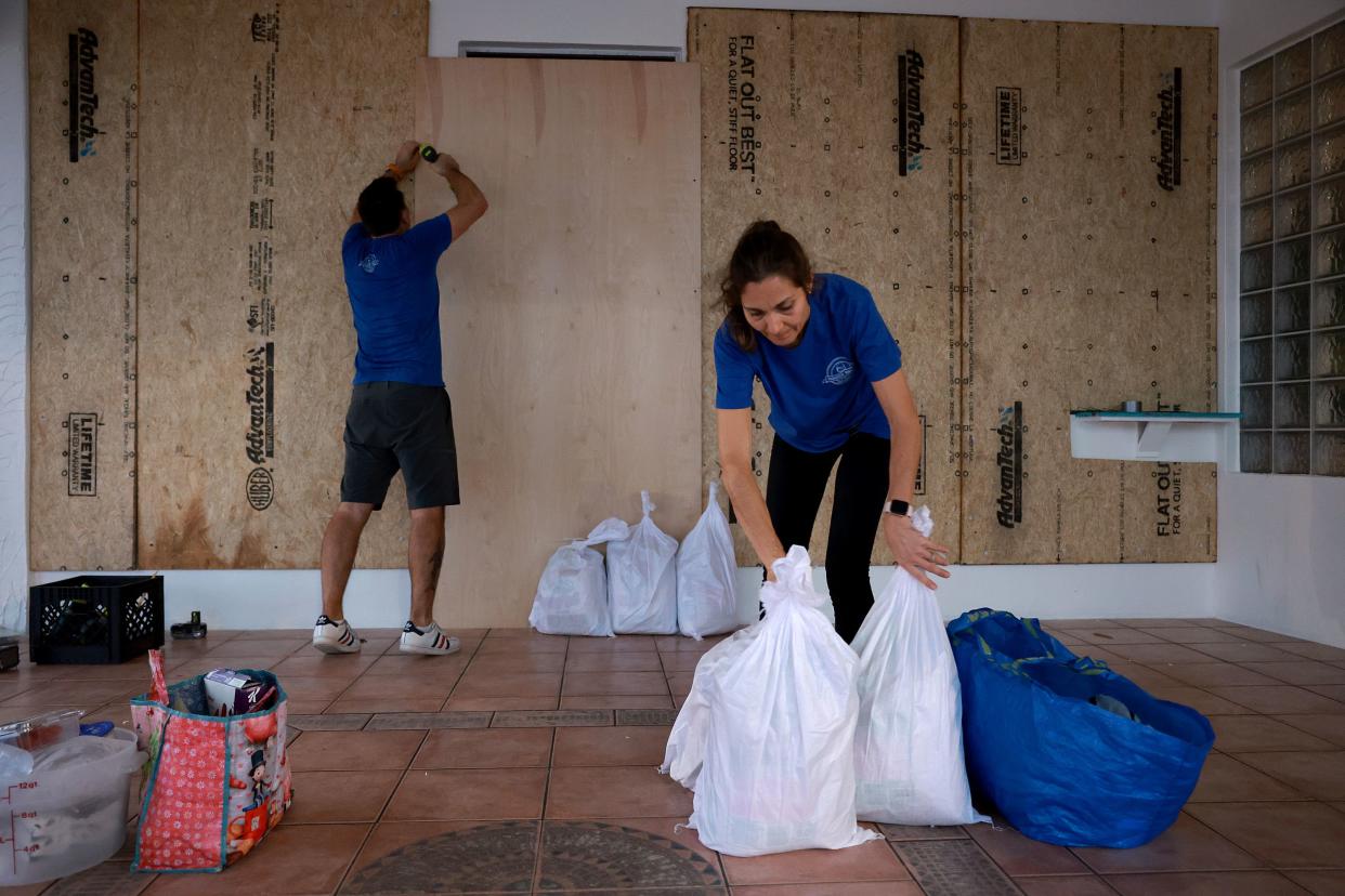
Rebecca Hale and her mother, Edda Howard, place shutters on her home as they prepare for the possible arrival of Hurricane Ian on Sept. 27, 2022, in St Petersburg, Fla. Ian is expected in the Tampa Bay area Wednesday night into early Thursday morning.
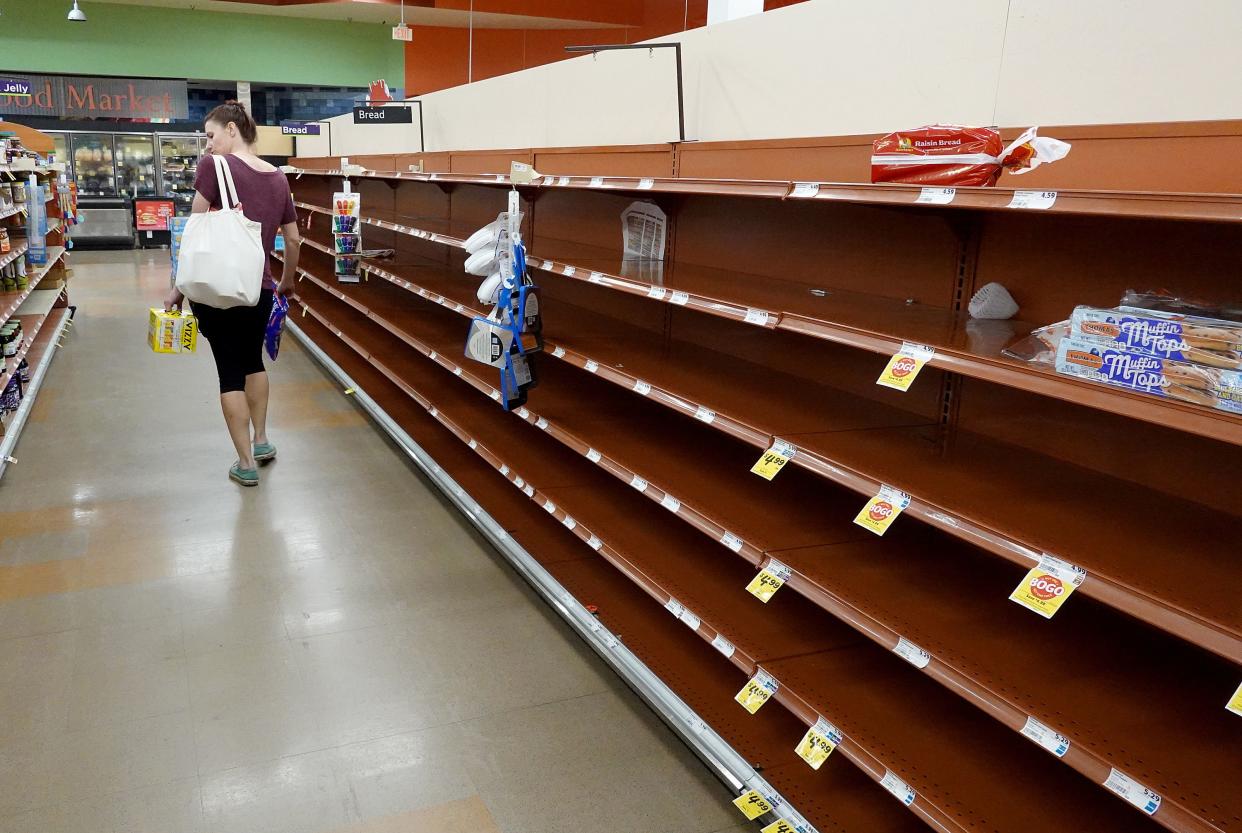
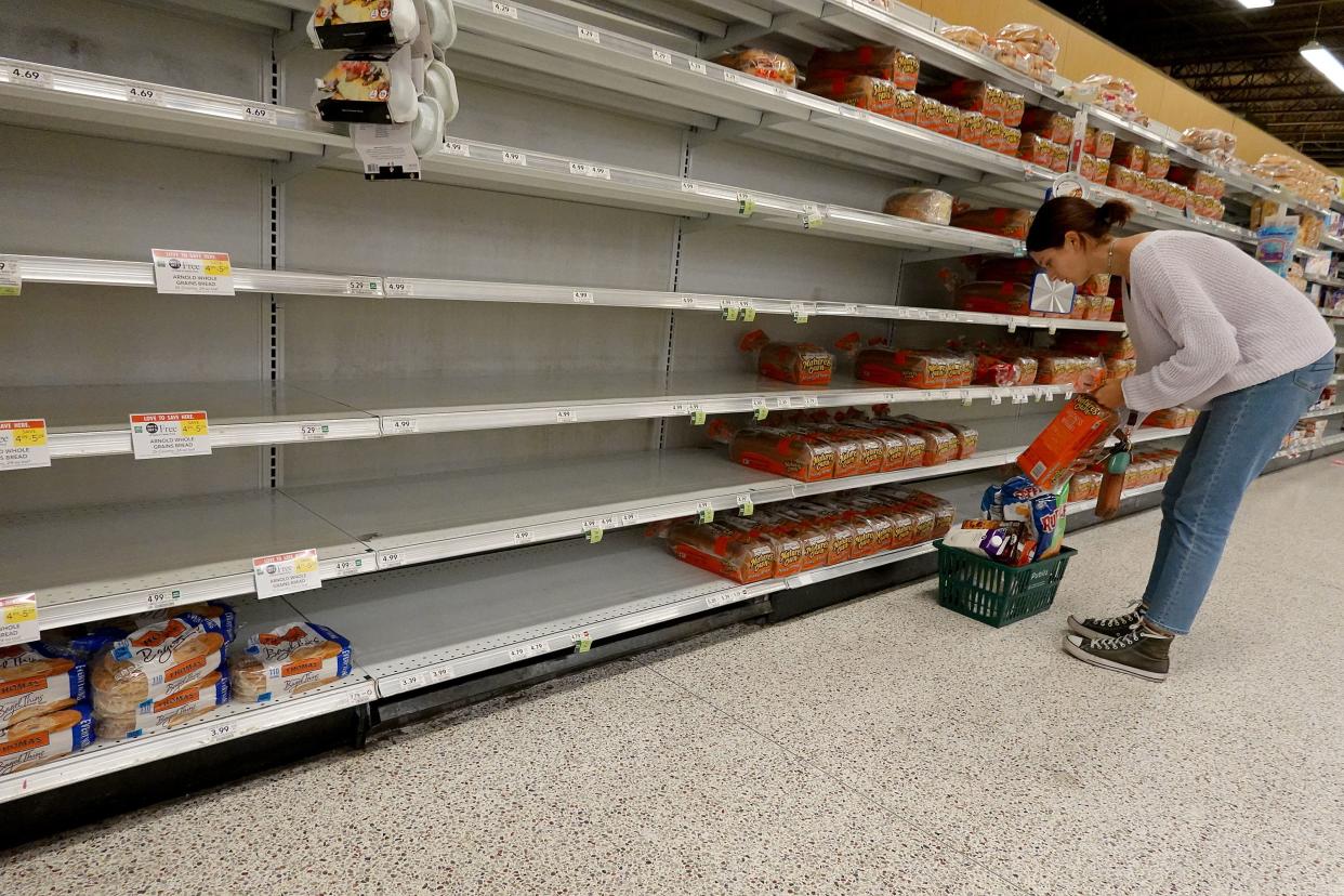
Shelves in the bread aisle stand empty as residents prepare for Hurricane Ian on Sept. 26, 2022, in St Petersburg, Fla.
Alex Rico and other people fill sandbags at Helen Howarth Park as they prepare for the possible arrival of Hurricane Ian on Sept. 26, 2022, in St Petersburg, Fla. Ian is projected to make its closest pass to the Tampa Bay area on Wednesday with the current track putting the center 25 miles west of the coastline as it parallels the coast.
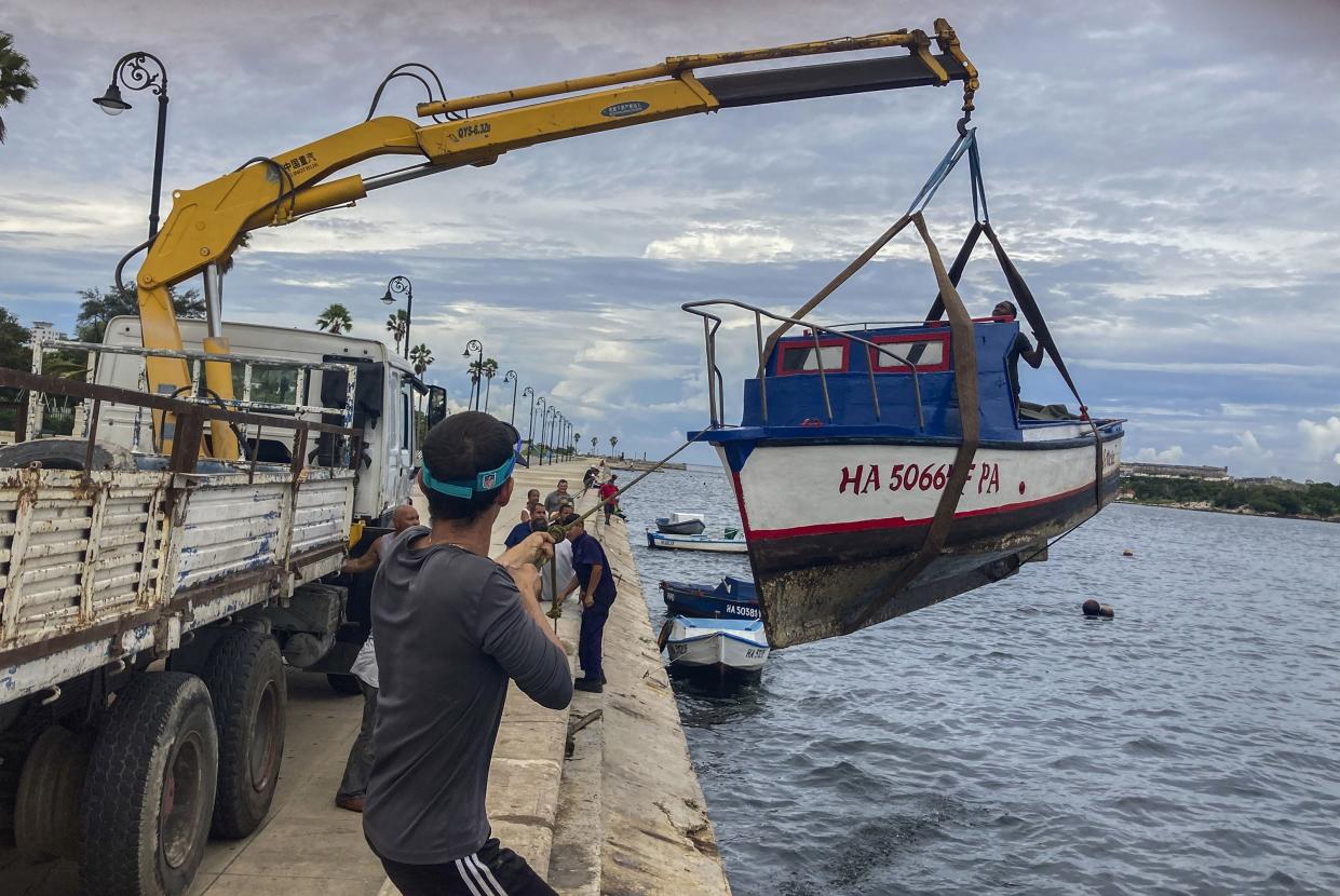
Workers remove a boat from the water in the bay of Havana, Cuba, Monday, Sept. 26, 2022.
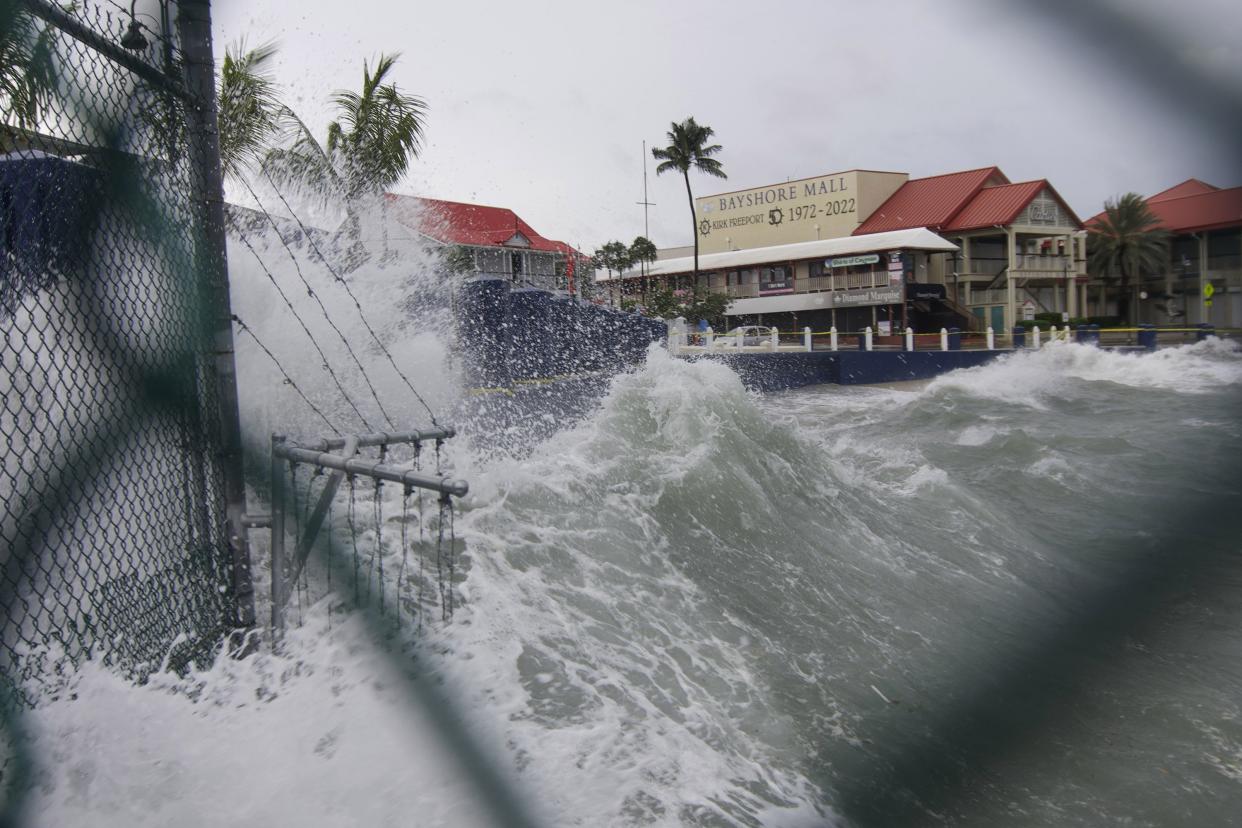
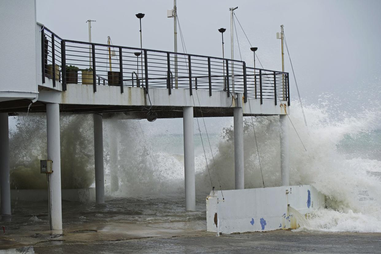
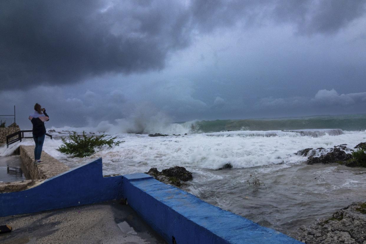
Waves crash against a seawall as Hurricane Ian passes through George Town, Grand Cayman island, Monday, Sept. 26, 2022.
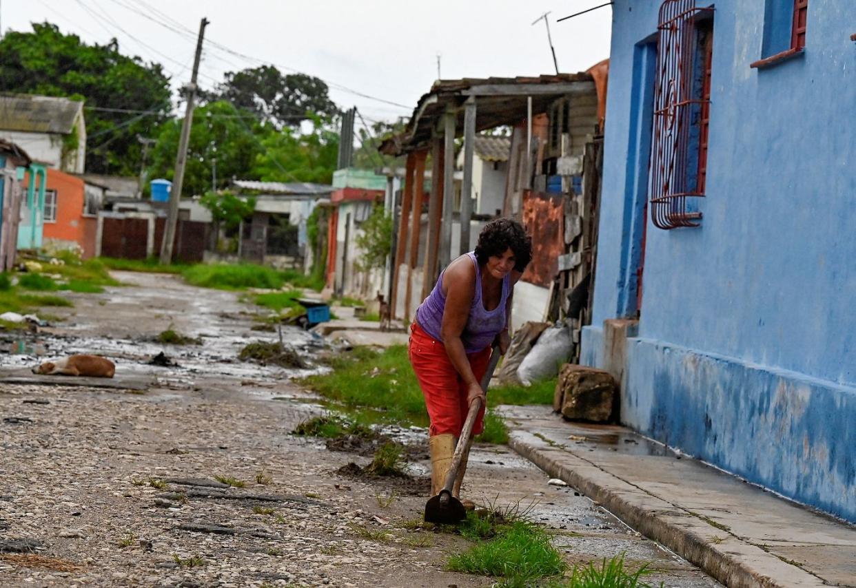
A woman cleans a drain near her home in Batabano, Mayabeque province, on Sept. 26, 2022, ahead of the arrival of Hurricane Ian in Cuba.
Waves kick up under a dark sky along the shore of Batabano, Cuba, Monday, Sept. 26, 2022. Hurricane Ian was growing stronger as it approached the western tip of Cuba on a track to hit the west coast of Florida as a major hurricane as early as Wednesday.
Steve Newberne (L) and Richard Latronita board up Gigi's restaurant in preparation for Hurricane Ian on Sept. 26, 2022, in St. Petersburg, Florida.
Luca Leguerchois (L) and Eglantine Leguerchois board up their Paradise Sweets store in preparation for Hurricane Ian on Sept. 26, 2022, in St. Petersburg, Fla.
Waves crash against the patio of Lobster Pot restaurant as Hurricane Ian passes through George Town, Grand Cayman island, Monday, Sept. 26, 2022.
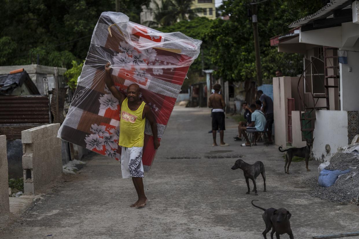
A resident of El Fanguito neighborhood carries a mattress in preparation for the arrival of Hurricane Ian, in Havana, Cuba, Monday, Sept. 26, 2022. Hurricane Ian is growing stronger as it approached the western tip of Cuba on a track to hit the west coast of Florida as a major hurricane as early as Wednesday.
A woman takes photos while waves crash against a seawall as Hurricane Ian passes through George Town, Grand Cayman island, Monday, Sept. 26, 2022.
Shelves in the bread aisle stand nearly empty as residents prepare for Hurricane Ian on Sept. 26, 2022, in St Petersburg, Fla.
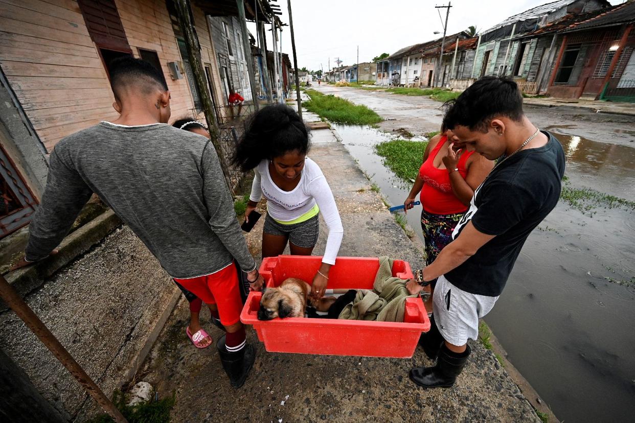
A family carries a dog to a safe place in Batabano, Mayabeque province, on Sept. 26, 2022, ahead of the arrival of Hurricane Ian in Cuba.
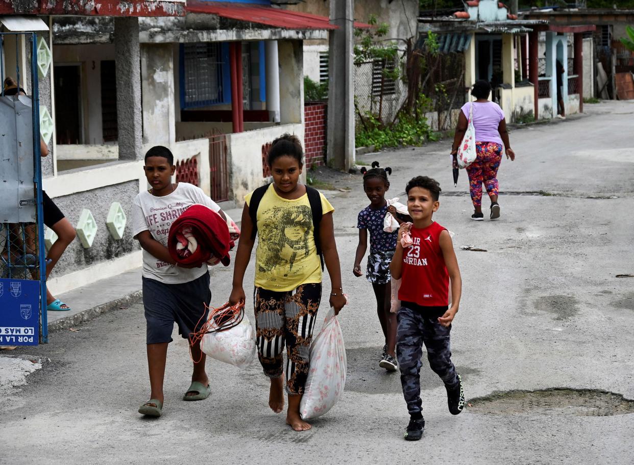
Cuban children carry personal belongings to a safe place in the Fanguito neighborhood in Havana, on Sept. 26, 2022, ahead of the arrival of Hurricane Ian. Cuba declared an emergency alert in its six most western provinces as fast-approaching Hurricane Ian was moving northwest towards Cuba and the Cayman Islands with maximum sustained winds of 85 miles per hour.
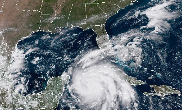
In this NOAA handout image, Hurricane Ian moves toward western Cuba on Sept. 26, 2022, in the Caribbean Sea. The storm is expected to bring a potentially life-threatening storm surge and hurricane-force winds. Meteorologists expect Ian to peak at Category 4 strength over the Gulf of Mexico later this week, then weaken before reaching Fla.
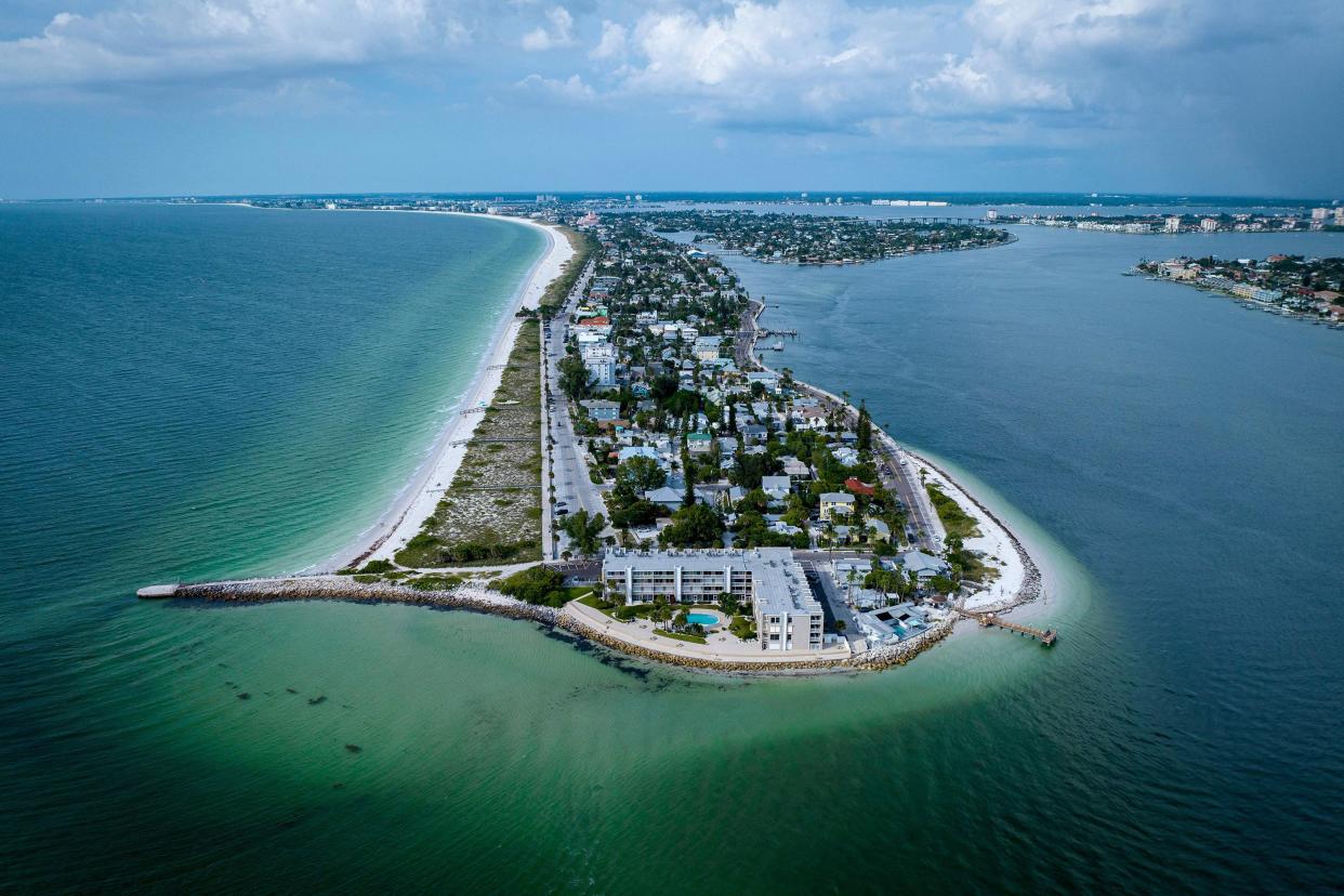
An aerial view of St. Pete Beach as Hurricane Ian approaches Florida on Sept. 26, 2022. The city of Tampa is under a hurricane watch and Governor Ron DeSantis declared a state of emergency in all 67 counties as officials scrambled to prepare for the storm's forecast landing on late Wednesday or Thursday. Ian "will bring heavy rains, strong winds, flash flooding, storm surge, along with isolated tornado activity along Florida's Gulf Coast," DeSantis said at a press conference in Tallahassee on Monday.
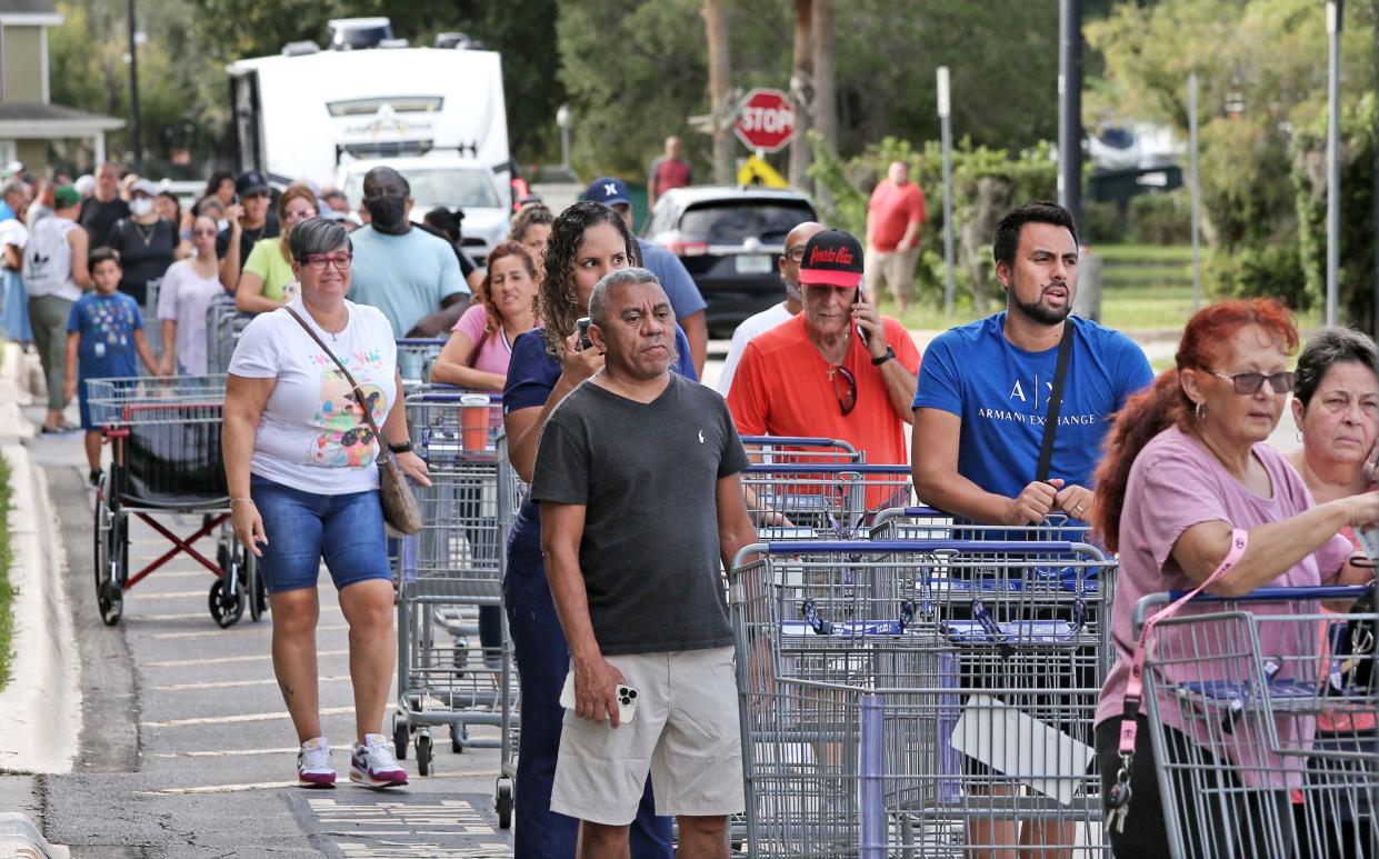
Tampa residents wait for over 2 hours at Himes Avenue Complex to fill their 10 free sandbags on Sunday, Sept. 25, 2022, in Tampa, Fla. Authorities and residents in Florida are keeping a cautious eye on Tropical Storm Ian as it rumbles through the Caribbean.
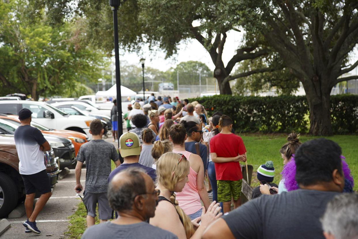
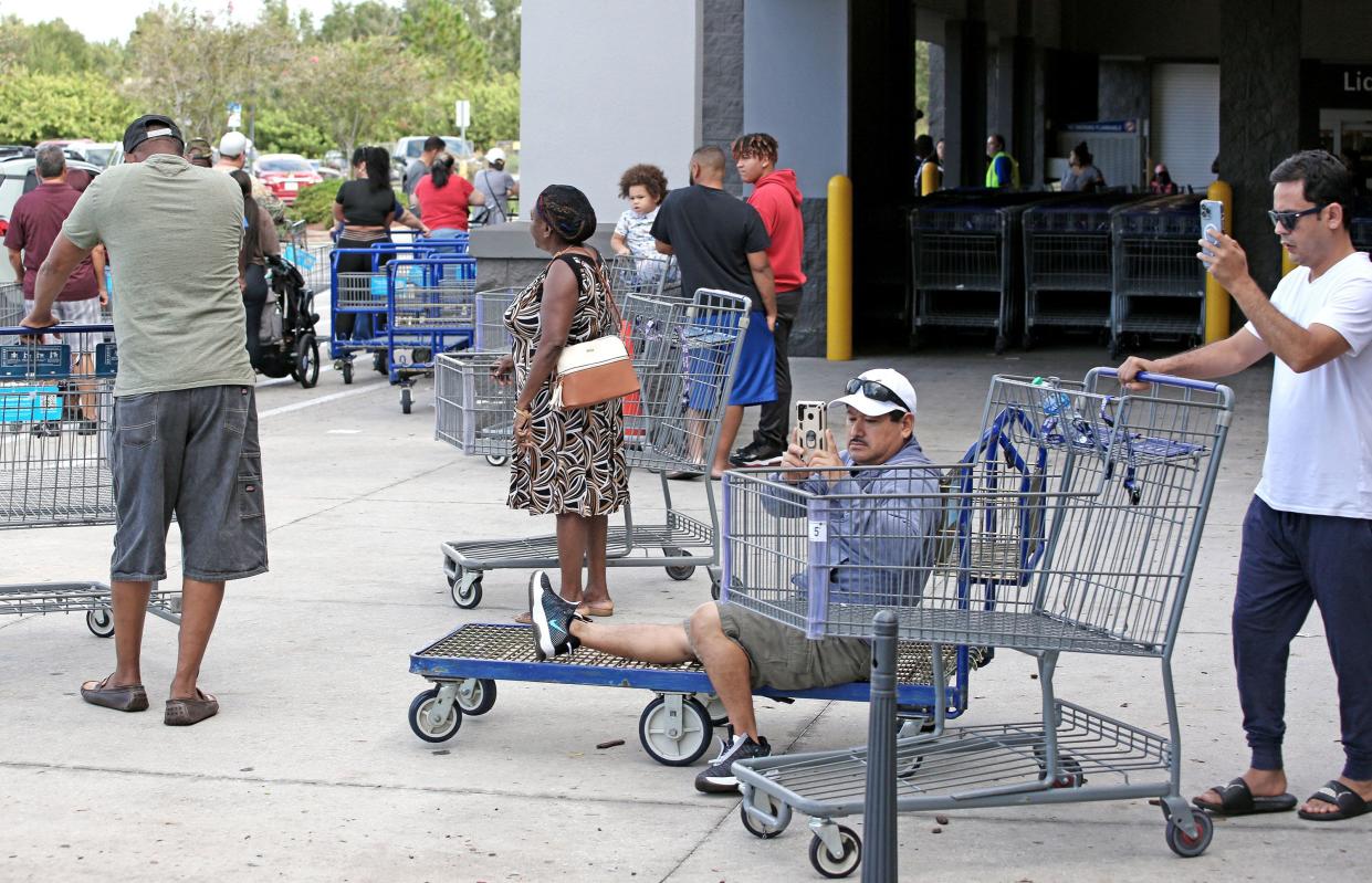
Shoppers wait in line outside a retail warehouse as people rush to prepare for Tropical Storm Ian in Kissimmee, Fla. on Sept. 25, 2022. Tropical storm Ian is forecast to "rapidly intensify" over the weekend and become a major hurricane as it moves toward Florida, according to the U.S. National Hurricane Center.
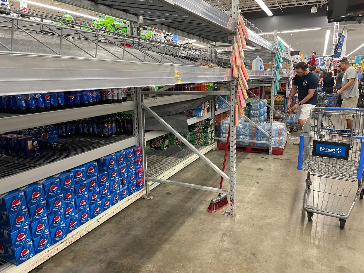
Shoppers go for what was left of the water on the shelves of the Walmart Supercenter at 1505 N. Dale Mabry Highway on Sunday, Sept. 25, 2022, in Tampa, Fla. as Tropical Storm Ian threatens to impact Tampa Bay as a major hurricane later in the week.
A long line of shoppers are seen past a person pushing cases of water outside a retail warehouse as people rush to prepare for Tropical Storm Ian in Kissimmee, Fla. on Sept. 25, 2022.
Shoppers take photos while waiting in line outside a retail warehouse as people rush to prepare for Tropical Storm Ian in Kissimmee, Fla. on Sept. 25, 2022.
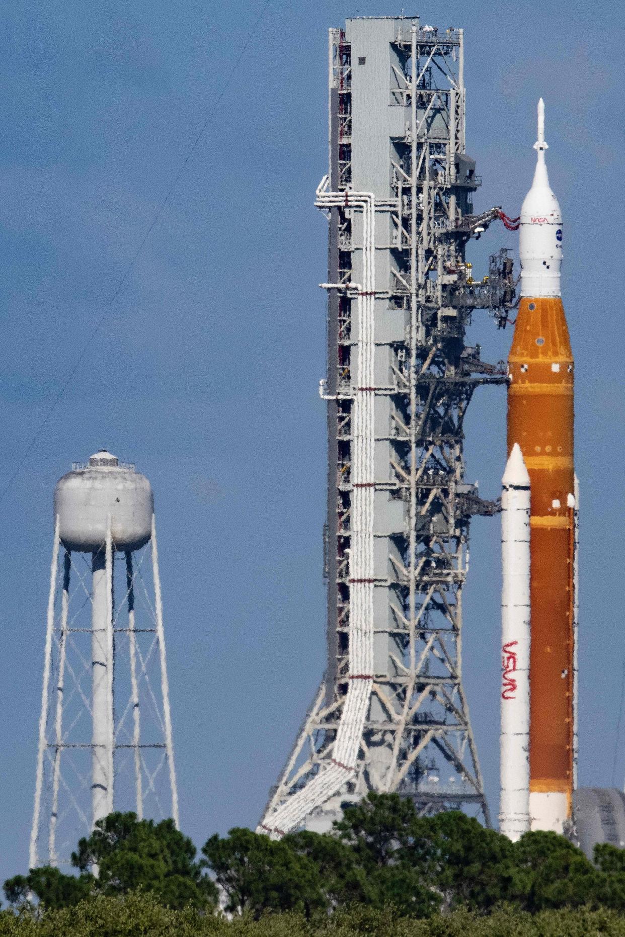
The Artemis I unmanned lunar rocket sits on launch pad 39B at NASA's Kennedy Space Center in Cape Canaveral, Fla. on Sept. 24, 2022. NASA has called off the scheduled Sept. 27, 2022, launch of its historic uncrewed mission to the Moon due to a tropical storm that is forecast to strengthen as it approaches Florida. "NASA is forgoing a launch opportunity... and preparing for rollback (from the launchpad), while continuing to watch the weather forecast associated with Tropical Storm Ian," NASA said on Saturday.
This satellite image provided by the National Oceanic and Atmospheric Administration shows Tropical Storm Ian over the central Caribbean on Saturday, Sept. 24, 2022.
Ian is expected to head toward the Cayman Islands early Monday. By Monday night into early Tuesday, the storm will close in on western Cuba before emerging over the southeastern Gulf of Mexico on Tuesday, according to forecasters.
Jamaica and the Cayman Islands could see 3 to 6 inches of rain, with 4 to 8 inches falling across western Cuba, and with hurricane-force winds in Grand Cayman by early Monday.
Swells in the Cayman Islands, the southwestern coast of Cuba and the coasts of Honduras, Belize and the Yucatan Peninsula of Mexico could cause life-threatening surf and rip current conditions.
DeSantis activated the National Guard in his emergency declaration. President Biden also declared a state of emergency and postponed his own scheduled trip Tuesday to Orlando.
More than 2 million meals and more than 1 million gallons of water have been loaded onto trailers in Florida, director Kevin Guthrie of the state’s emergency management division said.
Floridians should start picking up supplies ahead of potential power outages, senior hurricane specialist John Cangialosi of the NHC told the Associated Press.
“It’s a hard thing to say stay tuned, but that’s the right message right now,” Cangialosi said “But for those in Florida, it’s still time to prepare. I’m not telling you to put up your shutters yet or do anything like that, but it’s still time to get your supplies.”