Tropical Storm Harold barrels toward south Texas, with threat of heavy rain and floods
A tropical storm that formed in the Gulf of Mexico overnight barreled toward south Texas on Tuesday morning, threatening to bring heavy rain and possible flooding to an area that has grappled with unrelenting heat all summer.
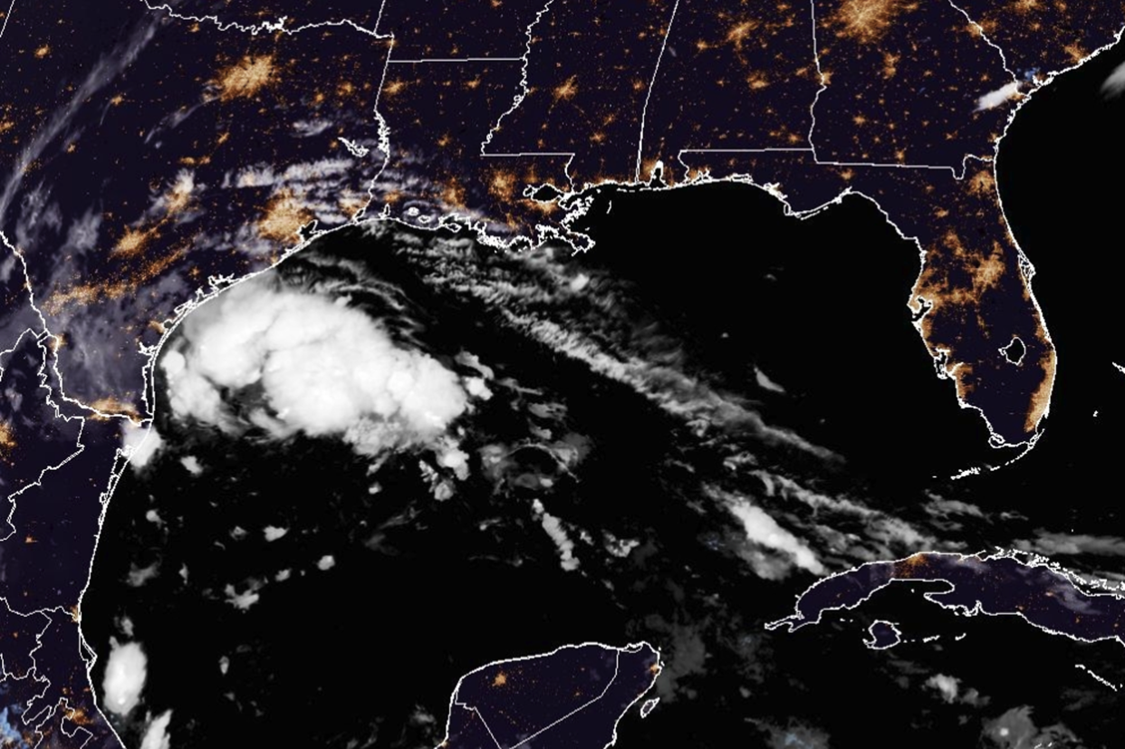
Harold, the latest system to form in what has become a busy Atlantic hurricane season, was about 70 miles east-southeast of Port Mansfield, Texas, around 7:30 a.m. CT (8:30 a.m. ET). It was moving northwest towards the Texas coast at around 18 mph.
The storm, which had sustained winds of 45 mph, was forecast to make landfall between Brownsville and Port Mansfield as a tropical storm at around 11 a.m. CT (12 p.m. ET).
The storm was expected to slam south Texas with heavy rain and gusty winds, the National Weather Service said.
Rainfall amounts of 3-5 inches with isolated higher amounts of up to 7 inches were expected through early Wednesday, bringing the threat of flash flooding for some areas, the agency said.
The weather service's Weather Prediction Center said there was a slight risk of excessive rainfall for the region.
Around 1 to 3 feet of storm surge is possible from the Mouth of the Rio Grande to Sargent, which includes Baffin Bay, Corpus Christi Bay and Matagorda Bay.
Mexico is more likely to see flooding from remnants of Harold, with 4 to 6 inches and locally, up to 10 inches, possible there through Wednesday.
Harold will bring some much-needed rain to a drought-stricken Texas. While the heaviest rain won’t reach the parts of Texas that need it most, the showers and clouds associated with the system will bring a brief reprieve to the excessive heat including for cities like Austin, Corpus Christi and Brownsville.
The weather service in Corpus Christi said in a situation overview Monday night that the main hazards would be the potential for locally heavy rainfall overnight through Tuesday night, warning it could produce isolated flash flooding, mainly in urban areas.
It said sustained winds of 40-50 mph with gusts of 60-70 mph were possible Tuesday, along with the possibility of "a couple of tornadoes" in the early hours of the day.
"Increasing swells will produce a risk of dangerous rip currents and moderate coastal flooding through late Wednesday," it warned.
On Monday, Texas Gov. Greg Abbott ordered the deployment of state emergency response resources and activated the Texas State Emergency Operations Center to Level 2, or "elevated response conditions," ahead of Harold's arrival.
“Texas stands ready to deploy all available resources to South Texas as tropical storm conditions impact the region this week,” he said.
"I encourage Texans to remain weather-aware and heed the guidance of state and local officials and emergency management personnel as they work together to keep communities safe," Abbott said.
As the storm barrels toward Texas, dangerous heat was also expected to continue to intensify in the state and in the central Plains, with numerous daily high temperature records expected, the weather service said.
Harold comes following storms Emily, Franklin and tropical depression Gert, with Franklin expected to reach the Hispaniola, including Haiti and the Dominican Republic, by Wednesday, according to the hurricane center.
Meanwhile, in the West, residents faced the threat of flash flooding and urban flooding caused by Hilary, a post-tropical cyclone.
The system became the first to hit Southern California as a tropical storm in decades earlier this week, bringing heavy flooding, mudflows and sinkholes to desert cities and smashing rainfall records.
