Tornadoes possible in forecast for the Midlands. Here’s when to expect severe weather
Severe weather could return to the Columbia area Wednesday, and that includes the possibility of more tornadoes in the Midlands.
A line of strong thunderstorms and showers will move across South Carolina, with rain and wind beginning to affect the Midlands Wednesday morning, the National Weather Service said.
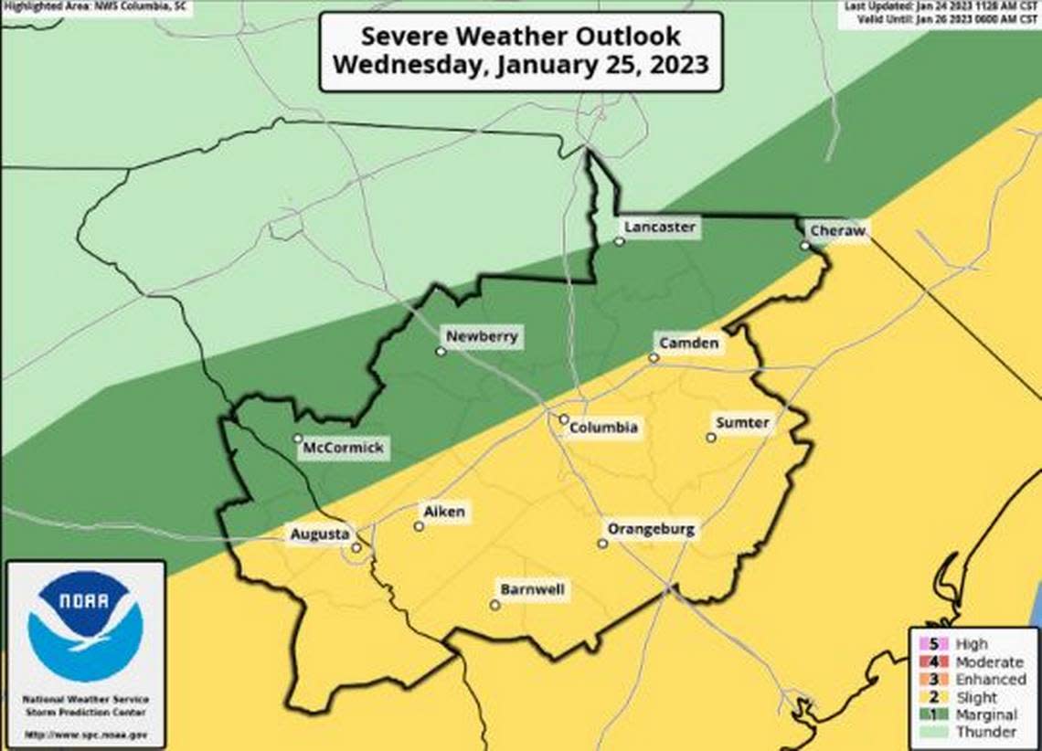
The storms could persist through the evening, and the greatest impact to the Columbia area — along the Interstate 20/Interstate 77 corridor — is expected between 10 a.m. and 4 p.m., according to a briefing issued Tuesday by the National Weather Service.
There is potential for some of these storms to produce damaging wind gusts and isolated tornadoes, according to the briefing.
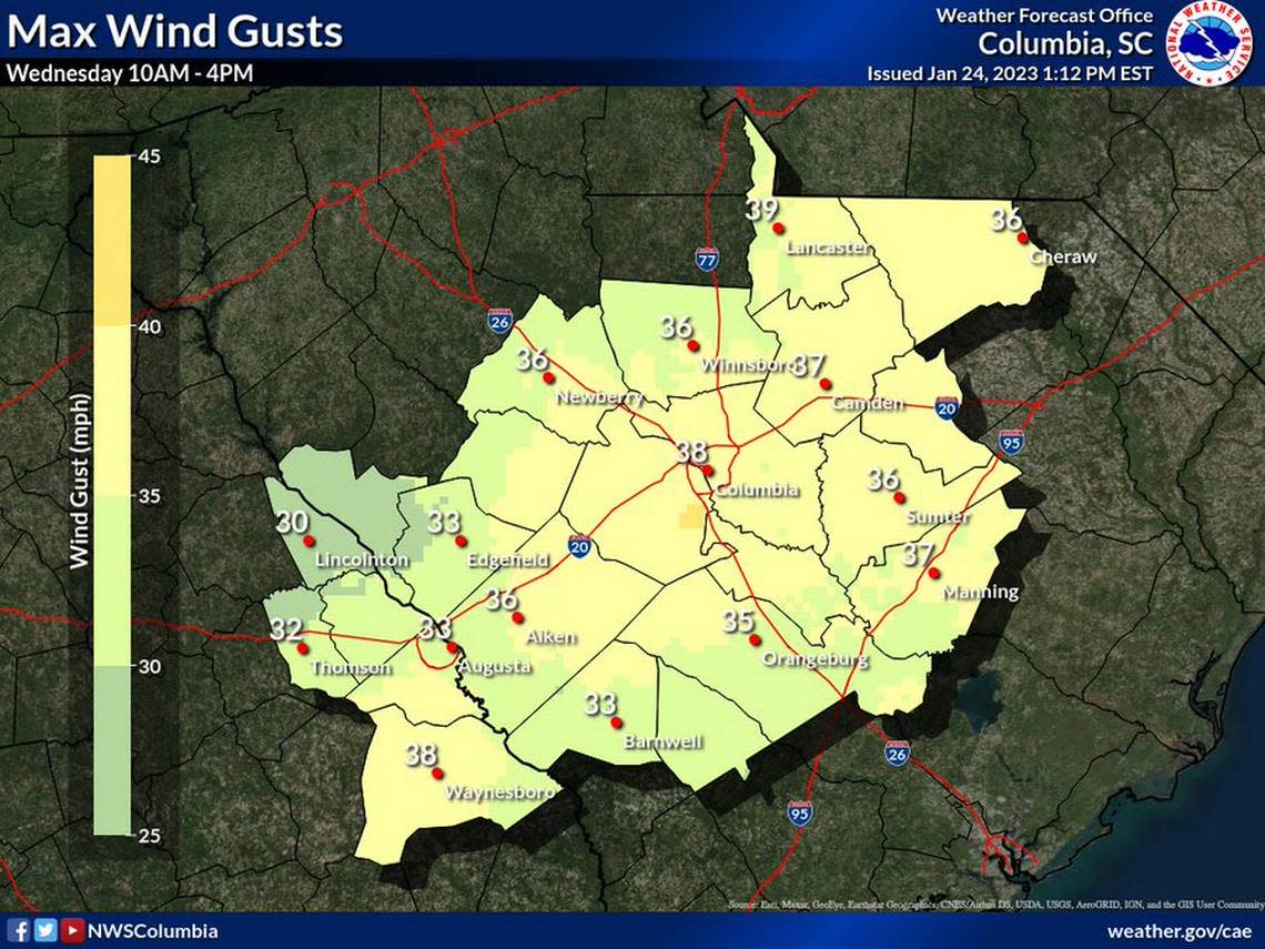
The “strongest wind gusts are expected between 9 a.m. and 6 p.m. ahead of the line of storms and just behind it,” the National Weather Service said.
Wind gusts upwards of 35-40 mph are forecast, and a few damaging wind gusts in excess of 60 mph are possible, the National Weather Service said.
Across the Midlands powerful winds and tornadoes could cause considerable damage to trees and branches, in addition to mobile homes, roofs and outbuildings. Vehicles would also be under siege in the case of a tornado.
Damage to trees and branches creates the possibility of downed power lines and outages.
The storms are forecast to dump three-quarters of an inch of rain or more on the Columbia area. Localized amounts could be higher, and there is a 90% chance of rain Wednesday, the forecast shows.
New rounds of heavy rainfall after Sunday’s record-breaking 2.41 inches of rain could result in isolated flash flooding, according to the briefing. The record was for every Jan. 22 in the Columbia area, since precipitation totals began being measured.
All of the recent rain could pose another issue. While gusty winds will blow around loose outdoor objects, they could also cause isolated tree damage given the saturated soils, the National Weather Service said.
No warnings or watches have been issued, but that is subject to change as the storms get closer. A lake wind advisory is scheduled to go into effect for all Midlands counties at 10 a.m. Wednesday and run through 2 a.m. Thursday, according to the National Weather Service.
Temperatures are expected to climb into the upper 60s during the storms, before dropping to a possible low of 39 overnight, the forecast shows. Thursday, Friday and Saturday are all forecast to be sunny, clear days with temperatures in the 50s, before the next chance of rain on Sunday.
In the first week of January, five tornadoes were confirmed in the Midlands.
During those Jan. 4 storms, wind bursts as powerful as 90 mph were recorded as tornadoes were confirmed in Lexington, Orangeburg, Aiken and Calhoun counties, the National Weather Service said.
A week later, another tornado was confirmed just across the state line in Georgia, before the storms marched through the Midlands, according to the National Weather Service.
