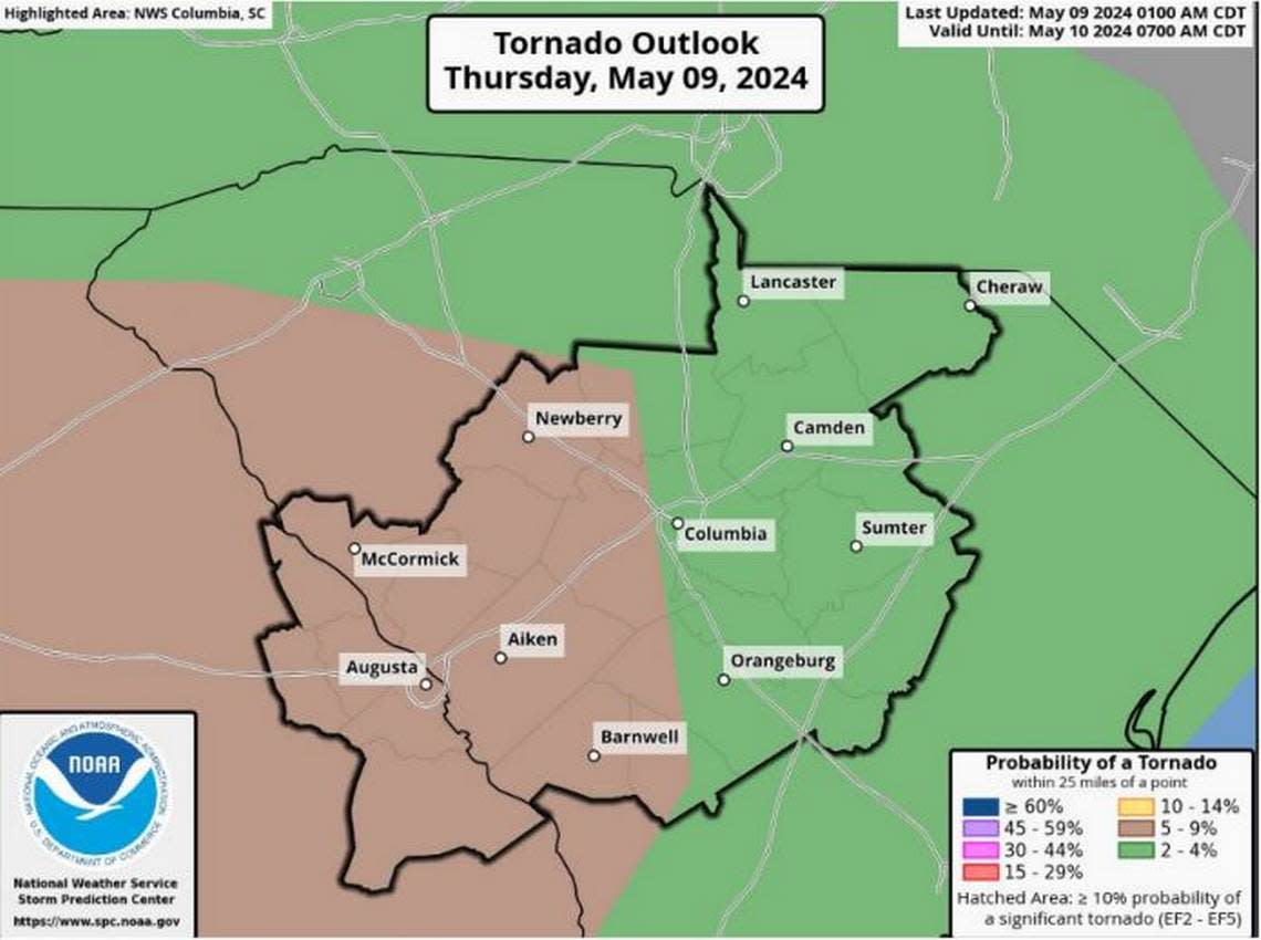
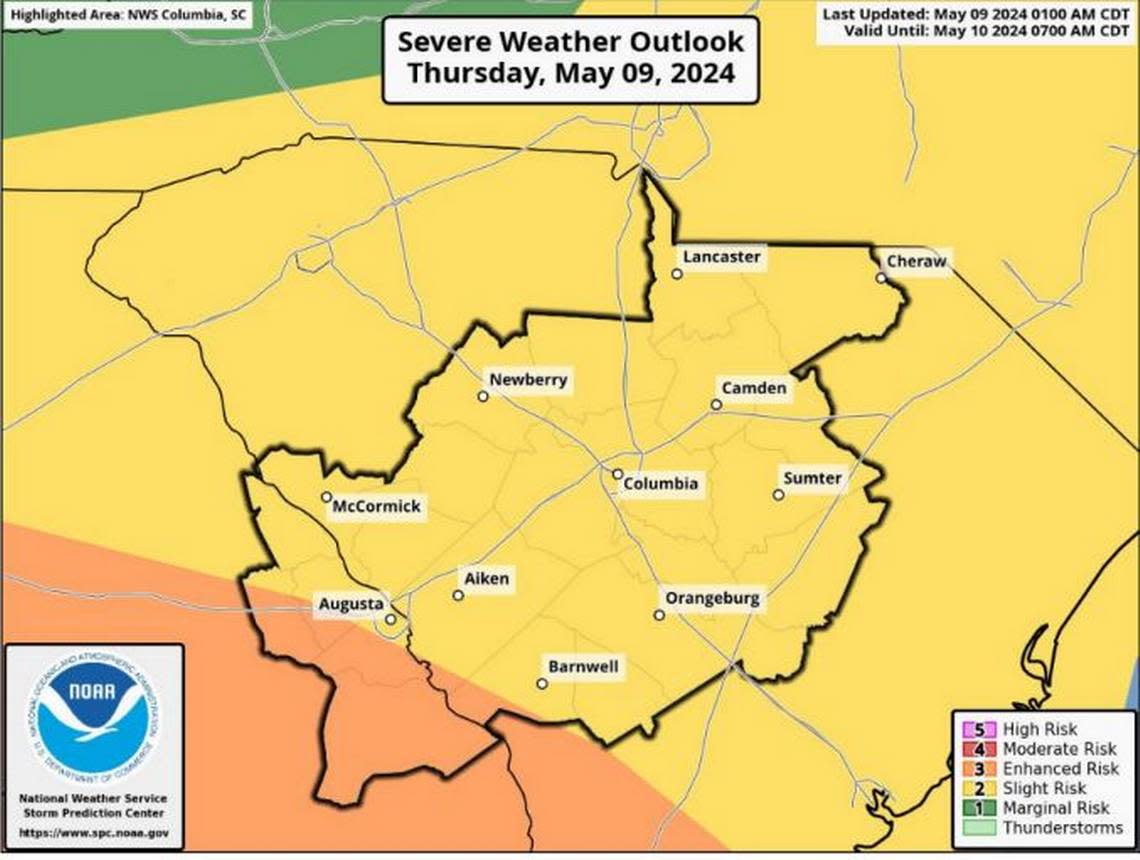
Tornado watch issued for Columbia area as storms move across SC
Severe weather continued to affect the Columbia area Thursday, and a tornado watch was issued for much of the Midlands, according to the National Weather Service.
The tornado watch was in effect through 1 p.m., the National Weather Service said.
Both Richland and Lexington counties were included in the tornado watch. Other counties listed in the tornado watch were Calhoun, Clarendon, Orangeburg, Saluda and Sumter — among other areas in the central region of South Carolina.
Multiple rounds of showers and thunderstorms are possible Thursday morning and afternoon across the Midlands, meteorologists with the National Weather Service said in a morning briefing.
The severe storms could include damaging winds, hail, and even an isolated tornado, according to the briefing. Flooding is also possible in urban areas and near small streams, the National Weather Service said.
Winds with powerful 60-70 mph gusts are possible, according to the briefing.
Powerful winds and tornadoes could cause considerable damage to trees and branches, in addition to mobile homes, roofs and outbuildings. Vehicles would also be under siege in the case of a tornado.
Damage to trees and branches creates the possibility of downed power lines and outages.
This is a developing story, check back for updates.
