Tornado threats, heavy rain and snow expected as dangerous spring storms threaten millions
Millions of people are under weather alerts as a dangerous storm system moves through parts of the Ohio Valley region and the Northeast, bringing heavy rain, threats of isolated tornadoes and snow.
A severe weather outbreak is possible for the Ohio Valley, middle Tennessee and the Southeast on Tuesday with multiple rounds of storms expected throughout the day and into the evening.
The Ohio Valley region is already being hammered by a storm. As many as 4 million people along the Ohio River were under tornado watches until noon ET. Some of these storms could have 90 mph straight-line winds.
A significant outbreak of severe storms stretching from the Great Lakes to the Gulf Coast has put 54 million people at risk.
One weather-related injury was reported in Lexington, Kentucky, Mayor Linda Gorton said, without providing further details.
Dozens of calls have come in, with the Lexington Fire Department receiving 61 calls for emergency service, two calls for trees crashing into homes, and two structure fires caused by downed power lines, the mayor said in a statement Tuesday.
"Three injury collisions" were also reported as well as seven collisions that did not result in injuries.
Kentucky Gov. Andy Beshear declared a state of emergency following the severe weather.
"We have reports of substantial damage to a number of structures — and thankfully, as of right now we are not aware of any fatalities," Beshear said in a statement. "We need all Kentuckians to stay weather aware as we brace for more severe weather throughout the afternoon and evening."
The National Weather Service's Weather Prediction Center said in a post on X on Tuesday that late-season heavy snow and gusty winds across the Great Lakes and the Northeast through the midweek are expected.
In Wisconsin, a winter storm warning has been issued beginning at 1 p.m. Tuesday to 1 p.m. Wednesday, according to the local station NBC26.
Over the next 24 hours, people should expect a lot of wet heavy snow, wind gusts up to 40 mph and slippery roads, it reported. Snow will continue until Thursday across northeast Wisconsin as the storm passes through, making way for sunny weather Friday.
High winds and hail are a threat in central Indiana and Ohio. The weather service warned that the storms could also bring tornadoes in Indiana. NBC affiliate WCMH-TV of Columbus, Ohio, said that there is an isolated tornado threat for the region.
At least four tornadoes were reported Monday in Oklahoma and Missouri and damage was reported Tuesday in Lexington and Nicholasville, Kentucky, and Charleston, West Virginia.
The city clerk for Barnsdall, Oklahoma, said several homes were damaged but there have been no reports of fatalities. Due to the weather, public schools in the city were closed Tuesday.
Schools were also closed in parts of Ohio.
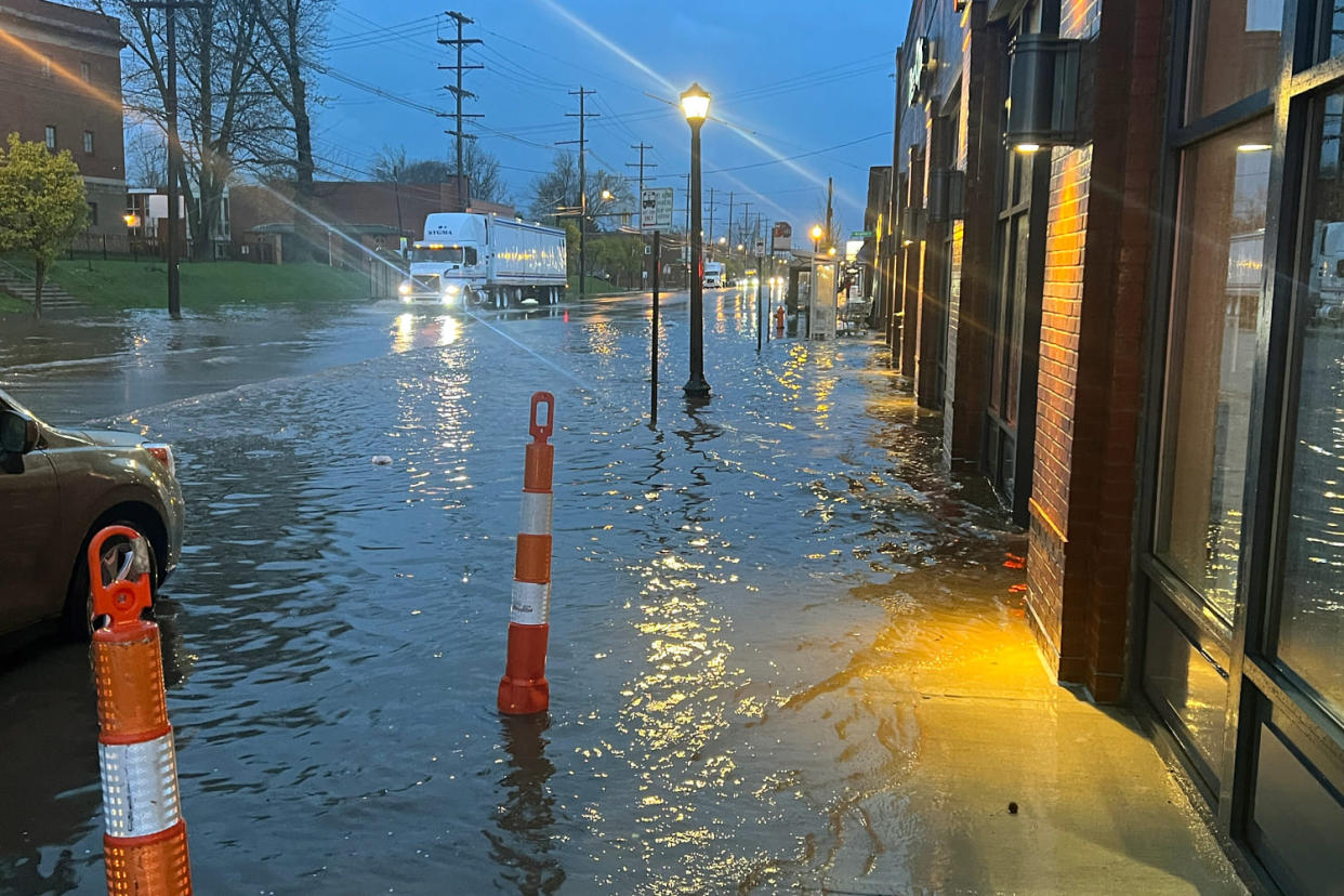
Flooding is a major concern, with 41 million people from Indiana to New Jersey under flood watches.
As of Tuesday afternoon, flash flood warnings were in effect for Pittsburgh and other areas of western Pennsylvania, where 2 to 4 inches of rain has already fallen.
The highest flood threat Tuesday will be associated with the severe thunderstorms charging across portions of the Ohio Valley. Rainfall rates of 1 to 2 inches per hour could spark flash flooding.
Because of the heavy rain, the Weather Prediction Center issued a slight risk of excessive rainfall over parts of the lower Great Lakes, the Ohio and Tennessee valleys, and the central Appalachians through Wednesday morning. The wet weather will likely create localized flash flooding, with urban areas, roads and small streams being the most vulnerable.
On Wednesday, the mid-Atlantic and Florida were under a severe weather risk. That expanded to include 22 million people from Florida to Maryland.
A secondary low-pressure system along the mid-Atlantic coast could bring heavy, wet snow and some sleet to the Northeast on Wednesday afternoon through Friday, the center said.
Upstate New York and northern New England should expect significant snow accumulations that could create hazardous travel because of low visibility and snow-covered roads.
The center also issued a slight risk of severe thunderstorms over the Florida Peninsula from Wednesday into Thursday morning. The storm is expected to bring frequent lightning, severe wind gusts, hail and possible tornadoes, it said.
The springtime storms follow a wet Monday where unconfirmed tornadoes, hail, strong gusts and heavy rain battered parts of the South.
