Thunderstorm could bring strong winds, heavy rain, tornadoes Tuesday night to the Fox Valley
APPLETON - April showers may bring May flowers, but this May shower could bring thunderstorms, strong winds and possibly even tornadoes Tuesday night in Appleton, according to the National Weather Service Green Bay.
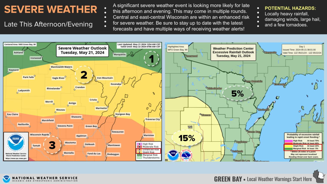
Two rounds of showers are expected to reach the Fox Valley Tuesday. While showers are forecast for late this morning and early afternoon, the worst storms are expected this evening. NWS meteorologist Roy Eckberg said the timeframe for the second round of storms is likely 5 to 9 p.m. Tuesday, with the worst potential for storms most likely around 7 p.m.
Eckberg said the storm is triggered by "low pressure across Iowa and Minnesota, moving northeast." That, plus "a cold front sweeping across the state this afternoon," is what will "trigger the main line of storms."
While the risk of flooding and hail in Appleton isn't severe, the storm could bring damaging winds to the Valley, possibly with gusts of up to 60 miles per hour, Eckberg said. There's also the possibility of "an isolated tornado."
The NWS recommends staying up to date with the latest forecasts and having multiple ways to receive severe weather alerts.
Green Bay, Appleton-area weather radar
Can't see the map? Click here.

Rebecca Loroff is a K-12 education reporter for the USA TODAY NETWORK-Wisconsin. She welcomes story tips and feedback. Contact her at 920-907-7801 or rloroff@gannett.com. Follow her on X (formerly Twitter) at @RebeccaLoroff.
This article originally appeared on Appleton Post-Crescent: Appleton weather could be severe with thunderstorms forecast for Tuesday
