Thousands of power outages reported across Austin after storms
Severe storms early Sunday led to power outages for thousands of Austinites, Austin Energy said Sunday.
As of 3 p.m., the Austin Energy outage map showed about 2,500 customers across Austin were experiencing power outages, a significant decrease from a morning estimate of about 18,000 customers. Most of the remaining outages were concentrated in South Austin, with others in Central and East Austin. Most outages happened just after 8 a.m. when storms began rolling into the Austin area.
The outages were caused by the severe weather, Matt Mitchell, a spokesperson for Austin Energy, confirmed. Crews were restoring outages that affected the largest number of customers first and would continue to work their way down the list, Mitchell said.
As of 3 p.m., Oncor Energy was reporting scattered power outages affecting fewer than 100 customers across Williamson County and near Pflugerville on its map. The Pedernales Electrical Cooperative, which serves part of the Hill Country west of Austin and parts of western Williamson, Travis and Hays counties, reported that fewer than 100 customers were affected by outages. Bastrop County outages were down to zero after having several hundred customers out of power earlier, according to Bluebonnet Electrical Cooperative.
Camp Mabry and Austin-Bergstrom International Airport recorded less than an inch of rain after Sunday's storms, said Eric Platt, a meteorologist at the National Weather Service in New Braunfels. April's total rainfall will exceed 3 inches, according to the weather service's data.
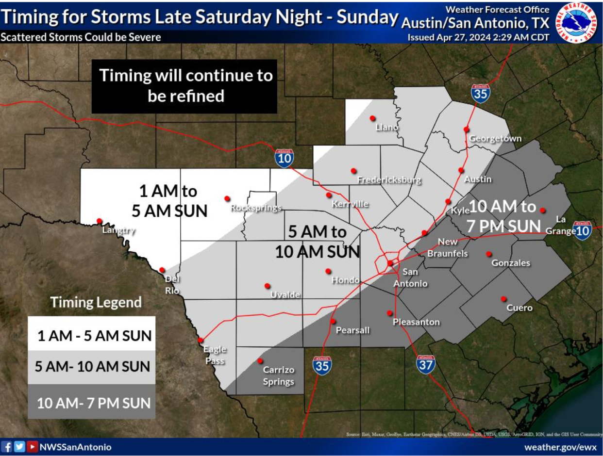
Rain chances will continue to decrease throughout the day, with most rain chances east of Austin, according to the National Weather Service. An area severe storm watch expired at 10 a.m.
A small portion of Williamson, Lee and Fayette counties could see more severe storms continue during the day Sunday.
A tornado watch was issued until 9 p.m. Sunday in areas east of Interstate 35, including Bastrop and Caldwell counties. A few tornadoes, damaging wind gusts up to 70 mph and hail up to 2 inches in diameter are possible, according to the National Weather Service.
Austin's forecast this week
Temperatures will climb this week, with highs in the mid- to upper 80s. Heat indexes Monday and Tuesday will reach into the low 90s before temperatures level out into the low to mid-80s from Wednesday to Saturday. Lows are expected to stay within the upper 60s to low 70s all week. The possibility of rain will return to the forecast Tuesday and Wednesday, but the best chances for precipitation will come on Thursday and Friday.
Monday
High: 88
Low: 67
Partly cloudy skies will break at midday, with a heat index reaching into the low 90s. No rain anticipated.
Tuesday
High: 86
Low: 69
Another muggy, cloudy day with a heat index reaching up to 93 degrees; 20% to 30% chance of rain from morning to evening.
Wednesday
High: 84
Low: 72
Mostly cloudy skies with windy conditions and gusts up to 26 mph. Chances of storms from early afternoon into the evening.
Thursday
High: 85
Low: 73
Storm chances all day, varying from 20% to 45%.
Friday
High: 82
Low: 71
More chances for rain and severe storms, with rain probability ranging from 25% to 40%, probably all day.
Saturday
High: 83
Low: 67
Mostly cloudy skies and slight chances of rain throughout the day.
This article originally appeared on Austin American-Statesman: Thousands of power outages reported across Austin after storms
