A Tacoma area heat wave? Not quite yet, but better be careful with those campfires
We’re only just a few days into June, and already it seems like summer deck party time in the Tacoma area, normally not seen until July at the earliest.
By midweek, we could edge into the upper 80s, according to the latest forecast.
Keep in mind June 21 is considered the astronomical first day of summer on the calendar.
The trend of cool mornings (40s and 50s for lows) should continue through the week, with highs in the 70s except for Tuesday and Wednesday, according to the forecast, as the thermometer creeps into the 80s. Wednesday is set to be the warmest day for the week, climbing into the mid-to-upper 80s.
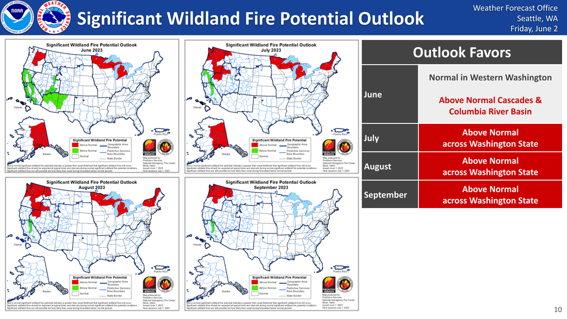
The National Weather Service’s Seattle office, in its latest long-term outlook issued Friday, noted that the early heat and dry conditions have set up “nearly all of Washington State for an increased risk of above-normal fire activity from July through September.”
According to NWS, “Dry conditions and breezy northeast winds may develop in the Sunday through Wednesday time frame, increasing concerns for fire conditions.”
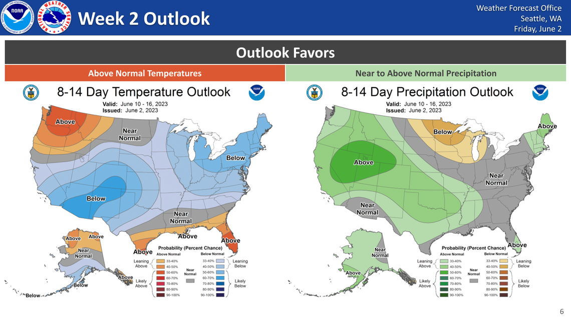
Later in the week, a slight cooldown will take place, but “still above-normal temperatures are expected through the end of next week along with a 10-20% chance of showers in the lowlands, and slightly higher chances for showers in the mountains.”
The above-normal temperatures are expected to continue into the following week (June 10-16, with the potential for mountain thunderstorms.
The Seattle weather office noted in a Twitter post Saturday that “In the first week of June 2022, Seattle picked up over an inch of rainfall.”
This year, it’s likely to be none.
In the first week of June 2022, Seattle picked up over an inch of rainfall.
This year, it's likely to be nil, none, zilch, zip, a goose egg, bupkis, squat...
Alright, I might be a little verbose there.
Let's just call it...
Zero.#wawx pic.twitter.com/4Ho5XwmSyM— NWS Seattle (@NWSSeattle) June 2, 2023
