A street in south Salem is named Hrubetz Road. Why is that?
This is part of an on-going series answering "Why is that?" questions about Salem and the Mid-Valley.
The question: Why is a street in south Salem called Hrubetz Road, and who or what is it named after? Plus, how the heck do you pronounce it? We have all the answers. But first, a little history.
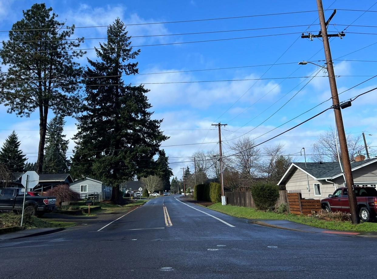
The background: Hrubetz Road SE runs east to west and slices through a section of the Faye Wright Neighborhood, which includes Wright Elementary School and Judson Middle School.
The neighborhood is part of what once was called the Liberty district, back when much of south Salem as we know it today was miles outside the city limits and where addresses were identified by rural mail route.
The Liberty district was a farming community with its own post office, school district and volunteer fire department. Property listings often advertised farms claiming “no finer fruit land in Oregon.”
Berry and prune farms thrived in the fertile soil, and prunes were one of the most profitable crops. More than 80% of prunes in the United States were grown in Oregon in the early 1900s, practically all in the Willamette Valley. The area south of Salem regularly was referred to as the prune belt.
Who or what is Hrubetz Road SE named after?
Frank and Mary Hrubetz came to the Liberty district in 1898 from Illinois. He was born in the Bohemia part of what became Czechoslovakia, then the Czech Republic. She is believed to have been born in the United States.
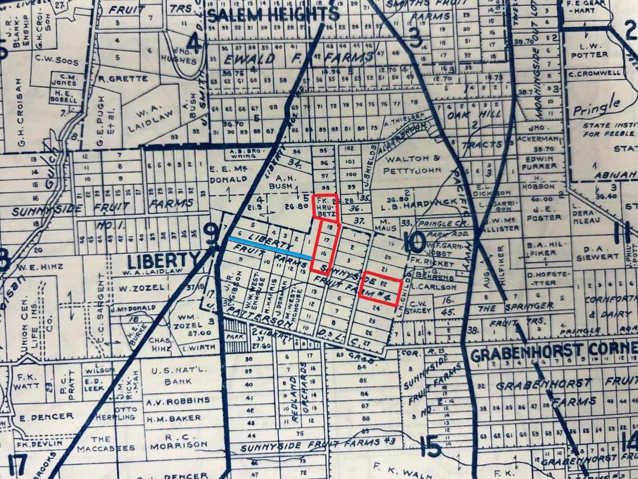
The couple purchased multiple plots of land within Sunnyside Fruit Farms #4, which occupied 160 acres in the eastern half of the former J.R. Patterson donation land claim. The other half included Liberty Fruit Farms.
For more details, we turned to the Marion County Surveyor's Office, which has a collection of historic maps in its vault. With white gloves and assistance from survey technician Adam Hoyt, we inspected Metsker Atlases for the county published in 1929 and 1941.
Frank Hrubetz owned six tracts within that area, plus an adjoining seventh tract to the north.
He and his wife raised their five children on an estimated 40-acre farm where they grew cane berries, prunes and other fruit. They also had about 10 acres of woods with a natural spring, where their children and grandchildren loved to explore.
The Daily Oregon Statesman reported Frank's early farming success in 1905 after the red raspberry harvest season. He had paid off his mortgage and built his family a new house.
The original farmhouse still stands near the midpoint of Hrubetz Road, although nearly impossible to identify after numerous renovations over the decades. Address number changes after the farm and surrounding area were subdivided also make locating it difficult.
Frank imported his first loganberry plants from California in 1905. He would be described 40 years later in his obituary as a pioneer loganberry grower in the Willamette Valley. He also was considered one of the best local authorities on the cultivation of cane berries, including boysenberries and red raspberries.
But the farm’s primary source of income came from its Italian prune trees. The prunes were dried and sold, and Frank had a large prune dryer on the farm. His 1910 harvest from six acres netted 946 bushes he sold for $1,020, the equivalent of nearly $33,000 today.
Mary Hrubetz started a candied fruit business in the late 1920s, only using what was grown on their farm or in the Liberty district. She packaged candied fruit and nuts in gift boxes and never could meet the Christmas holiday demand, according to a 1932 article in The Oregon Statesman.
She and her husband did well for themselves, the fruits of their labor enabling them to put their three daughters and two sons through college.
Frank farmed the property until not long before he died in 1945. Mary continued to live in the home but eventually began selling off portions to developers.
That area south of Salem experienced rapid growth after Liberty School District consolidated with the Salem school district in 1947.
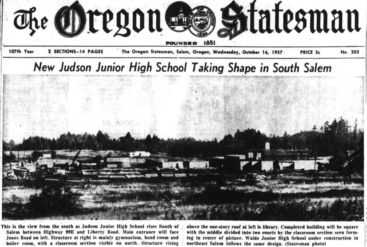
Liberty Gardens, a 75-lot subdivision, was approved in the late 1940s, launching a cascade of development. At least five Liberty Gardens annexes came after, providing homes for families whose children would attend a new junior high. Metsker maps in later years show annex No. 4 where the Hrubetz farm used to be.
Construction on Judson Junior High began in 1957, the same year Mary Hrubetz had one of the last reminders of the area’s once-thriving prune industry removed. The Liberty-Salem Heights volunteer fire department razed their old prune dryer during a supervised burn.
Judson opened in the fall of 1958. Mary died the following year.
Oh, by the way
Longtime locals likely will be more familiar with the Hrubetz name because of one of Frank and Mary's sons.
Frank Hrubetz Jr. was a pioneer in the amusement park rides industry. He helped develop and manufacture rides first for Eyerly Aircraft and then for his own company, all right here in Salem.
The street bearing his family name is about 10 blocks long, starting at Liberty Road SE and ending at Jones Road SE in front of Judson's athletic fields. Most of the road, except for three blocks near the school, has no sidewalks.
It is unknown when the Hrubetz Road was named, but one of Frank and Mary's granddaughters believes it was sometime in the 1940s, perhaps while they were alive. It was a county road before that and appeared on maps only about half as long.
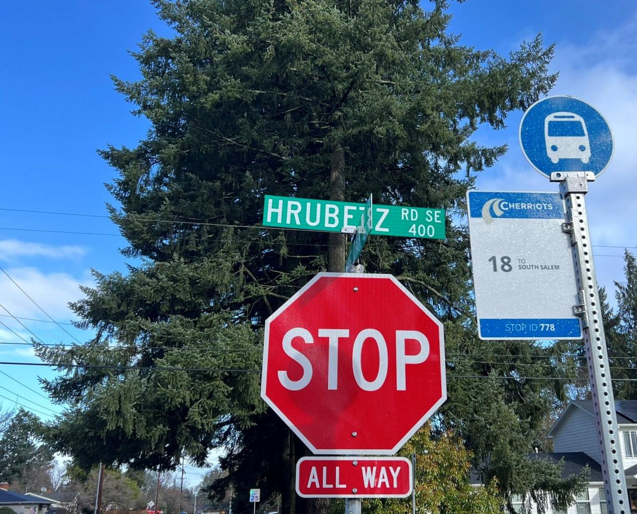
A search of the Marion County Survey Graphic Index finds the surname associated with the street on a 1948 survey. It is labeled Hrubetz Lane.
Hrubetz Road first appears in the Statesman archives in 1949 in a classified advertisement for registered bulldog puppies.
The pronunciation apparently has long been a mystery. A 1955 newspaper story about residents wanting to change the name of a couple of local streets because of frequent misspellings brought up the subject.
“Newcomers to Salem always seem to be clearing their throats when they try to pronounce Hrubetz Road,” the article said.
The author offered no pronunciation help, making you wonder whether even they knew.
To get the scoop for that question, we tracked down descendants of Frank and Mary. They had two grandchildren, both granddaughters, still living in Oregon.
Both confirmed the name is of Czech origin. They said the H is silent, and it is pronounced Roo-bets.
Capi Lynn is a senior reporter for the Statesman Journal. Email your "Why is that" questions to her at clynn@statesmanjournal.com.
This article originally appeared on Salem Statesman Journal: Why is a street in south Salem named Hrubetz?
