Lowcountry should ‘prepare for low-end hurricane conditions,’ storm surge of 3-5 feet
Hurricane Ian could produce storm surge of more than 3 feet along some areas of the South Carolina coast, the National Weather Service said Wednesday.
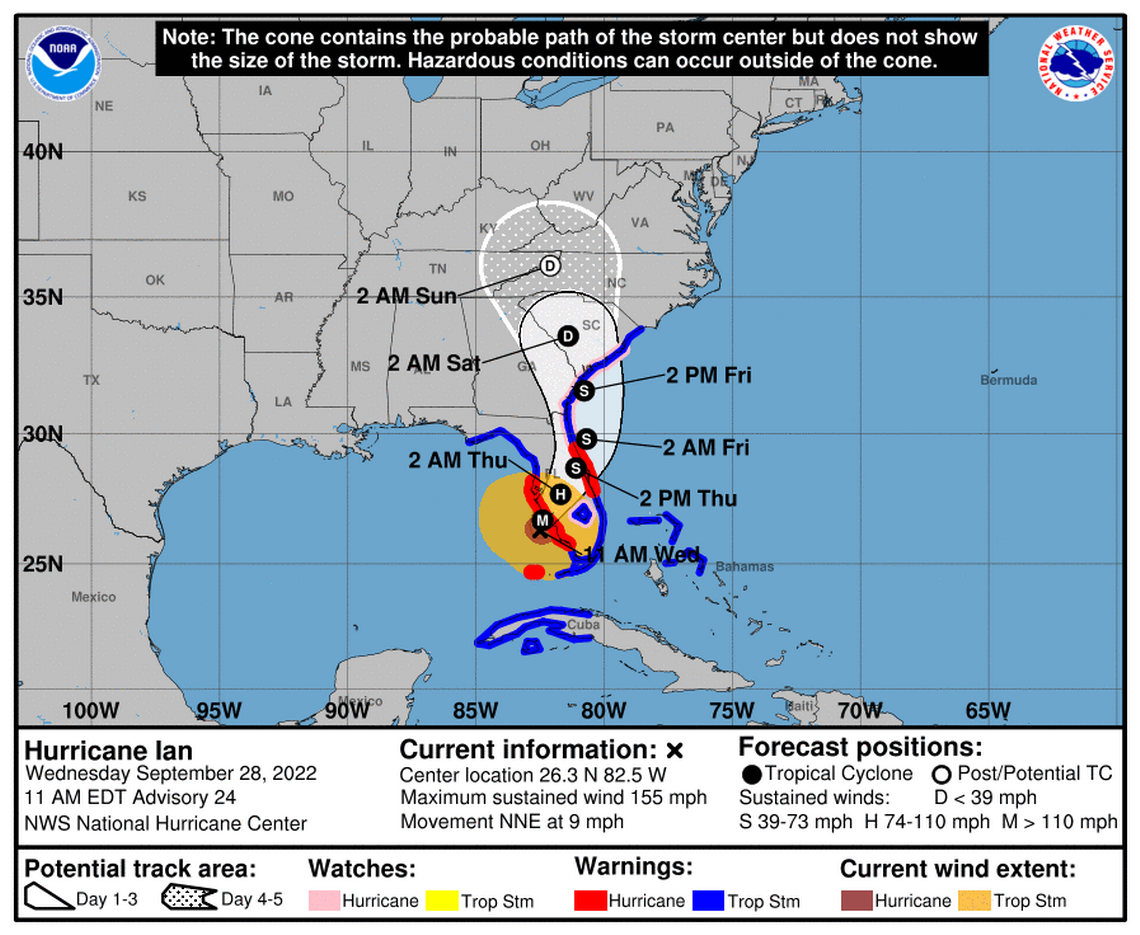
Hurricane Ian was upgraded to a Category 4, just short of a 5, Wednesday morning and the eye made landfall at Punta Gorda, Florida, about noon. That city faces storm surges of 8-10 feet and winds clocked at 130 mph, according to the NWS
The storm, the Weather Service added, may develop into a low-level hurricane by the time it reaches the South Carolina’s coast late Friday, instead of a tropical storm, which had been predicted.
“There is still uncertainty with the track and intensity of “Ian” after it emerges from the Florida east coast,” the Weather Service said. “Best to prepare for low end-Hurricane conditions.”
Meanwhile, Gov. Henry McMaster signed an executive order declaring a state of emergency and activating the state’s emergency operations plan, which enables state agencies to prepare for Hurricane Ian’s potential impacts.
“We do know we’ll see a lot of rain and significant storm surge on our coastline over the coming days,” McMaster said. “Now is the time for each South Carolinian to make plans for every contingency and be prepared.”
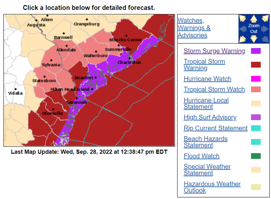
The Weather Service issued a storm surge warning for the state’s coastal areas in advance of the approaching storm, whose track shifted slightly eastward, which could make it even more dangerous if it remains on that course.
The eastward shift means the storm will spend more time over the Atlantic Ocean, potentially producing stronger winds and storm surge, before making landfall again later on Friday, said Ron Morales, a Weather Service meteorologist. Landfall is expected along the southern coast of South Carolina, Morales said.
Morales also noted Wednesday that the catastrophic hurricane was also picking up speed. The faster progression, Morales said, means the storm could become a low-end Hurricane before it makes landfall in South Carolina.
Portions of South Carolina could see 58-73 mph winds, the Weather Service said.
From early Thursday to late Friday, tropical force winds will develop that will move north over the coast before the storm makes landfall, Morales said.
Coastal barrier Islands are expected to see impacts on Thursday. Areas farther inland will see impacts on Friday and early Saturday. The biggest threats of strong winds, storm surge and rainfall will be Friday.
Storm surge could range between 3 to 5 feet but it will depend on whether heavy rains coincide with high tides, Morales said. At some point, Morales said, heavy rains are likely to coincide with high tide.
“This will be fairly significant coastal flooding due to the storm surge,” said Morales, noting some roads could be washed out and some structures could be impacted.
Six to 10 inches of rain is expected along the coast. Isolated tornadoes also are possible along the coast, Morales said.
Hilton Head Island, Beaufort and Bluffton are affected by the storm surge warning, which was issued late Wednesday morning because of the potential for life-threatening flooding, the Weather Service said.
Such warnings are issued up to 36 hours before hazardous conditions begin.
Residents should urgently complete efforts to protect life and property, the Weather Service said, and follow any evacuation orders that are issued to prevent drowning or being cut off from emergency services.
The city of Beaufort is bracing for 4 to 10 inches of rainfall, said Neal Pugliese, who manages storm drainage projects as a consultant with the city.
“This is going to be a very large rain event if the track holds true,” Pugliese said.
Rainfall, Pugliese added, is expected to come “in a very short period of time.”
Some wind and uprooted trees because of saturated soils also are possible, he said.
Pugliese is expecting flooding in the Pigeon Point neighborhood and the Southside Park area.
City Manager Bill Prokop told City Council members Tuesday that flooding also is likely in the downtown area.
To prevent water from backing up into neighborhoods from Southside Boulevard to Rogers Drive, the city’s Public Works Department is opening tidal gates in Basin 1 and Basin 2, Pugliese said.
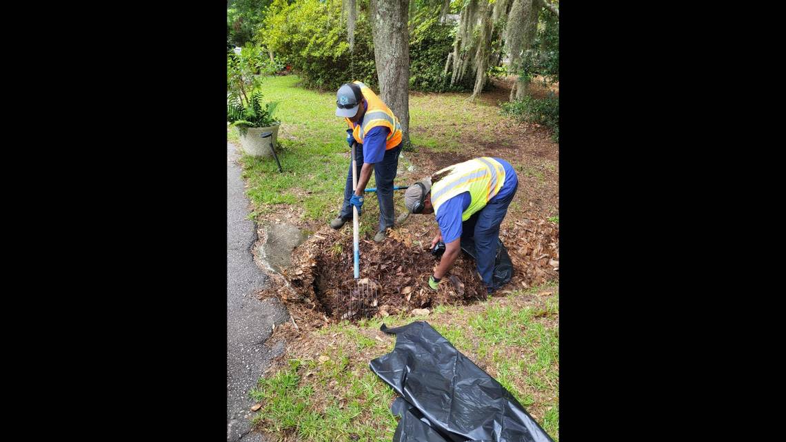
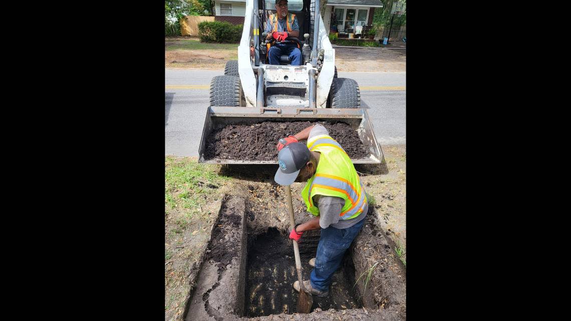
The city’s Public Works Department was busy Wednesday cleaning out storm drains and ditches. Residents can help make sure storm drains are functioning be keeping streets and drains free of obstacles or calling Public Works. Pugliese also urged residents to be mindful of their neighbors, especially senior citizens, and ask them if they need assistance.
“This is an all hands on deck sort of affair where everyone has to do there part,” Pugliese said.