South Florida geology 101: Lessons in the rock about future risks from sea rise
It’s South Florida Geology 101 — a class likely avoided or forgotten by many. Too bad, because there is a sobering lesson in the rock, one that promises to become increasingly important if sea rise continues as projected.
All of Florida was once underwater. The state sits on a layer of limestone two or three miles deep, which formed from the shells of ancient sea creatures that died and left their corpses strewn across the ocean floor over the past 200 million years.
Harold Wanless, who heads the University of Miami’s geology department, says there’s no reason to think the state couldn’t go underwater once again.
Sea levels haven’t exactly been stable over a geological time scale. As earth’s climate changed and glaciers froze and melted over the past 2.6 million years, sea levels have sometimes risen 100 feet higher than they are today or fallen 400 feet lower, Wanless said.
Florida sometimes emerged from the water as a collection of small islands, and sometimes it became a massive peninsula twice as wide as it is today. The place we call Miami has been a landlocked plain and it has been a part of the ocean floor.
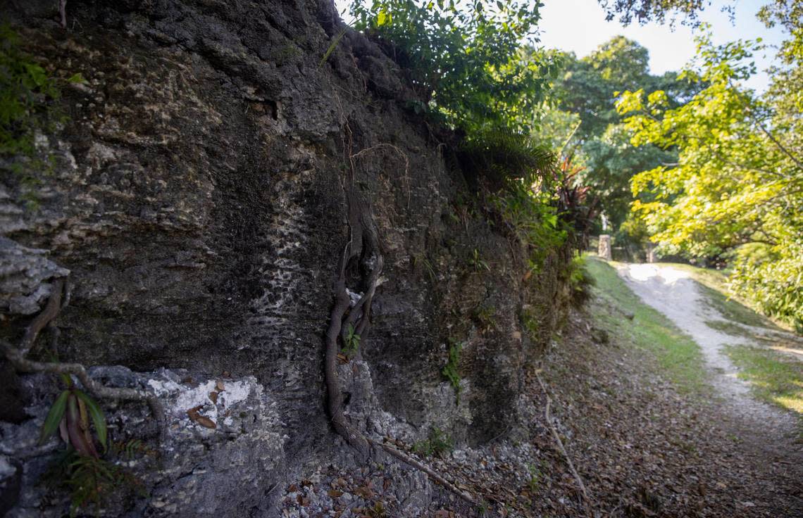
The layer of limestone you see sticking out of the ground in high elevation places around Miami started forming when South Florida was at the bottom of a shallow sea about 125,000 years ago. Along what would become the coasts of Florida, waves rolled bits of shells around in the sand, forming tiny, roly-poly balls known as ooids.
Besides being a fun word to know for Scrabble, ooids formed the fundamental bedrock of modern Miami. They stacked up into sandy beaches, and after sea levels fell during the last ice age, slightly acidic rainfall fused them together into a particularly hard form of limestone called oolite. Along the east coast of Miami-Dade County, this oolite deposit is called the Miami Rock Ridge.
Many of Miami-Dade’s highest points fall along this ridge, which runs roughly parallel to Biscayne Bay and passes through Palmetto Bay, Pinecrest, Coral Gables, Coconut Grove, Wynwood and Little Haiti. There’s a narrow crest at the very top of the ridge, which is just a few blocks wide in most places and rises to multiple peaks of 20 to 23 feet. The Miami Rock Ridge is part of the larger Atlantic Coastal Ridge, which runs up through Broward, along the Florida coast and continues intermittently as far north as South Carolina.
There’s a reason Miami-Dade County has dozens of high points that are all roughly 20 feet tall: That’s how high the oceans were before the last ice age. Ooids form in shallow seas, and the ooids that make up the Miami Rock Ridge couldn’t stack up any higher than the surface of the ocean.
“That’s why there’s almost nothing higher than 20 feet here,” said Wanless.
The ridge is taller in Broward and Palm Beach because these sections of the rock are older and formed at an earlier time when sea levels were even higher, according to Wanless.
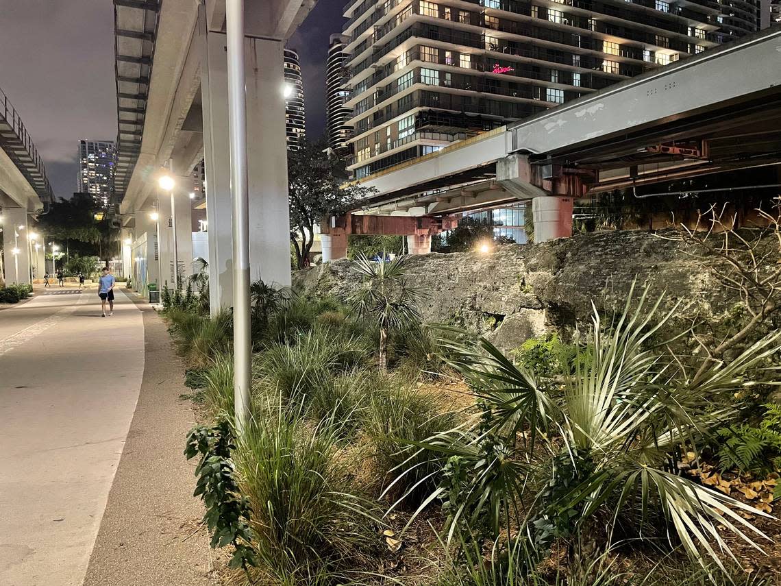
So the next time you spot one of Miami’s magnificent limestone outcroppings — like the ones you see along South Bayshore Drive in Coconut Grove or beneath the Metrorail tracks near Brickell Station — think of it as a monument marking how high the surface of the ocean was just a geological moment ago.
This climate report is funded by Florida International University, the Knight Foundation and the David and Christina Martin Family Foundation in partnership with Journalism Funding Partner. The Miami Herald retains editorial control of all content.
