How do you get to and from South Beach without going crazy? We have some traffic advice
Getting to and from South Beach is tough on most days.
But on spring break?
Or Art Basel? Or the Food and Wine Festival? Or just about anytime?
Eastbound traffic to Miami Beach gets knotted on the MacArthur Causeway all the way back to Bayshore Drive and Biscayne Boulevard
Westbound traffic to Miami gets clotted back at Hibiscus Island.
And with the construction lane-shift changes on Interstate 395, the trip gets even more torturous.
But there is more than one way in and one way out of South Beach. We have some tips.
First one: Don’t take the MacArthur Causeway.
Yes, the MacArthur offers killer views and a convenient landing point at Fifth Street in South Beach. But everyone has the same idea to get to Ocean Drive.
So, if not the MacArthur, then which way to go?
Go north, take one of several causeways spanning the bay, each with their own amenities, then head south on one of Miami Beach’s major roads: Collins, LaGorce/Pine Tree, Alton.
Waze won’t tell you that, but we will.
Here is a rundown on the alternative causeway routes:
Venetian Causeway
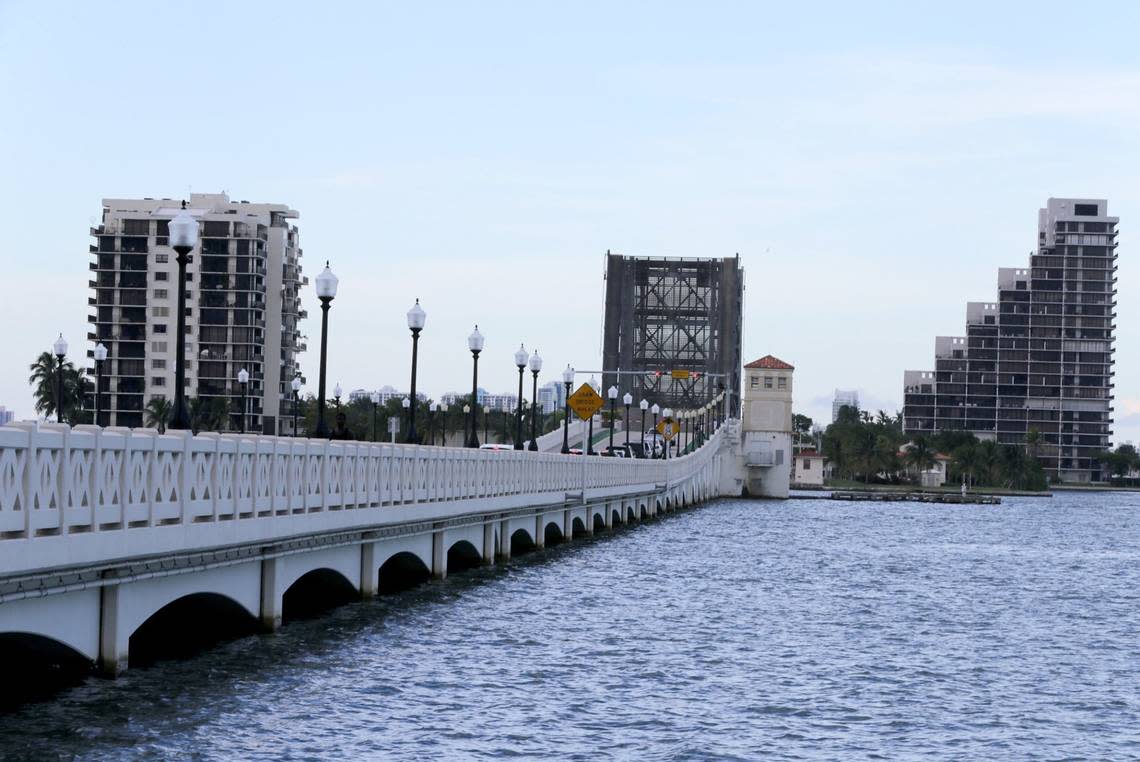
Toll: $2.25 SunPass, $3 toll by plate
Built: 1926, restored in 1995-99 and 2016, with repairs through the years. Take note: While this is an alternative route to the MacArthur, major construction on the Venetian has reduced lanes and slowed traffic.
Route: 15th Street in Miami to 17th Street/Dade Boulevard in Miami Beach
History: It cost about $2 million to build the Venetian in 1925. In the early 1960s, the first high-rises were built on the Venetian Isles, first on the south side of Belle Island. Over time, the number of apartment buildings increased on Belle and Biscayne islands.
Julia Tuttle Causeway
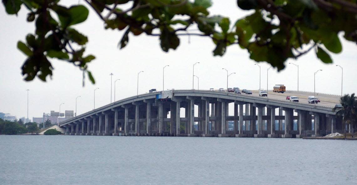
Toll: None
Built: Opened in 1959.
Route: Six-lane highway with no drawbridges to slow traffic. Runs from the southern terminus of the Airport Expressway and empties onto 41st Street in Miami Beach, and connects with Alton Road.
Alternative name: Interstate 195
History: Namesake Julia Tuttle earned her place in Florida history by giving railroad magnate Henry S. Flagler 100 acres of land in exchange for Flagler extending his railroad line from Palm Beach to Miami.
79th Street Causeway
Toll: None, unless you are tempted to stop at one of the restaurants along the stretch and spend some money.
Built: Opened in 1928 and rebuilt in 1948. The bridge was widened and bolstered in the late 1960s and early 1970s but since then has needed only minor repairs.
Route: Northeast 79th Street in Miami through North Bay Village to 71st Street in Miami Beach.
Alternative name: John F. Kennedy Causeway
History: Best known for its raucous reputation in the 1960s as a late-night hangout for entertainers and mobsters. Restaurants and watering holes of the past along the stretch included the Place for Steak, the Bonfire and Happy’s Stork Lounge. There was even a 24-hour beauty salon called the Head Hunter. Today, the causeway runs through more of a family-oriented town whose best known restaurant is Shuckers.
Other causeways
If you want to push your Intracoastal crossing point even farther north of your South Beach destination, several other causeways can get you to the barrier island:
Broad Causeway
Toll: $1.50 for SunPass and $2 for toll-by-plate. There is no longer a staffed toll booth.
Built: Opened in 1951.
Route: Runs from Northeast 123rd Street in North Miami and becomes Kane Concourse in Bay Harbor Islands and empties onto 96th Street on the Surfside-Bal Harbour border.
History: The causeway is named for lawyer and developer Shepard Broad, the first mayor of Bay Harbor Islands. A gas station sits in the middle of the eastbound and westbound lanes, and offers people pumping fuel stunning views of Biscayne Bay on both sides.
Sunny Isles Causeway
Toll: None
Built: Widened and renovated in 1985-89.
Route: Runs from Northeast 163rd Street east through Eastern Shores and past Oleta River State Park, crosses the Intracoastal and ends on A1A in Sunny Isles Beach.
Alternate name: 163rd Street Causeway, State Road 826
History: The Sunny Isles Beach side of the causeway, on the eastern side, used to be lined with restaurants and shops, including the popular 1970s and ’80s teen hangout My Pi pizza and the popular Lime House Chinese restaurant. When the road was widened, those shops were demolished. In the past few years, luxury high-rise condos, some with retail on the first floors, have been built on the eastern edge of the street leading to the causeway.
William Lehman Causeway
Toll: None
Built: Opened in 1983 after 14 years of design.
Route: Begins on the mainland at Northeast 192nd Street just south of Aventura Mall, runs for two miles and spans the Intracoastal before ending at A1A in Sunny Isles Beach.
Alternate name: State Road 856
History: Named after former Congressman William Lehman and features a 65-foot crest. It was the first major causeway to open in Miami-Dade County since the Julia Tuttle in 1960.