As snow falls across Kansas, here’s what’s expected when in Wichita area
Wichita could see up to 3 inches of snow that could affect Tuesday morning’s commute with slippery road conditions and patchy blowing snow.
The National Weather Service in Wichita issued a winter weather advisory that will take effect Monday at 6 p.m. and last until noon Tuesday.
Cities in the advisory include Wichita, Newton, Andover, Derby, Haysville, Bel Aire, Park City and Valley Center.
Rain is expected to come and go Monday with a chance of a rain/snow mix until it becomes all snow after 9 p.m., a detailed forecast shows.
Moderate or heavy snow is forecast to fall from 9 p.m. to 3 a.m. in Wichita followed by light snow going till 9 a.m. Tuesday is forecast to be sunny and breezy with a high near 32 during the day.
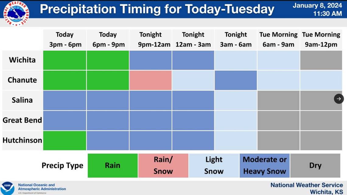
“Snow accumulation of 1 to 3 inches [is] possible,” the NWS said. An AccuWeather snow and ice outlook model forecast a 62% chance of 1 to 3 inches of snowfall by Tuesday.
“Plan on slippery road conditions,” the NWS said. “Patchy blowing snow could significantly reduce visibility. Please slow down and use caution while driving.”
While Wichita waits for snow, other parts of the state already are seeing weather- related closures and whiteout conditions that make travel difficult.
In western Kansas, Scott City has received 6.5 inches of snow followed by Manning and McCracken with 4 inches so far. An area south of Oakley, between Garden City and Colby, is reported to have 9 inches of snowfall, NWS meteorologist Bryan Baerg said.
Seward County Community College in Liberal closed their campus at 1 p.m. Monday and suspended all activities and events because of impending inclement weather, the school said in an email.
The Sherman County Sheriff’s Office closed Highway 24 east and westbound from Goodland to all non-local traffic, the sheriff’s office said in Monday Facebook post.
“Poor visibility everywhere with near whiteout conditions in some areas,” the sheriff’s office said. “Please stay home if you do not need to be out.”
I-70 is also closed in both directions between Hays and the Colorado border, a KanDrive map shows.
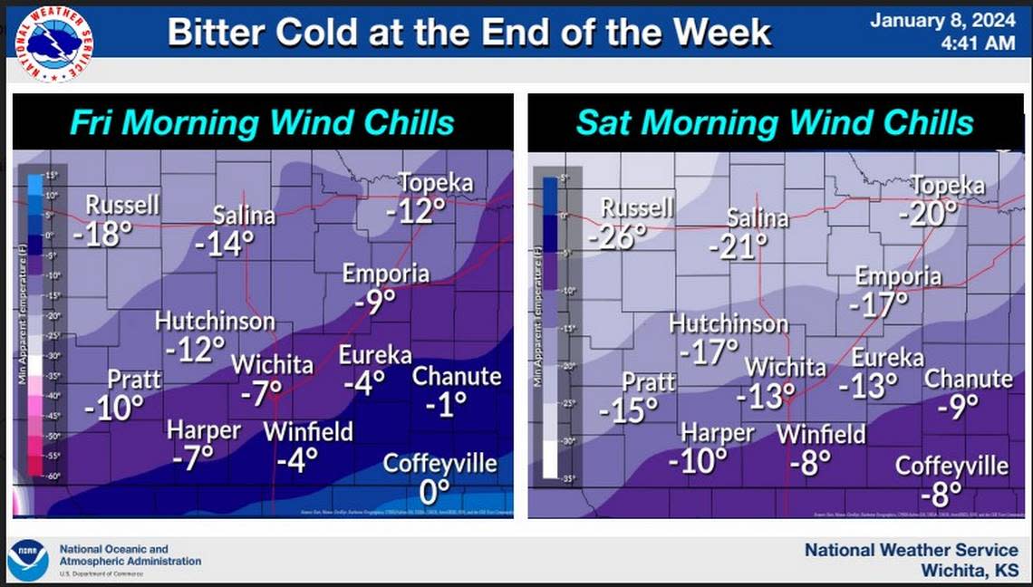
Looking further ahead, negative wind chills will make for a bitter cold end of the week as a surge of arctic air seeps into the state, likely bringing 10 to 20 below zero wind chills Thursday night through Saturday, an NWS Hazardous Weather Outlook said.
Wichita is forecast to see between negative 5- to 13-degree wind chills for Friday and Saturday, the NWS said.