Small earthquake shakes the Tri-Cities. What we know about the Richland tremor
A small earthquake shook homes along the southern stretch of the Tri-Cities on Friday night.
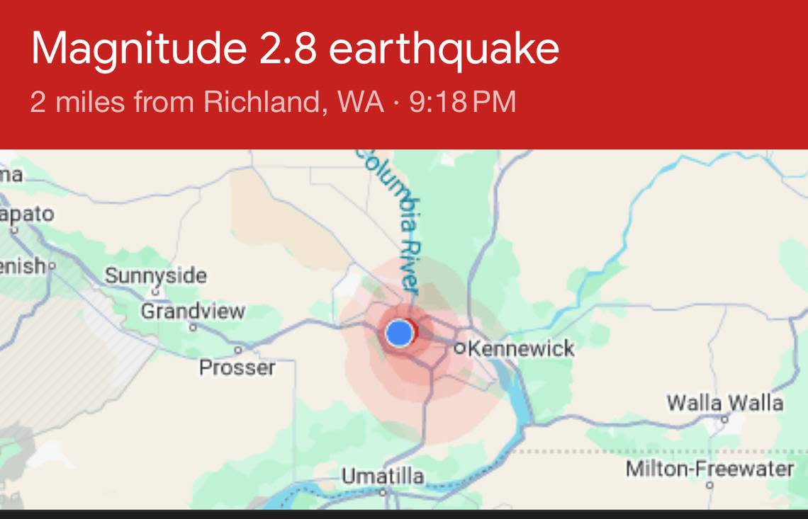
At around 9:20 p.m. a 2.8 magnitude earthquake was registered two miles from Richland by the Pacific Northwest Seismic Network.
The tremor hit at a depth of about 5 miles. It’s the largest recorded in the Tri-Cities in more than a decade, according to the United States Geological Service.
The last time a tremor this hard hit was a series of shallow earthquakes along the Columbia River just north of Richland ranging from 2.6 to 3.2 magnitude in 2011, all at depths of just over a mile or less.
Before that a 3.7 magnitude earthquake was recorded south of the Horse Heaven Hills in 2008 at a depth of just over 12 miles.
Friday’s tremor was felt largely in south Richland, West Richland and Kennewick.
An earthquake monitoring station on Red Mountain caught the tremor, and some residents, mostly in south Richland, West Richland and Kennewick, posted on Facebook that they felt the tremor
One woman near Claybell Park in south Richland posted “it rattled everything in our house” and another person said a few things fell off shelves in her garage.
Others reported feeling a slight shaking, but said they thought it was the wind or from the street racing they could hear. Another poster said “We all thought the washer was freaking out, but then realized there was no laundry in.”
Others wondered whether their dogs starting to bark around 9:20 p.m. might have been because of the earthquake.
