A ‘significant’ winter storm? Boise morning commuters to be affected, weather service says
The National Weather Service in Boise is preparing for a “significant” fall snowstorm starting early Friday and lasting through Saturday evening.
Snow initially will fall at altitudes as low as the Treasure Valley floor before being limited to higher elevations in the Boise foothills and Idaho mountains because of rising temperatures throughout the day.
The weather service predicted that around half an inch of snow would fall in Boise, but it has given the city a 24% chance of receiving as much as 1.2 inches.
If Boise did receive at least an inch of snow, it would be the third-earliest fall day for such an amount since records began in 1962, beaten only by 2008 (Oct. 10) and 1991 (Oct. 29).

National Weather Service meteorologist Les Colin told the Idaho Statesman that he expects commuters in the Treasure Valley to feel the storm’s effects most heavily between 5 a.m. and 8 a.m.
“On the main roads, I doubt it’s going to accumulate at all, but it could be slush there,” Colin said. “I would expect the less-traveled roads, the side roads, and roads at higher elevations above the city — those roads will be the more impacted roads.”
Colin said snow could accumulate on grass and other colder surfaces before melting later in the day, when any precipitation is expected to turn to rain. Boise’s high temperature on Friday is expected to be 44.
Heavier snow in the mountains
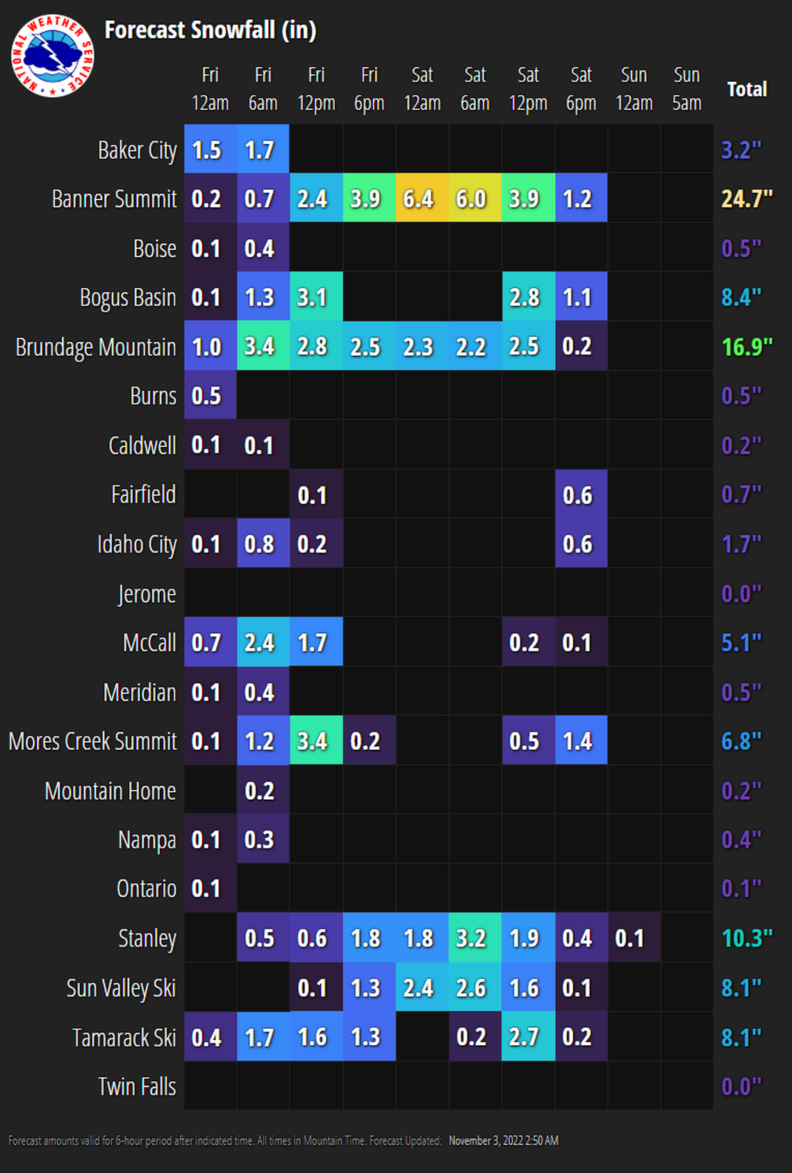
The more serious impacts of the storm will occur in the mountains north of Boise. Snow will be limited to above 6,500 feet by late Friday, but Colin warned that roads leading into the mountains would accumulate snow starting at 3,000 feet or so. Downtown Boise sits at an altitude of 2,730 feet.
“You get up about 3,000 or 4,000 feet, and you’ll get snow on the road,” Colin said. “You get up above 5,000 feet, and it’ll probably be heavy snow covering all the roads and reducing visibility.”
Bogus Basin is forecast to receive 8.4 inches of snow through Saturday evening, while Banner Summit, northwest of Stanley, could receive over 2 feet.