Shift in Hurricane Ian track could bring 10 inches of rain to North Carolina coast
A track shift by Hurricane Ian means North Carolina’s coast could see a deluge, with as much as 10 inches of rain in some spots, according to the National Hurricane Center.
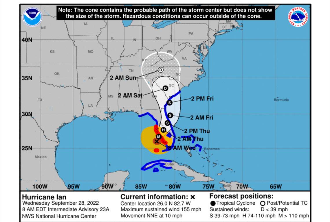
Ian — now downgraded to a tropical storm — made landfall as a Category 4 hurricane near Port Charlotte, Florida, Wednesday, Sept. 28, about 100 miles south of initial projections.
That shift means Ian will likely cross Florida and end up back in the ocean, where it will then make landfall again as a downgraded tropical storm near the Georgia/South Carolina line Friday evening, forecasters say.
Ian’s remnants are forecast to move inland through South Carolina into central North Carolina.
“This will spread heavy rain northward across the Carolinas, especially on Friday. Flooding and even an isolated tornado are possible,” the National Weather Service says.
“High tides should produce coastal flooding along the lower Cape Fear River from Wilmington southward through late week as Ian tracks up from Florida.”
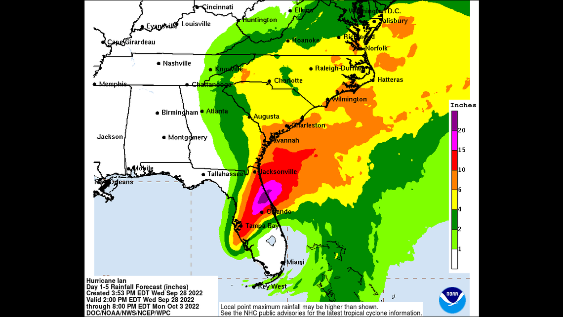
Five to 8 inches of rain is likely across much of the North Carolina coast, and the stretch from Wilmington to Cape Lookout National Seashore could see 10 inches, experts say.
The rain will begin late Thursday, and continue into Friday, the National Weather Service reports.
Localized flooding from the rain may be worsened Friday and possibly Friday night by coastal storm surge “pushed onshore by the force of the wind,” forecasters say.
Winds will also pick up along the North Carolina coast Thursday, with gusts exceeding 30 mph through Thursday night, officials say.
The storm is moving north from Florida at a speed of about 8 mph.
Winds were at 155 mph when Ian made landfall in Florida Wednesday, forecasters said. That put the storm within just 2 mph of being a Category 5 hurricane (157 mph or higher.)
Ian dropped to tropical storm status overnight Thursday, as it created “catastrophic wind damage” in Florida. Sustained winds of 65 mph were reported early Thursday in the storm’s path.
As much as 2 feet of rain was predicted for parts of Central Florida and a foot of rain could fall in areas of in eastern Georgia and coastal South Carolina.
This storm surge is blowing my mind considering we’re still 4 hours from high tide @weatherchannel #keywest #HurricanIan #Ian pic.twitter.com/JBxNcHwo0m
— Felicia Combs (@FeliciaCombsTWC) September 27, 2022
Extremes hit Eastern US as snow falls in New England and Hurricane Ian nears Florida
Two Outer Banks homes collapse into ocean and more could fall at any time, park says
Hurricane Ian rain may top 7 inches in North Carolina mountains. When will it arrive?
