Severe weather threat in Midlands gets clearer as Tropical Storm Nicole nears
As Tropical Storm Nicole moves closer to making landfall in the U.S., its potential impacts in the Columbia area are becoming clearer.
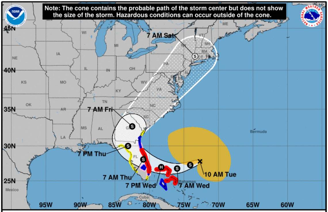
The storm, which could increase in strength and be a hurricane when it’s forecast to hit Florida, is predicted to affect the Midlands later this week.
Nicole is expected to move across the Columbia area Thursday night and into Friday evening, according to the National Weather Service.
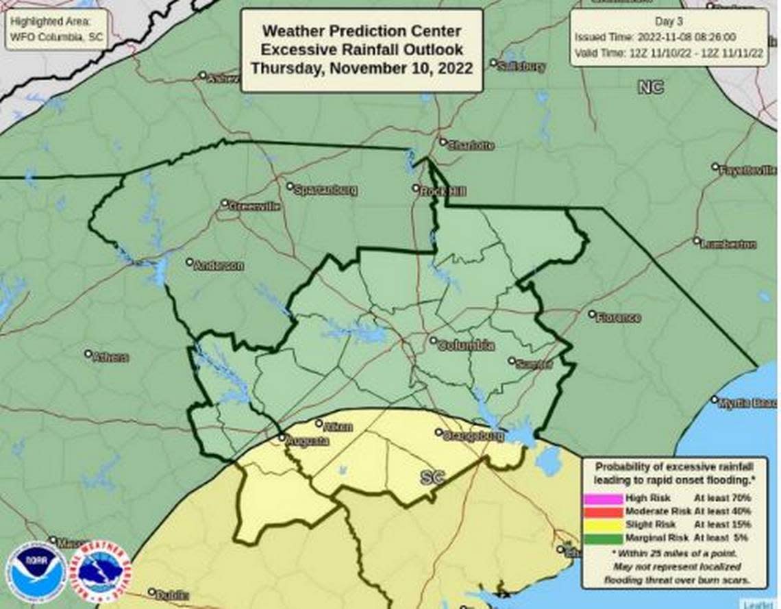
Severe weather threats in the Midlands caused by the storm are expected to include heavy rain — which might lead to flooding — and gusty winds, the National Weather Service said.
There’s currently a 90% chance of showers on Thursday night in Columbia, dropping slightly to 80% on Friday, the forecast shows.
Anywhere from 1-3 inches of rain is possible, and localized amounts could be higher, according to the National Weather Service.
“We’ve got a little more confidence in the storm’s track,” National Weather Service meteorologist Nicole Rebarick told The State Tuesday. “The storm is expected to strengthen before it hits Florida, then weaken as it moves north.”
Although it’s not believed that Nicole will be at tropical storm strength when it reaches South Carolina — meaning winds speeds will not reach 39 mph — it’s expected to cause gusty winds in the Midlands, the National Weather Service said. Gusts moving as fast as 35 mph are possible, the National Weather Service said.
“There is currently an elevated wind threat overnight Thursday into early Friday morning, when winds will be the greatest threat,” Rebarick said. “Both the wind and rain will tick up at that time, causing concern for anyone on the roads.”
Isolated tornadoes are also possible Thursday and Friday, but are more likely to form in the eastern portion of the Midlands and closer to the South Carolina coast, according to Rebarick. Should the storm’s track shift, the Columbia area could be at risk of tornadoes forming, Rebarick said.
The current forecast shows the center of the storm will move through the Midlands on Friday afternoon then begin to dissipate, according to Rebarick.
“But the rain won’t be fully out of our hair until that night,” Rebarick said.
The southern portion of the Midlands is at the greatest risk for flooding, but there could be localized floods in other parts of the Columbia area, according to Rebarick.
As of Tuesday no warnings, watches or advisories were issued for the Columbia area by the National Weather Service. That could change as the storm moves closer.
Nicole is the 14th named storm of 2022 and could become the second to hit the Columbia area since the remnants of Hurricane Ian doused the Midlands at the beginning of October.
Nicole could become just the fifth tropical storm or hurricane to affect the Midlands in November since 1850, according to the National Weather Service. The most recent was Eta in 2020, which was well offshore but still brought heavy rain and flooding to the Carolinas, the National Weather Service said.
As of 10 a.m. Tuesday, the storm was moving west at 9 mph toward the Bahamas and Florida and had maximum sustained winds of 50 mph, according to the National Hurricane Center.
Rebarick said too much attention should not be focused on where the center of Nicole tracks, and severe weather is possible beyond that cone since it is such a large storm. Tropical-storm-force winds extend out up to 380 miles from the center, according to the National Hurricane Center.
