Severe thunderstorm risk ahead for Knoxville: See when storms are predicted to hit
Well, you might be ready for summer. But it's still more than a month away and Mother Nature still has a few cold spells and rain storms in store for us.
East Tennessee is under a severe thunderstorm risk Tuesday night into Wednesday − and Knox County got a little preview Monday morning when a strong thunder and wind event moved into the area, triggering a "special weather statement" just after 9 a.m.
Scattered showers and thunderstorms were predicted to "break out like pox this afternoon and continue into the evening hours," the National Weather Service's Morristown office said in a Facebook post Monday morning.
Several rounds of showers and storms are expected through the week, with more "organized" storms increasingly likely Tuesday night and Wednesday night, the weather service said. An organized storm is one that maintains itself for much longer than a typical storm, which might pass through in 30 to 45 minutes.
Currently, the overall threat is higher for Wednesday, but the exact timing is still uncertain for both of these possible severe events, the weather service said Monday morning. Localized flooding is possible through Thursday afternoon, as most places are forecast to see 2 inches or more of rainfall with locally higher amounts expected.
What is the weather going to look like on Tuesday and Wednesday?
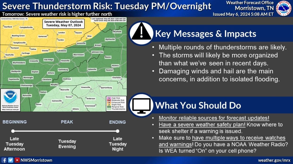
Multiple rounds of thunderstorms are likely, beginning late Tuesday afternoon, the weather service stated. Damaging winds and hail are the main concerns, in addition to isolated flooding. The Knoxville area is at marginal risk Tuesday, with a higher risk further north along the Kentucky border.
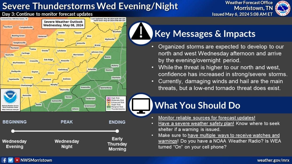
On Wednesday, organized storms are expected to develop to the north and west in the afternoon, moving into East Tennessee by the evening. The weather pattern is trending more for a severe storm; a low-end tornado threat does exist, the weather service said.
Knoxville weather radar

Liz Kellar is a Tennessee Connect reporter. Email liz.kellar@knoxnews.com.
Support strong local journalism by subscribing at knoxnews.com/subscribe.
This article originally appeared on Knoxville News Sentinel: Knoxville weather: Forecast shows severe storm risk starting Tuesday
