Hail, tornado threats forecast in North Texas as storms roll through Dallas-Fort Worth
Hazardous weather remain in the forecast on Monday as thunderstorms move through North Texas neighborhoods, according to the National Weather Service in Fort Worth.
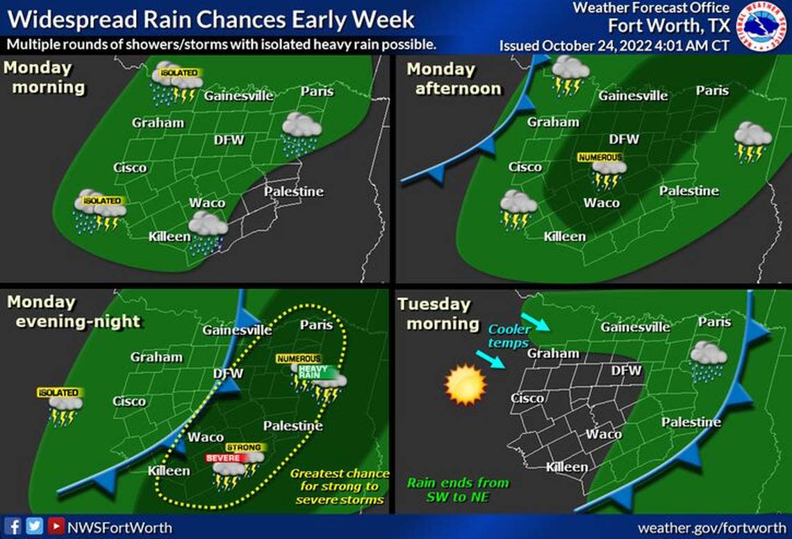
Damaging winds are the main threat, though some hail and a couple of tornadoes cannot be ruled out, authorities said. In addition, periods of heavy rainfall may lead to isolated flash flooding.
Strong to severe storms will be possible Monday afternoon and evening across North and Central Texas.
A severe thunderstorm warning was in effect until 10:15 a.m. for southeastern Wise, southwestern Denton, eastern Parker and western Tarrant counties. At 9:56 a.m., severe thunderstorms were located along a line extending from 7 miles east of Decatur to near Springtown to near Western Lake, moving east at 45 mph. Wind gust over 60 mph were expected.
In Wise County, the emergency manager reported damage to buildings in and around Paradise, according to the weather service. Most of the damage was to garage doors that were blown in, according to the report.
A tornado warning was issued Monday morning for southwestern Montague County and northeastern Jack County in north central Texas. The warning ended at 9:15 a.m. Monday, but meteorologists had said severe thunderstorms capable of producing both tornadoes and extensive straight line wind damage were located just after 8:30 a.m. Monday 11 miles west of Newport, or 14 miles north of Jacksboro, moving northeast at 50 mph.
At that time, radar indicated rotation, but no damage reports have come in so far. During tornado warnings, any flying debris will be dangerous to those caught without shelter. Mobile homes may be damaged or destroyed. Damage to roofs, trees, windows and vehicles may occur, according to the NWS in Fort Worth.
Most of the storms, which are forecast to be strong or severe, were expected to affect the region before 4 pm. on Monday. But another round of strong to severe storms was developing this afternoon and will march eastward through the evening, the weather service said. Damaging winds will be the main threats, but large hail and a few tornadoes may develop as well, especially across Central Texas.
A severe thunderstorm watch is in effect for counties west of Fort Worth until 9 p.m. The watch includes Erath, Jack, Palo Pinto, Stephens and Young among other counties and includes risks of hails up to 1.5 inches in diameter, damaging winds up to 70 mph and a tornado or two.
Heavy rain on Monday may lead to isolated flash flooding.
Most locations in North and Central Texas will see rainfall totals ranging from half an inch to 1 and a half inches from multiple rounds of storms Monday into Tuesday morning, the weather service said. Areas in the northeast and southeast will see up to 2 inches. Isolated totals near 3 inches are possible in parts of North or East Texas.

A steady temperature of about 70 degrees is forecast for Monday. Winds could gust to 25 mph.
Temperatures are expected to drop Monday night into Tuesday as a cold front moves into the region. The low Tuesday morning is predicted to be near 50, with a high Tuesday near 70 along with strong northwest winds up to 25 mph.
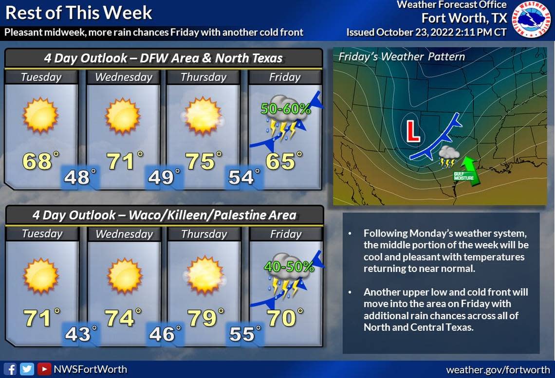
Another round of storms is expected Thursday night into Friday along with another cold front, but severe weather appears unlikely at this time, according to the weather service.
High temperatures Friday and Saturday will be in the mid to upper 60s, the weather service said.
Weather watches and warnings
A live data feed from the National Weather Service containing official weather warnings, watches, and advisory statements. Tap warning areas for more details. Sources: NOAA, National Weather Service, NOAA GeoPlatform and Esri.
