Scientists Mapped the Grand Canyon of the Sea Right Down to the Centimeter
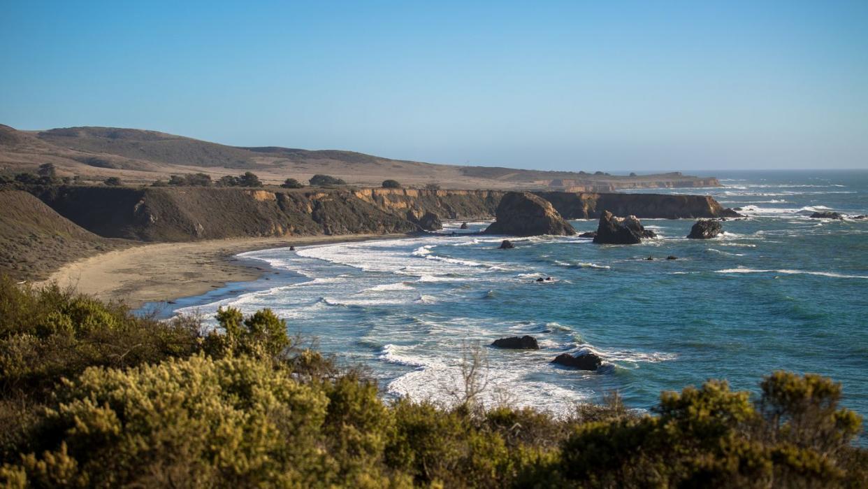
Monterey Bay, California, is known for its beaches. Big Sur in the north is a favorite destination among surfers, and Moss Landing in the south is a bird-watchers paradise. But just off the coast lies a stunning geographic landscape that few know about—and even fewer have seen with their own eyes. It’s called the Monterey Canyon, and its submarine majesty rivals even that of the Grand Canyon.
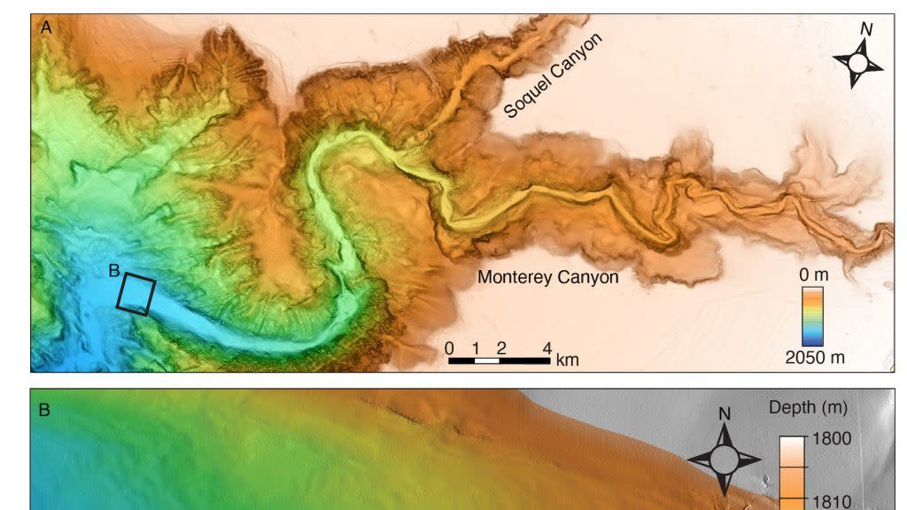
Stretching 292 miles and reaching a maximum depth of 2.5 miles, the Monterey Canyon is the largest submarine canyon in North America. And it’s is home to a constantly shifting ecosystem, thanks to tidal erosion and landslides.
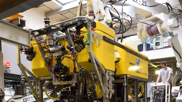
To better understand this dynamic undersea environment and how the canyon has been sculpted over time, scientists from the Monterey Bay Aquarium Research Institute (MBARI), USGS, Durham University, the University of Hull, and Pontificia Universidad Católica de Chile strapped a Low Altitude Survey System (LASS) to Doc Ricketts—a remotely controlled vehicle, or ROV, named after the influential marine biologist Ed Ricketts—to map the canyon with centimeter-level accuracy. The stunning results were published in the journal JGR Earth Surface earlier this year.
“MBARI’s Low-Altitude Survey System maps seafloor environments at the scale of the animals that live there, making it particularly useful for ecological studies,” Dave Caress, MBARI principal engineer and study co-author, said in a statement. “In this geological project, the lidar bathymetry data revealed changing centimeter-scale textures in the sediment on the floor of Monterey Canyon that would have been undetectable by more traditional methods like ship-based sonar or even the autonomous mapping robots we use to map at one-meter scale.”
The LASS is the star of the show. Developed by MBARI’s Seafloor Mapping Lab, the LASS includes wide-swath lidar, multibeam sonar, and stereo cameras. The lasers that make up the lidar pulse 40,000 times a second, and every pulse produces a “sounding,” or a single bathymetry (water depth) measurement. The “low altitude” part of the LASS acronym comes from the height at which the ROV hovers—only 10 feet from the ocean floor. Once in place, the LASS system can articulate in several directions to capture horizontal surfaces like canyon walls or hydrothermal chimneys. The lasers also record the presence of soft-tissue animals, such as coral and sponges, whereas regular sonar would usually miss these details.
“With sonar, we see the aftermath of large, catastrophic events, but miss the small, minute changes that happen every day,” says Monica Wolfson-Schwehr, the study’s lead author. “As technology advances and we can map at finer and finer resolutions, we can observe a new level of complexity in the seabed. We don’t realize how much of the picture we’ve been missing.”
With the help of this highly detailed mapping, scientists have discovered how tides carve small scours and textures into the canyon floor over time—a detail completely missed on previous surveys, and a testament to what lidar-equipped marine tools like LASS can do.
America’s other Grand Canyon is finally getting its close-up.
You Might Also Like
