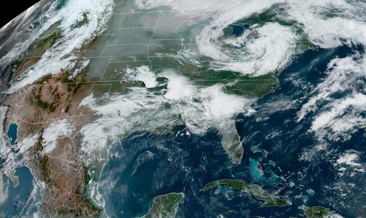
Tornadoes reported as rare June severe weather outbreak hits Southeast
There have been two reported tornadoes and more than 20 reports of dangerously high winds as rare volatile weather in June hit portions of the Southeast and Gulf Coast on Wednesday.
More than 23 million people will be in the path of multiple waves of severe thunderstorms capable of damaging winds, destructive hail and strong tornadoes. Parts of Alabama, Arkansas, Georgia and Mississippi are among the states with the highest risks.
Tornado and severe thunderstorm warnings have been issued for parts of Georgia until late Wednesday afternoon, the National Weather Service in Tallahassee said in a series of tweets.
By late Wednesday afternoon, there were 37 reports of high winds that knocked down trees and power lines, especially in Georgia and Alabama.
A large area of intense thunderstorms producing damaging winds was forecast to advance through northeast Louisiana to southwest Georgia throughout the day with winds in excess of 80 mph. This includes the possibility of a derecho, a particularly intense line of severe thunderstorms that travels hundreds of miles producing damaging winds along its entire path.
More than 30 million people are in the risk zone for severe thunderstorms from northeast Texas through the Southeast coast into the overnight hours.

The greatest risk of tornadoes was more focused Wednesday afternoon in central/eastern Alabama and southwest Georgia. This includes the cities of Montgomery, Alabama; Dothan, Alabama; and Columbus, Georgia.
Wednesday morning, the Storm Prediction Center issued a moderate risk of severe storms, a level 4 out of 5 on their scale, for a region that does not typically see such a high echelon of severe thunderstorms of this nature during the month of June. For the Southeast and Gulf Coast regions, severe storms are most likely during the early spring months like March or April. By mid-June, the greatest concentration of severe thunderstorms is typically across the Great Plains.
The ingredients leading to the dangerous day will be the combination of an unusually strong subtropical jet stream combined with high amounts of available energy (in the form of warmth and moisture) to produce explosive thunderstorms. Both the strength of the winds and amount of available energy are at the top of the scales for what is normal this time of year.
Severe thunderstorm watches had already been up by sunrise on Wednesday across parts of Arkansas and Mississippi, the start of round one of multiple rounds of storms projected to blast through the regions over the next 24 hours.
As the day progressed from morning into the afternoon, Alabama and Georgia joined the severe weather threat with the greatest chance of storms set to occur in the afternoon into the evening hours.
The highly traveled I-20 corridor including Birmingham and Atlanta could be affected by these storms and see impacts including possible tornadoes, damaging hail and gusty winds.
Across all of these areas, hail could also exceed 3 inches in diameter, the size of a baseball. Hail of this size is rare for the Southeast for any time of the year, yet alone June. The greatest hail risk includes the areas of northeast Texas, southern Arkansas, and northern Louisiana and cities like Little Rock, Shreveport, and Jackson.
The risk continues Thursday for nearly 4 million people across the Gulf Coast and the Florida Panhandle, including the I-10 corridor. Hazards will include damaging hail and gusty winds, yet again.
Severe storms are not the only concern for this region as Mississippi, Alabama, Georgia and the Florida Panhandle all are also dealing with flooding concerns from the rounds of storms that could produce locally up to 5 inches of rain or more through Thursday morning. For this reason, Flood Watches are up for 6 million people across this region. Cities at greatest risk of flash flooding include Birmingham, Tuscaloosa, Montgomery and Savannah.
The northeast could also see some thunderstorms on Wednesday with impacts including gusty winds and small hail. These storms will most likely occur from 12-4 P.M. ET in cities such as New York. Other cities such as Hartford, Connecticut, and Boston could see these storms around the 4-9 P.M. ET time frame.
Other than storms, Texas is struggling with triple digit temperatures that are forecast to stick around through the weekend. Heat alerts are in effect for areas stretching from Waco to Brownsville. Highs could vary from 110 to 120 degrees. Possible records could be broken Friday in cities such as Austin, Dallas, Houston and San Antonio; all are set to soar to the century mark.
