Planning a trip to the Florida Keys for the holiday weekend? There are some obstacles
You’re heading to the Florida Keys for the holiday weekend? Get ready for heavier traffic than usual.
Weekend traffic to and from the Keys can back up. A crash or other emergency, and things can get worse.
Add a holiday like Presidents Day and an extra day of day-trippers from other parts of Florida, and, well, you better pack some patience along with your picnic.
One piece of good news: Card Sound Road from Florida City to Key Largo is back open after Tuesday’s shutdown because of construction.
While the Overseas Highway offers breathtaking views, you’ll want to know a few things about traveling on U.S. 1, the only road that goes through the island chain all the way to Key West:
Are there tolls on the Overseas Highway?
No toll: Traveling on the Overseas Highway is toll-free.
What about Card Sound Road?
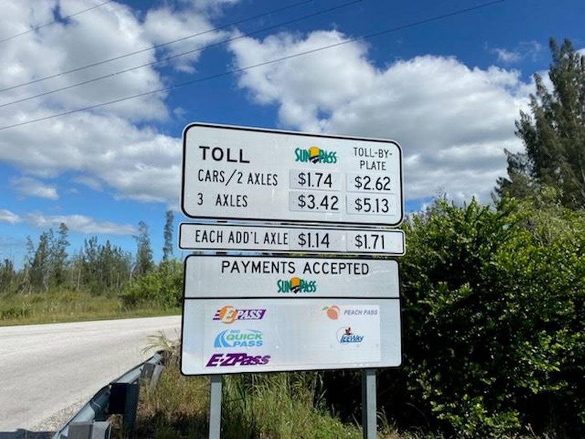
Toll: Card Sound Road, considered an alternate road to the Keys, has a $1.74 toll, taken electronically through SunPass, at the northern end of the bridge, a 65-foot high, 2,800-foot long span that crosses Card Sound.. The cost for toll-by-plate is $2.62
Directions: Getting into the Keys using Card Sound Road, or County Road 905A, drivers take the highway southeast, over the bridge to a three-way stop sign. If you make a left, you’ll head to the ultra-exclusive gated community of Ocean Reef. Turn right on County Road 905 (without the “A”) and you’re on your way to Key Largo.

How long will it take to reach your destination?
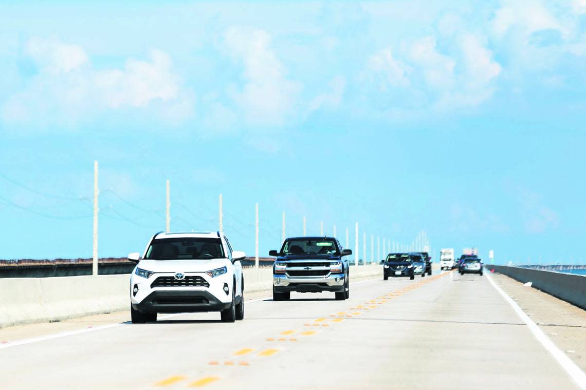
Traffic congestion in the Upper Keys, especially on holiday weekends, can slow things considerably. Passing is allowed only in certain spots. Most of the Overseas Highway runs two lanes.
Here are some estimates for your trip:
Miami to Key Largo: The trip can take 2 1/2 hours.
Key Largo to Key West: The trip can take 2 1/2 hours.
Miami to Key West: It’s about a four-hour drive from Miami to Key West, and under three hours from Florida City to Key West without delays.

How fast can you go?
Card Sound Road: The speed limit on most of Card Sound Road is 55 mph.
Overseas Highway: The speed limit changes on U.S. 1, and you’ll only be able to hit 55 mph in certain places. Until you hit downtown Key West, expect 50 mph for most of the road. But you’ll need to go slower when you start to see clusters of businesses and homes because the Overseas Highway runs through small communities. Most of the highway is patrolled by the Monroe County Sheriff’s Office and the Florida Highway Patrol.
Here’s what to know:
▪ Speed limits drop to 45 mph in residential spots such as Cudjoe Key and Big Coppitt in the Lower Keys.
▪ A piece of the highway through the Middle Keys city of Marathon has a 35 mph limit.
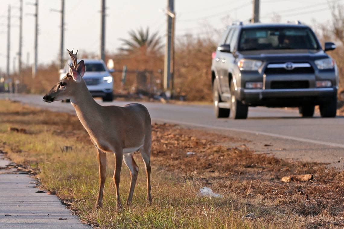
▪ There is also a 35 mph limit zone at night on Big Pine Key, from mile marker 29.5 to 33. It’s all about protecting the endangered Key deer, the dog-sized animals often drawn to the busy highway. During the day, the limit on Big Pine is 45 mph.
▪ In Key West, speed limits are between 25 mph from about mile marker 0 to 1 and rise to 35 mph from about mile marker 1.7 to 4.5.
Other things to know about U.S. 1 in the Florida Keys
Length: The highway runs 113 miles through the Keys over the Atlantic Ocean, Florida Bay and the Gulf of Mexico.
Mile markers: Green mile marker signs are on the side of the road and are used for addresses and directions. The road begins and ends in Key West, where the mile marker zero signs are at Whitehead and Fleming streets.
Bridges: The longest span is the Seven Mile Bridge, which is actually 6.79 miles long. The second longest is the Long Key Bridge, at 2.3 miles.
How to monitor traffic to and from the Florida Keys
Two free apps can help you navigate the Overseas Highway. One is for traffic and the other is a guide to the Keys.
▪ The Monroe County Sheriff’s Office has a namesake app that is a must-have for people who must take the road regularly. The app has a “live calls and traffic info” tab that gives the location and times of crashes or other traffic disruptions, such as when a medical helicopter is landing on the highway. You can also sign up for notifications, which will tell you when lanes are reopened. The sheriff’s office also posts about crashes in real time on its Facebook and Twitter feeds, which you can access through the app.
▪ A travel app from the Monroe County Tourist Development Council —The Florida Keys and Key West — features just about everything you want to know about exploring the islands. The app includes narrated driving tours — one for each direction of the highway — along with lists of hotels, restaurants, art galleries, watersports rentals and fishing guides. Information is categorized by location: Key West, the Lower Keys, Marathon, Islamorada and Key West. The app also has videos of the Keys, a map and weather forecasts.
Both apps are available through the Apple Store and Google Play.
Miami Herald/FLKeysNews staff writer David Goodhue and WLRN Key West reporter Gwen Filosa contributed to this report.