Buffalo declares a state of emergency as it braces for brunt of lake-effect snowstorm
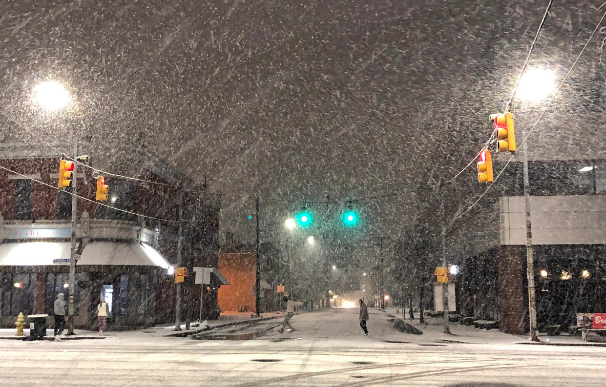
A historic lake-effect snow event will blanket swaths of the country in white into the weekend, with up to 5 feet of snow possible in Buffalo, New York.
The event, coming from the Great Lakes which span the Midwest to parts of the Northeast, has already seen flurries, with some areas in western Michigan, northern Ohio and northwestern Pennsylvania picking up as much as 10 inches.
The Buffalo, New York, metro area is in the bull's-eye of the event, with heavy snow expected to hit the area Thursday evening and continuing for up to 48 hours, if not longer.
New York Gov. Kathy Hochul declared a state of emergency for 11 counties Thursday, saying the state and the Buffalo area are "prepared" for the brunt of the major "life-threatening" storm. She said the state's Department of Transportation, National Guard and snow plows are all on standby.
She urged locals to stay off the roads as visibility “will be next to zero" and said schools will be closed. She said locals are also encouraged to work remotely and stay home if possible.
New York State Police said commercial vehicle bans will go into effect at 4 p.m. Thursday in western New York on various roads, including the full length of Interstate 290, Interstate 990, Route 33 and Route 400.
Lake-effect snow occurs when arctic air races across the relatively milder waters of the Great Lakes every fall. These snowfalls can be intense, but are often localized.
Climate change has impacted such events. As the planet has warmed due to the increase in greenhouse gases, so have the lakes, which means there’s more evaporation into the atmosphere during the winter, which has led to an increase in lake-effect snow.
However, that trend is not expected to last in the long term. Rather, by the late 21st century, it is forecast that there will be a shortened lake-effect snow season, and rather than peaking in the fall and the early winter, it'll be pushed back later to January through March.
Snowfall rates in this week's event could increase to 1 to 3 inches an hour starting Thursday evening into Friday, accompanied by thunder snow. The lake-effect snow will continue for areas downwind of the lakes into Sunday.
The Buffalo metro area could pick up between 4 to 5 feet of snow. Meanwhile, between 1 to 3 feet of snow is possible for places such as Grand Rapids and Kalamazoo, Michigan.
The National Weather Service described the snow event as “paralyzing” with snowfall rates of over 2 inches an hour expected, “creating nearly impossible travel.”
Temperatures are also expected to dip in the United States as an arctic blast is forecast to bring the coldest air of the season.
Much of the country will feel below average temperatures Thursday, lasting into the weekend.
The cold arctic air mass will lead to the first freeze for some large metropolitan areas, such as Atlanta and Washington, D.C., and the first dangerously cold wind chills of the season for places, such as Chicago and New York.
Minneapolis will see a high of 27 degrees Thursday, Chicago a high of 33 degrees, and New York and Washington a high of 46 degrees.
