Paddling the Combahee River and Wimbee Creek — the Lowcountry’s historic route to freedom
On the night of June 1, 1862, three steamships entered the Combahee River from St. Helena Sound. Aboard were 300 soldiers of the 2nd South Carolina. These were not men in Confederate gray, but Union blue — and most were former slaves.
The 2nd South Carolina was a US unit formed of freed men of the Sea Islands, Lowcountry and coastal Georgia and Florida. They were led by an unlikely figure: A 5-foot, 2-inch tall woman, herself a former slave. Her name was Harriet Tubman, and tonight they were steaming into the heart of “Rebeldom” to free more slaves.
Using Tubman’s network of spies and agents, word passed through the local plantations that help was on the way. On the morning of June 2, the small flotilla landed at a plantation bluff on the Combahee River and were met by hundreds of escaped slaves. Mothers carried babies, men carried bags, “pigs oinked, chickens squawked, and children squealed,” Tubman recalled. Soon, the multitude was loaded aboard and, with plantation houses burning in the distance, made their way back to the Union Fleet in Port Royal. Over 750 people had been led to freedom — all on the banks of the Combahee.
You have probably crossed the Combahee River hundreds of times as you have traveled across the Lowcountry between Beaufort and Charleston. The old “steel bridge,” where Hwy 17 emerges from the woods and crosses the wide marsh of the Combahee, has been renamed “Harriet Tubman Bridge” to commemorate the site of her famous raid.
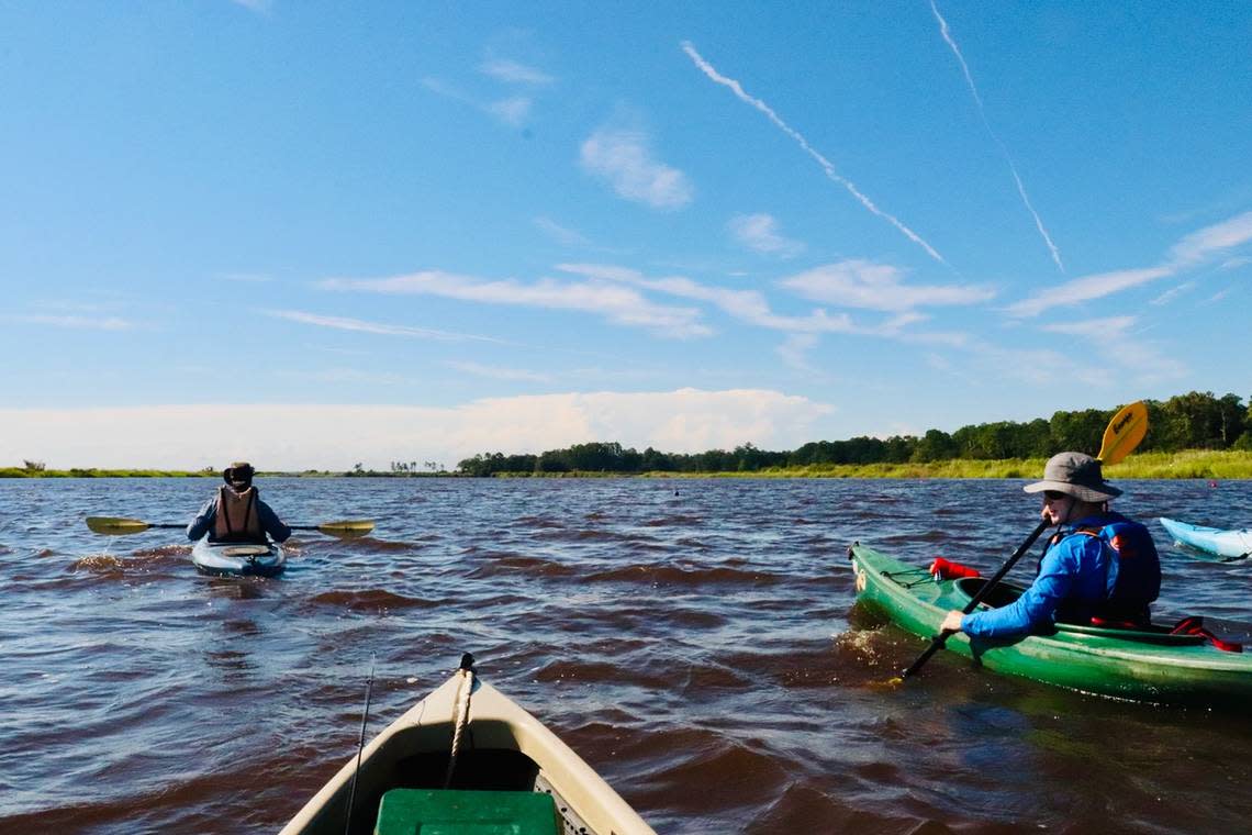
Today, you can launch a boat or kayak from the public landing there for an enjoyable exploration of a section of the river along the historic route to freedom. One good route you can take is a descent from Steel Bridge Landing to Wimbee Landing in Seabrook. However, like Harriet Tubman surely did, you will need to consult a tide chart to help you on your way.
When you launch at Steel Bridge Landing/Harriet Tubman Bridge, it is best to launch at high tide as you head downstream and into the heart of South Carolina rice country. The plantations along the Combahee grew rice with such success that it came to be called “Carolina Gold.”
Slaves worked the land to form flooded fields surrounded by earthen dikes and controlled by river current and tide. Today, you will see the remains of these fields in the surrounding marsh and in the wetlands preserved by modern property owners, such as Nemours Plantation. The Nemours Wildlife Foundation uses the former rice fields to manage waterfowl habitat that is a haven for migratory ducks and other birds.
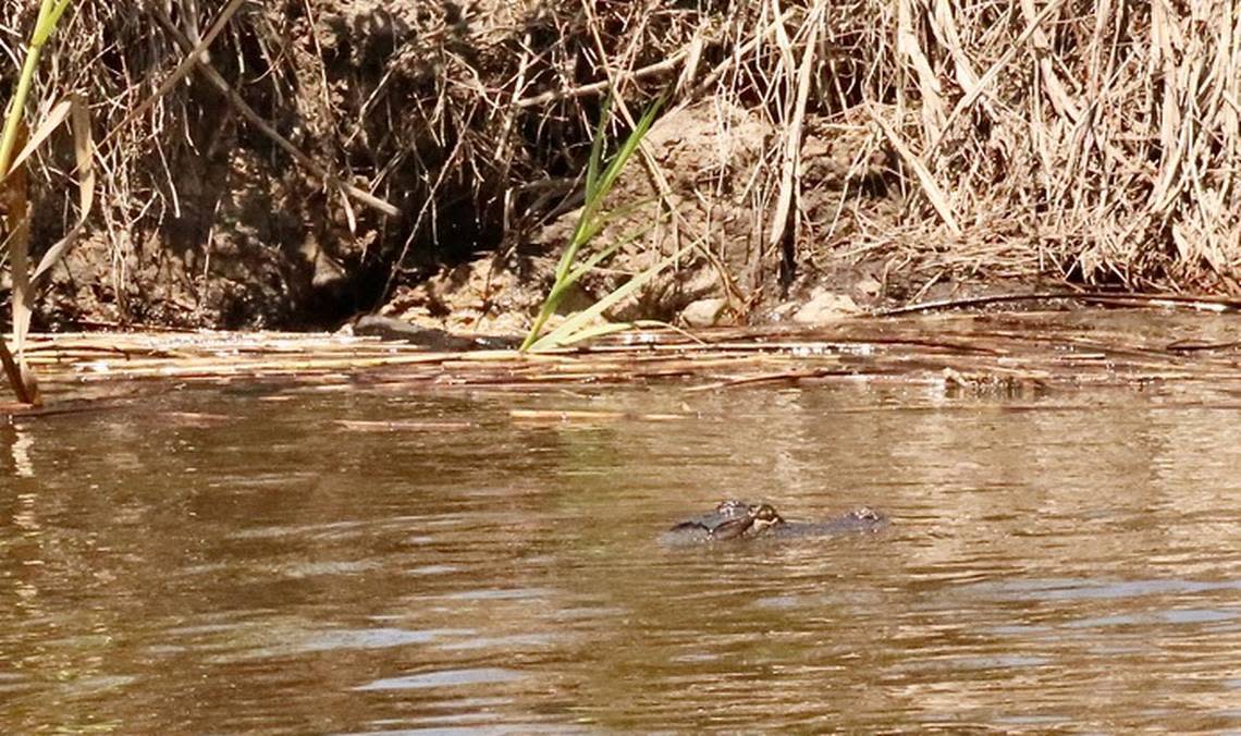
For two miles you will follow the bends and curves of the river between these fields. Red-winged blackbirds sing in the tall grass, fish jump, and alligators lurk along the edges, peering at you as they silently slip beneath the sparkling blue water. At about two miles, as you leave the former rice fields and tree-covered bluffs, you will enter a region of pure marshland where channels cut patterns in the green lace of grass and pluff mud. Here you will take the first right-hand channel you encounter and enter the upper reaches of Wimbee Creek.
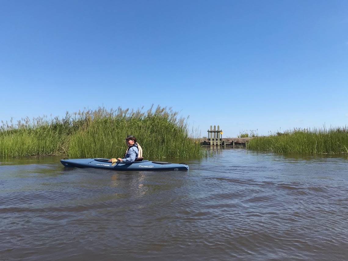
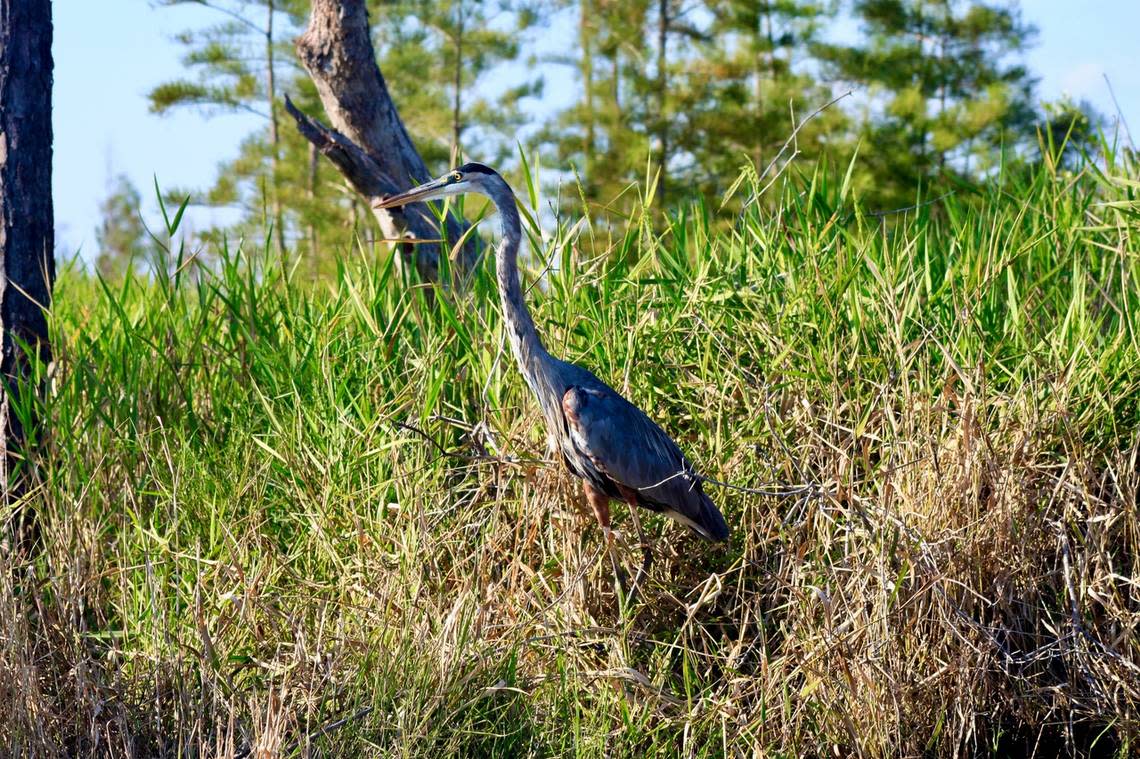
As you enter Wimbee Creek, the channel widens but the scenery becomes more remote. Here, alligators are still numerous, but egrets, heron and other birds are numerous as well as they explore the shallow reaches of this vast tidal region. Redfish boil the water at the mouths of narrow creeks, and as you descend further, playful dolphins make their entrance to this beautiful scene.
Wimbee Creek, like the Combahee River, has few houses or other signs of human habitation. This makes it an ideal place to fish or view wildlife. As you descend with the tide — for the lunar pull is very strong — you will be carried along a region that slowly changes from wide marsh to pass between small, wooded islands covered in pine, palmetto and live oak. Here, deer snort and splash away from your approach and insects buzz in the warm sunshine.
After a seemingly short, but very rewarding, seven miles you will see the fishing pier at Wimbee Landing. Here, where once the old Seacoast Rail Line crossed the Lowcountry, you will take out for your journey’s end.
A day spent on the waters of the lower Combahee River and the marshy network of Wimbee Creek will provide you with scenic views and some of the most pristine waters of the Lowcountry. What’s more, you will get a glimpse of the path of freedom taken by Harriet Tubman and the hundreds of newly liberated people she led from bondage in 1862.
Getting There
Steel Bridge Landing is located on the Beaufort County side of Harriet Tubman Bridge where Hwy 17 crosses the wide marshland of the Combahee River into Colleton County. The landing is maintained by Beaufort County, has a two-lane ramp and floating dock. There are 14 gravel spaces and, though this can be a busy location in season, there is ample room to park.
Wimbee Creek Landing and Wimbee Fishing Pier are located at 550 Wimbee Landing Road in Seabrook. It is also maintained by Beaufort County, has 10 parking spaces and a single-lane ramp with a floating dock. To get there, take a right onto Keans Neck Road in Lobeco and at 1.2 miles turn left onto Wimbee Landing Road. The landing and pier are at 3.4 miles the end of the road.
One of the best parts of this kayaking trip is that the two landings are a mere 9 miles apart, or a relatively short 10 minute drive. This makes shuttling between landings easy and convenient. Both landings are public and opened dawn to dusk. There are no facilities, but I recommend a good breakfast or lunch at the nearby Lowcountry Produce in Lobeco.
For more info on boating these waterways, visit https://www.dnr.sc.gov/boating.html