Oak Fire live updates: ‘Extreme’ wildfire surpasses 15,500 acres, crews race to halt spread
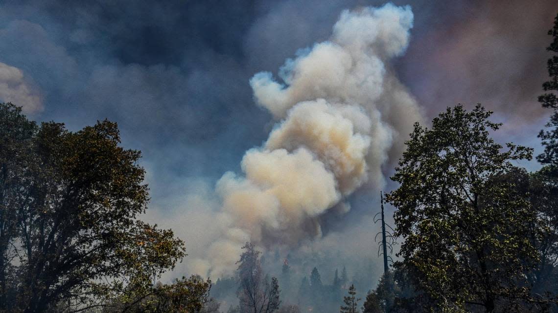
The massive Oak Fire has burned an estimated 15,603 acres as of 7 p.m. Sunday, an increase of 1,322 acres since morning, Cal Fire officials said during their evening briefing at the Mariposa County High School.
The fire, which remains at 0% containment, has destroyed 10 structures and damaged five since it erupted Friday afternoon in the Midpines area, near Highway 140 and Carstens Road. Around 3,800 residents have been evacuated from their homes, according to Mariposa County Sheriff’s Office.
No severe injuries or deaths have been reported.
“The reason we’re still showing at 0% contained, there is hot ash, hot trees still throwing stuff over the line causing us concern,” said Mike van Loben Sels, Cal Fire Madera/Mariposa/Merced unit chief.
“What I really don’t want to do is really start showing containment or control lines or black lines on the map if all of the sudden we get some spot fires that start to go over. We’re being very cautious on this.,” he added.
“I will tell you we’re going to start seeing it real soon. You’re going to start seeing black lines on the map. We’re just trying to be very cautious on this, with the fire behavior that we have seen. It is by far in my 30 years in the fire service some of the most extreme behavior that I’ve seen.”
Justin McComb, Cal Fire team 5 operations section chief, said the blaze “quickly outflanked” firefighters on the first day, saying they were unable to attack it with the resources on hand. “In my career I haven’t seen fire behavior like that,” McComb said.
McComb said on Sunday firefighters did have some success getting a line around the southern edge of the fire, using “dozers, everything we could” to stop the wildfire from spreading south.
“That was a win for me,” he said.
Van Loben Sels said the growth of the fire was “pretty amazing,” particularly given how quickly resources were sent there, and “how quickly the state supported the incident with all the aircraft across the board, from the very large air tankers that you guys see out there to the helicopters. We really threw everything at this thing from the beginning.”
The cause of the fire is under investigation. Full containment is not expected until at least July 30, according to Cal Fire.
There are multiple evacuation orders and fire advisories in effect. Mariposa Elementary School, located at 5044 Jones St., is being used as an evacuation center. Several road closures near highways 140 and 49S remain in effect, according to Cal Fire.
As of early Sunday, there were 51 crews battling the fire, 17 helicopters, 23 water tenders, 225 engines, 58 dozers and a total of 2,093 personnel, according to Cal Fire.
Mariposa County Fire, PG&E, the California Highway Patrol, Bureau of Land Management, Mariposa County Public Works, North Fork Rancheria and the Red Cross are cooperating in the fire efforts.
On Saturday evening, Gov. Gavin Newsom declared a state of emergency for Mariposa County.
Evacuations remain in place
As of Sunday afternoon, these are the areas impacted by evacuation orders near the wildfire, according to Cal Fire.
Carsten Road from Morningstar to Silva Road including all side roads
Buckingham Mountain Road
Plumbar Creek Road
Triangle Road from Highway 140 to Darrah, Jerseydale and all side roads
Lushmeadows Subdivision
Triangle Road from Darrah Road to Westfall Road and all side roads
Boyer Road from Highway 49S and all side roads,
Darrah Road from Highway 49S to Triangle Road, including all side roads
Triangle Road from 49S to Westfall Road and all side roads including Triangle Park, Tip Top Road, Wass Road, Westfall from Triangle to Oliver Creek
Silva Road from Carlton to Highway 49S including all side roads
Shaffer Road from Silva Road to Allred Road
Ginger Trish Road
Cole Road to Darrah Road, including all side roads
McNally Road
Highway 49S from Darrah Road to Triangle Road (east side only)
Woodland Drive
Brooks Road
Carlton from Triangle to Morningstar Lane
Morningstar from Carlton to Allred Road, including all side roads
Indian Rock Lane
Allred from 140 to Morningstar
Westside of Highway 140 from Triangle Road to Allred Road.
Highway 49S from Silva to Darrah Road (on the Bootjack Market Side) Use Carlton/Silva Road to Highway 49S to evacuate
Highway 140 from Triangle Road to Ponderosa Way (on the Midpines Market side of Highway 140)
Ponderosa Way from Highway 140 to Feliciana Mountain Road and all side roads
Sweetwater Ridge / Mine area
Feliciana Mountain Road
Ferguson / Apperson Mine Road area
Savage Lundy Trail
Hites Cove Road
Footman Ridge area
Devils Gulch area
As of early Sunday, these are the road closures near the wildfire area, according to Cal Fire.
Highway 140 from Highway 49N to Ponderosa Way
Carstens Road
Triangle Road from Highway 140 to Highway 49 and all side roads
Jerseydale Road
Silva Road from Cole Road to Triangle Road
Wass Road
Tip Top Road
Darrah at 49
Westfall from Triangle to Oliver Creek
McNally Road
Woodland Drive
Brooks Road
Bootjack Lane
Cole Road
Carlton from Triangle to Morningstar
Allred from Highway 140 to Morningstar
Morningstar from Carlton to Allred including all side roads
Watching the new ‘Wheeler Fire’
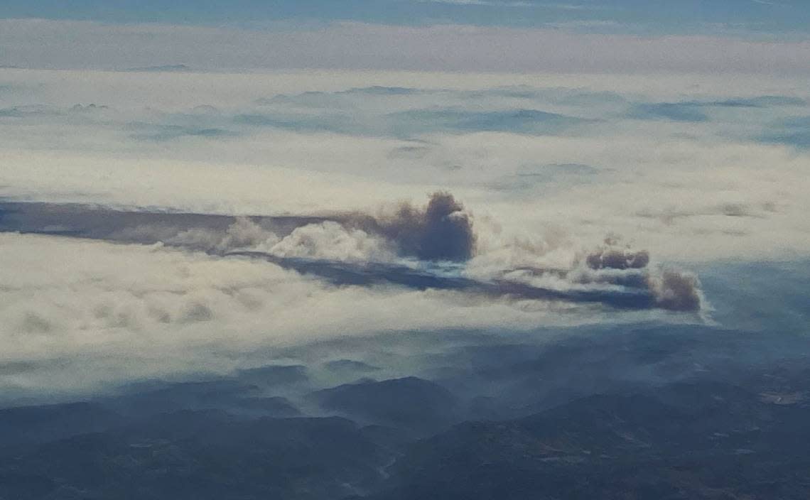
Another wildfire broke out Sunday, about 20 miles from the Oak Fire. This one, labeled the Wheeler Fire, had burned about 10 acres as of mid-afternoon.
The fire started at 2:35 p.m. and was in the area of Highway 49 and Oak Ridge Road, about 25 miles northwest of Mariposa.
Video of the Wheeler Fire which started in Mariposa County this afternoon. This is the same county as the Oak Fire. It looks like they may catch this one small. Thank you to the Substack Subscriber who sent me this footage. #oakfire #wheelerfire #California #mariposa #wildfire pic.twitter.com/NhrWIwNE0L
— TheHotshotWakeUp: Podcast (@HotshotWake) July 24, 2022
According to Flight Radar, two helicopters were assigned to the small blaze at 3:30 p.m.
Jonathan Pierce, a Cal Fire spokesman working mostly on the Oak Fire, confirmed the fire was burning north of Highway 49, with firefighting personnel already on scene.
Going to Yosemite National Park? What you need to know
Hector Vasquez, a spokesman with Cal Fire, said there was “zero impact” from the Oak Fire on Yosemite National Park on Sunday. At this point, it’s difficult to say if that could change.
The Oak Fire, he said, is relatively far from the national park. Vasquez said there were no road closures leading to Yosemite.
But park visitors should have masks in hand.
Bill South, senior meteorologist with the National Weather Service in Hanford, said the transport winds — the winds in the layer of the atmosphere — will be taking the smoke from the southwest to the northeast.
“The smoke will move to the northeast over Yosemite National Park this afternoon due to these southwest winds,” he said.
The smoke will move over the park on Sunday and Monday afternoon, he said.
“The best type of precaution would be to wear some type of mask to keep the particulates out your your lungs ... as the smoke should be relatively thick,” he said.
South said the best advice he would provide would be for people not to be outdoors, but he recognizes that it could be difficult since “there’s people traveling from all over the world to go to the park.”
“So I would say a strong mask and that’s really about all you can do, and if you feel like it’s affecting your breathing, than go inside or leave the park,” he said.
Generally, he said, if there’s no storm system, the winds will transition to a down-slope direction at night, and that down-slope wind will push the smoke into the Sierra Nevada foothills of Mariposa and Madera counties.
There is also ash impact on the ground in areas close to the Oak Fire, Vasquez said.
Mariposa County offices reduce access
Governmental offices for the County of Mariposa will operate on restricted access within many departments for an undetermined length of time, a move the county says is to help focus resources on firefighting and relief efforts.
The closures affect public walk-ins. Many departments have no restrictions.
“Please be advised that Mariposa County has closed several offices due to the Oak Fire,” a statement posted Sunday on the county website stated. “We apologize for any inconvenience this may cause but we know it is essential that we do our part to support our community and staff.
“Please note that essential services such as law enforcement, fire, utilities, road maintenance, and public health services continue. We encourage our residents to take advantage of our many online services and visit county department web pages for more information.”
For a full list of the closures and the options available to still contact the agencies as needed, visit mariposacounty.org/55/Changes-to-Public-Services.
