Northeast hit by heavy rain, flood warnings and power outages
The Northeast was hit by torrential rain and flash flood warnings early Wednesday, leaving more than half a million customers without power.
More than 144,00 homes and businesses were without power in New York and 105,000 in Pennsylvania as of 7.30 a.m. ET, according to PowerOutage.us. By Wednesday afternoon, those numbers had dropped to 115,612 in New York and 77,816 in Pennsylvania. New Jersey had nearly 51,000 customers without power.
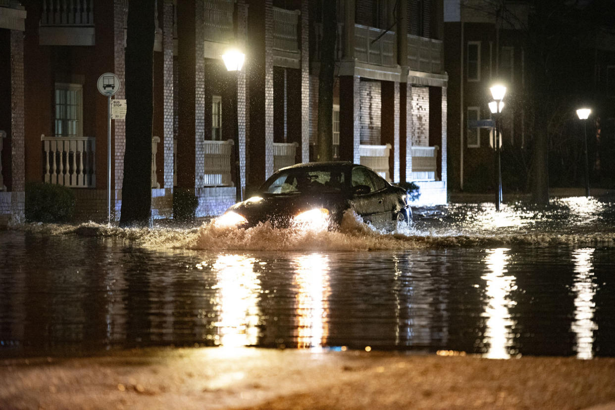
Pictures shared on social media early Wednesday showed coastal areas of Maryland hit by flooding, with parts of Baltimore and Annapolis underwater as winds in parts of the state reached 80 mph.
One man was taken to a local hospital Tuesday night after being rescued from floodwaters in Beltsville, Maryland, about 15 miles northeast of Washington, Prince George's County Fire said in a statement. He was given CPR after being pulled from a building by a good Samaritan, but was said to be unresponsive. His condition is not known.
Stormy weather has killed five people across the country this week so far.
The National Weather Service in New York warned after 4 a.m. that low-lying, coastal areas were entering the coastal flooding stage of the storm, with southern Long Island and southern Queens at high risk.
A warning of high winds was in place for all of New York City, with City Hall warning residents to prepare by gathering supplies and charging cellphones. "Winds at these speeds can cause flying debris, cause unsecured objects to fly, and cause power outages," NYC Emergency Management said in a statement early Wednesday.
LaGuardia Airport ordered a ground stop because of high winds overnight — meaning not a complete halt but longer delays between flights — but other New York airports remained fully operational.
New Jersey Gov. Phil Murphy announced a state of emergency Tuesday in advance of this storm. In New York, officials moved 1,900 migrants from temporary housing in a field in southern Brooklyn to a nearby school, as winds reached over 70 mph, a City Hall spokesman said.
River flooding was possible from southern New England to Maine, the weather service said early Wednesday. Maine was expected to receive 1 to 3 inches of rain Wednesday on already saturated or snow-covered ground, with swollen creeks and streams increasing the flood risk.
Because of the flooding and extremely high seas, an emergency was declared in Hampton, New Hampshire, police said in a post on X.
"Ocean Boulevard is temporarily closed down. Please avoid the area. If you live in the area we recommend you temporarily leave the area for higher ground," authorities said.
In Connecticut, homes and businesses along the Yantic River in Norwich were evacuated following a partial dam break, NBC Connecticut reported. A flash flood warning was issued until 6:45 p.m.
Residents in the area were told that they may not be able to return to their homes and businesses for several days, according to the news station.
Meanwhile, extreme winter weather continues for wide swaths of the country.
State troopers in Nebraska posted video on X showing them towing a stricken semi-trailer on a highway in blizzard conditions.
The weather service said in a storm warning Tuesday night that moderate to heavy snow would continue across parts of the Great Lakes, the Midwest and northern parts of New England, with a winter storm warning continuing for much of these regions.
Parts of Iowa saw more than 15 inches of snow Tuesday, with temperatures in neighboring Nebraska reaching 7 degrees Fahrenheit. Snowfall of 6 to 12 inches was still possible Wednesday from the Great Lakes to northern New England, the agency said.
A low pressure weather system engulfing much of the eastern half of the U.S. was expected to move into Quebec, Canada, on Wednesday afternoon.
In western regions, a weather front moving inward from the Pacific on Wednesday was expected to bring "very heavy" snow to the Cascade Mountains and the Sierra Nevada.
The extreme weather is still not done for this week. A potent Arctic front will move south from Canada later Wednesday bringing some of the coldest temperatures of the winter season so far for the northern Plains region, including possible subzero conditions for Montana and the Dakotas, the weather service warned. A daily high temperature for Oklahoma is expected to be below zero by Friday and the Arctic blast is expected to last beyond that.
