NOAA: Normal spring ahead but beware the return of La Nina
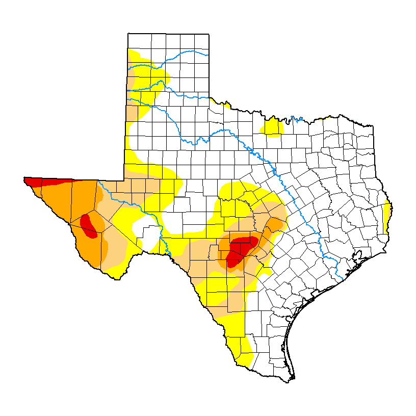
Wichita County is completely free of dry and drought conditions for the first time in two years and has the prospect of generous spring rains.
But government forecasters hint at a possibly ominous change in the months ahead.
The U.S. Drought Monitor map lists Wichita County as “none” in its drought conditions issued Feb. 15. Only tiny portions of Clay, Hardeman and Wilbarger counties are listed as abnormally dry.
Wichita Falls is off to a good start on precipitation in 2024 with 4.23 inches of rain as of Monday morning. That’s more than double the normal figure of 2.1 inches.
That rainfall has enabled the city’s primary reservoirs to register slight rises in water levels after months of decline during drought.
New water levels were not released by the city Monday because of the Presidents’ Day holiday, but Wichita Falls water customers remain under stage 1 drought watch usage restrictions as lakes Arrowhead and Kickapoo hover above 50 percent of combined capacity.
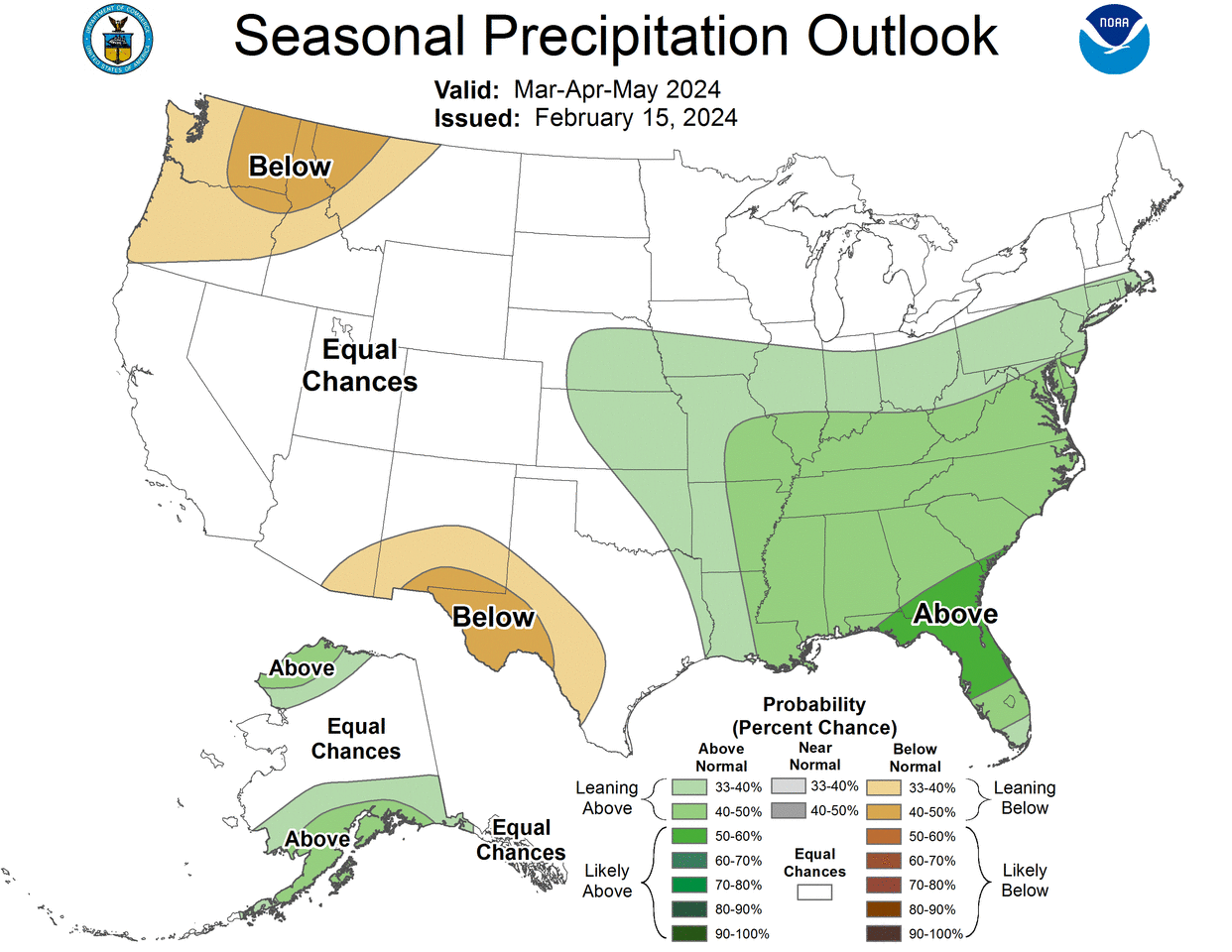
The government’s spring forecast predicts normal temperatures and rainfall for the region from March through May. Those are typically among the wettest months of the year.
Much of the reason for the hopeful outlook is because El Nino conditions exist.
El Nino is the name given to a phenomenon that develops in the Pacific Ocean every few years and affects weather around the globe. In Texas it usually means wetter and cooler weather.
The opposite is La Nina, which brings drier, hotter conditions to the area.
NOAA weather records show La Nina events dominated the period between 2020 into 2023, the same period North Texas experienced its most recent drought.
A very strong La Nina developed in 2010 and remained dominant through most of the historic drought of 2010-2015.
NOAA has said the current El Nino is weakening and La Nina conditions show signs of returning.
A transition from El Nino to El Nino Southern Oscillation-neutral is likely by April to June 2024, and the odds increase for La Nina to develop in June through August 2024, the government’s Climate Prediction Center said in a forecast statement Feb 8.
That means the Wichita Falls area could possibly head into another drought.
A La Nina on the heels of an El Nino could present another threat — wildfire.
Rains from an El Nino allow vegetation to grow. Arrival of La Nina can dry out vegetation, creating fuel for fire, according to the National Science Foundation.
Pacific Ocean phenomena aside, the week ahead will feel like spring in North Texas with daytime high temperatures seesawing from the upper 60s to the lower 80s. No rain is in the forecast.
More: Early voting starts Tuesday: Here's where to go
More: Glass factory, business park on City Council agenda Tuesday
This article originally appeared on Wichita Falls Times Record News: NOAA: Normal spring ahead but beware the return of La Nina
