Strong winds, possible flooding moving into greater Akron area Wednesday evening
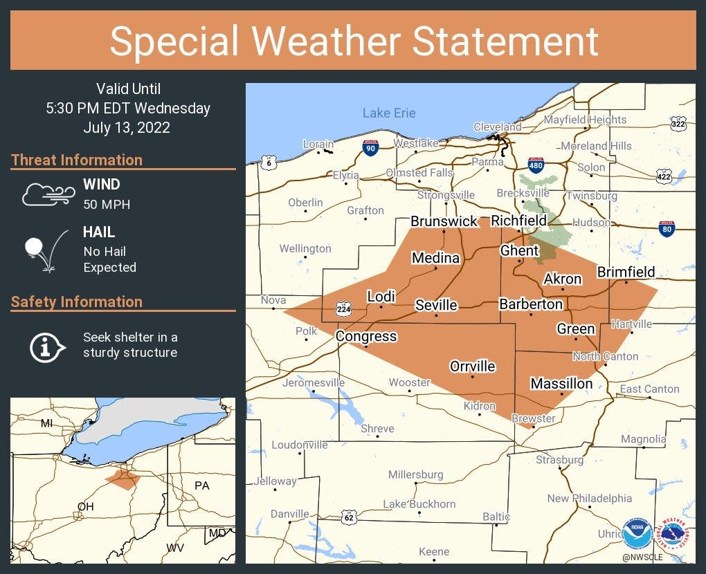
Wind gusts of up to 50 mph are expected Wednesday evening, as a line of thunderstorms moves across northern Ohio inland counties. Some flooding in low-lying areas is also possible, according to the National Weather Service.
Southwestern Portage, Medina, northeastern Ashland, northwestern Stark, Summit and northern Wayne Counties are in the hazard zone. Doppler radar was tracking strong thunderstorms along a line extending from Brunswick to near Chippewa Lake to near West Salem at around 4:40 p.m. Movement was southeast at 30 mph.
The weather service said gusty winds could knock down tree limbs and blow around unsecured objects.
Communities that could be impacted include Akron, Medina, Wooster, Cuyahoga Falls, Brunswick, Massillon, North Royalton, Kent, Barberton, Green, Wadsworth, Tallmadge, North Canton, Orrville, Rittman, Mogadore, Doylestown, Hartville, Lodi and Creston.
Also on Wednesday, a flood advisory has been issued for areas including Summit County, effective through 7:30 p.m., due to the potential for heavy rain from the storm front.
As of 4:22 p.m., Doppler radar indicated heavy rain due to thunderstorms. Minor flooding is ongoing or expected to begin shortly in the advisory area. Between 1 and 2 inches of rain have fallen. Additional rainfall amounts of 1 to 2 inches are expected over the area. This additional rain will result in minor flooding.
Areas that could experience flooding include Cleveland, Lorain, Elyria, Parma, Strongsville, Westlake, North Royalton, North Ridgeville, Solon, Hudson, Twinsburg, Streetsboro, Amherst, Macedonia, North Olmsted, Garfield Heights, Maple Heights, Avon, Parma Heights and Broadview Heights.
This article originally appeared on Akron Beacon Journal: Strong winds, possible flooding moving into greater Akron area
