Strong to severe thunderstorms possible as rain rolls through the Kansas City area
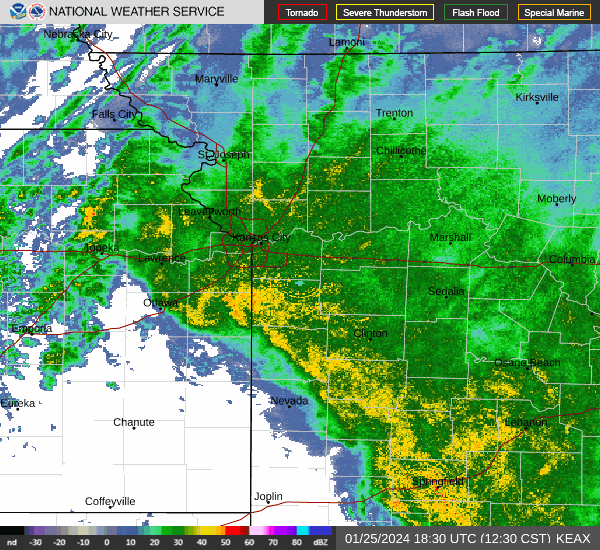
Rain and scattered thunderstorms are expected to sweep across the Kansas City area, bringing a few strong to severe storms to the metro region Wednesday, according to the National Weather Service in Kansas City.
“There remains a slight risk of a few severe storms from late morning through mid-afternoon,” the weather service said on social media. “Damaging winds and locally heavy rainfall are the greatest concerns with the strongest storms.”
Areas to the south and east of the Kansas City metro area are at a greater risk of severe weather. Moderate to heavy rainfall across southwest Missouri and into central and eastern part of the state could see localized flooding. The risk of a tornado from the storms is low.
The weather service is advising people to be aware of the weather and have multiple ways to receive warning information in case severe weather develops.
Temperatures are expected to climb into the upper 60s on Wednesday in the Kansas City area.
A strong cold front that is expected to move through Wednesday night will usher in strong, gusty winds and send temperatures tumbling.
Wind chills will range from the single digits to the teens on Thursday morning. Afternoon temperatures are not expected to climb above freezing.
Cold weather returns overnight, with temperatures falling into the teens. Wind chills of -10 to 5 degrees are possible Friday morning, according to the weather service.
Warmer conditions are expected this weekend. Kansas City could see temperatures of near 50 degrees on Saturday and near 60 degrees on Sunday.
Weather watches and warnings
A live data feed from the National Weather Service containing official weather warnings, watches, and advisory statements. Tap warning areas for more details. Sources: NOAA, National Weather Service, NOAA GeoPlatform and Esri.
