California approaching a record snow year as yet another storm hits
California was hit Monday with yet another winter storm, adding to what has become an unusually cold and wet season that some experts say has the chance to become one of the snowiest on record if conditions continue.
The new winter storm is forecast to bring more rain and snow across the state through Wednesday, though forecasters say it isn't expected to be as exceptional as the previous system, which brought snowfall to unusually low elevations almost statewide. However, the latest system could be indicative of a pattern of moisture-heavy storms over the coming weeks expected to further build up the Sierra's already-epic snowpack — particularly beneficial after California's driest year on record.
"Given the outlook of a continuation of very active and cold, snowy conditions for at least the next couple of weeks, it's very possible we'll end up vying for one of the top two snow years on record in parts of the state," Daniel Swain, a UCLA climate scientist, said in a virtual discussion Monday. "Regardless, we're going to end this year with a very large Sierra Nevada snowpack."
The snowpack, key to the state's water supply, remains well above average for this time of year, and with blizzard warnings across the Sierra Nevada through Wednesday, Swain said its depth will probably grow in the coming days — and possibly weeks. The National Weather Service has forecast up to 6 feet of additional snow through Wednesday in the Sierra, and up to 2 feet in Southern California's mountains, which saw unprecedented snowfall last week.
“It'll be interesting to see how this goes over the next few weeks before the snow accumulation season starts to tail off in April," Swain said. "But every indication right now is that there will be additional substantial snow accumulation events over the next few weeks.”
Although good for the snowpack and the state's ongoing drought, the continued snow over the next few days could bring new dangerous roadway conditions and power outages, officials warn.
Snowfall in the Southern California mountains is forecast to be the "most impactful part of the storm" locally, said David Gomberg, a National Weather Service meteorologist in Oxnard. More than 50 inches fell across many Southland peaks from the last storm, with the Mountain High ski resort in Wrightwood recording more than 90 inches, according to the National Weather Service's final accumulation count.
“This was one of the heavier snow falls on record in the Southern California mountains," Swain said. San Bernardino County officials issued a state of emergency Monday after "residents of mountain communities found themselves trapped at home or unable to reach home due to several feet of snow that fell over the weekend, with more to follow during the next several days," according to the declaration.
This new storm could bring up to 2 more feet of snow in the highest elevations, Gomberg said, which could create more challenges for residents and officials after days of blocked roadways, many still closed due to snow and ice from the last storm. A winter weather advisory is already in effect for most of the region's mountains, which will be upgraded to a winter storm watch Tuesday afternoon until late Wednesday, when heavier snow, high winds and difficult travel is expected.
Five feet of snow in the last five days completely blanketed the Lake Arrowhead area in the San Bernardino Mountains, according to the National Weather Service. The conditions have trapped students at nearby science camps and people in their homes or vacation rentals, and prompted others to ration food and supplies as they wait for more information and assistance.
So much snow hit Lake Arrowhead in the last several days that resident Lisa Griggs couldn’t recognize the highway outside her door when she walked to get groceries.
“You wouldn’t believe it was the same highway,” Griggs said. “It’s [now] a one-lane highway. It’s very narrow, and it’s not plowed at all. So, people are getting stuck in their [cars]. There are cars just being abandoned because, you know, nobody can get through.”
Griggs, who lives in the Blue Jay community, said that when there was a break in the snow Sunday, she made the two-mile round trip on Highway 189 to her local Stater Bros. store on foot to get groceries. She said she’s grateful to still have electricity but now is worrying about older residents or people on vacation who didn’t bring enough food — especially with another storm is on the way.
Hundreds of students from Irvine were stranded on their field trips to science camp in the nearby communities of Crestline and Running Springs over the weekend, after the roads to the Pali Institute Outdoor Education Center and the Thousand Pines Camp were inaccessible, Irvine Unified School District spokesperson Annie Brown said.
Parents were notified Monday that buses would be making the trip to the campsites — three days later than planned — with an escort from the California Highway Patrol.
The snow line in Lake Arrowhead will stay low Tuesday, at around 3,500 to 4,000 feet, but could dip even lower to around 2,500 feet toward the tail end of the storm Wednesday.
The Red Cross on Monday opened a shelter at Redlands East Valley High School for "mountain residents unable to return home and seeking safe shelter."
“Many people in their lifetime never experienced this type of snowfall,” said meteorologist Dan Gregoria with the National Weather Service in San Diego.
Another (weaker) storm will impact the area tonight-Weds. Snow levels will be lowest Tues-Weds. While we won't see snow levels quite as low as this last storm, the Grapevine will still be affected. Make sure to check road conditions before any travel! #CAwx#LArain#LAwx#socalpic.twitter.com/zRX5XDMn0Z
— NWS Los Angeles (@NWSLosAngeles) February 26, 2023
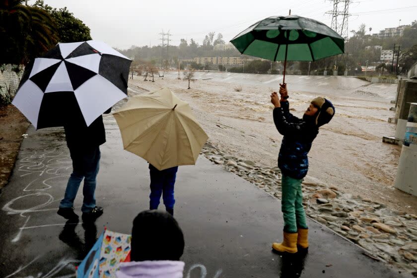
At lower elevations, the Southern California coasts and valleys can expect around 1 inch of rain from the storm through Wednesday, while the foothills could see up to 2 inches, forecasts show — significantly less than totals from last week.
Though the latest storm is not expected to dump excessive amounts, Gomberg said given the already fragile conditions across Southern California, this back-to-back rainfall could cause more significant issues — as crews continue to respond to thousands without power in Los Angeles County and roadways still closed from debris.
“If this rain was just on its own, it wouldn't be that big a concern, but because everything is loose and saturated already, it becomes more of an issue,” Gomberg said.
The last storm, which brought record-breaking rainfall, caused flooding, downed trees and unleashed mudslides and rockslides across the region, including one big slide in La Cañada Flintridge that damaged multiple properties, including Gevorg Terteryan's home on Paulette Place. The city saw more than 9 inches of rain in just a few days, records show.
Terteryan said he was awake early Saturday when part of the hillside behind his house collapsed, dumping loads of mud and debris into his home. No one was injured, but he said officials yellow-tagged the house early Monday — the home in which he planned to spend the rest of his life when he bought it less than four years ago.
"That's the home that I said, 'This is where I want to die,'" the 55-year-old said. "It's tragic. I can't right now find the words. ... We're thankful to God we're OK."

He said his wife and 15-year-old son were sleeping when he heard what sounded like "a bomb explosion," before mud breached his home, piling up just 2 feet from where his son was sleeping. Of the almost 2,300-square-foot home, he said about 700 square feet had been demolished.
Though his home saw the worst damage this weekend, he said the steep hill — on which two homes sit — remains a worry as rain probably picks back up.
"Everybody's concerned," Terteryan said. “Just the thought that could come down ... it will devastate like half of our street, I don’t want to even think about that.”
Other areas saw massive amounts of rain: More than 10 inches fell in Woodland Hills and Stunt Ranch in the Santa Monica Mountains, while Pasadena recorded more than 8 inches and downtown L.A. and Culver City around 5 inches. Los Angeles International Airport and Hollywood Burbank Airport both broke records for rainfall Friday, Gomberg said. In a 24-hour period, LAX got 2.04 inches, easily breaking its previous record for Feb. 24 of three-quarters of an inch from 2000. At Burbank's airport, 4.61 inches fell, breaking the previous record of 3.87 inches from 1998.
Winds from this storm will also be “not as strong as the last event" but still a concern, Gomberg said, with a wind advisory in effect through Monday night for the Antelope Valley. The mountains could see gusts up to 70 mph, advisories said.
Lake Arrowhead resident Nathalie Granger is trying to deal with effects from the last storm while preparing for the next. The 33-year-old said she has shared baby wipes, milk and dog food with neighbors in the last few days and plans to dig out her generator and fuel in case she loses power.
“There is a level of panic ... setting in,” Granger said. “It sounds silly, but we’re going to be rationing our fuel between ourselves and two other neighbors."
Though she had electricity as of Monday, Granger said she doesn’t know what to expect with the next storm. She said still she’s concerned about the vacationers stranded in Lake Arrowhead with limited resources, and the possibility that people from other parts of California are going to hear about the snow and want to visit the area.
“I just want everybody to be safe,” she said. “Let’s look at this a little bit more responsibly ... as I don’t want anything bad to happen to anyone.”
This story originally appeared in Los Angeles Times.
