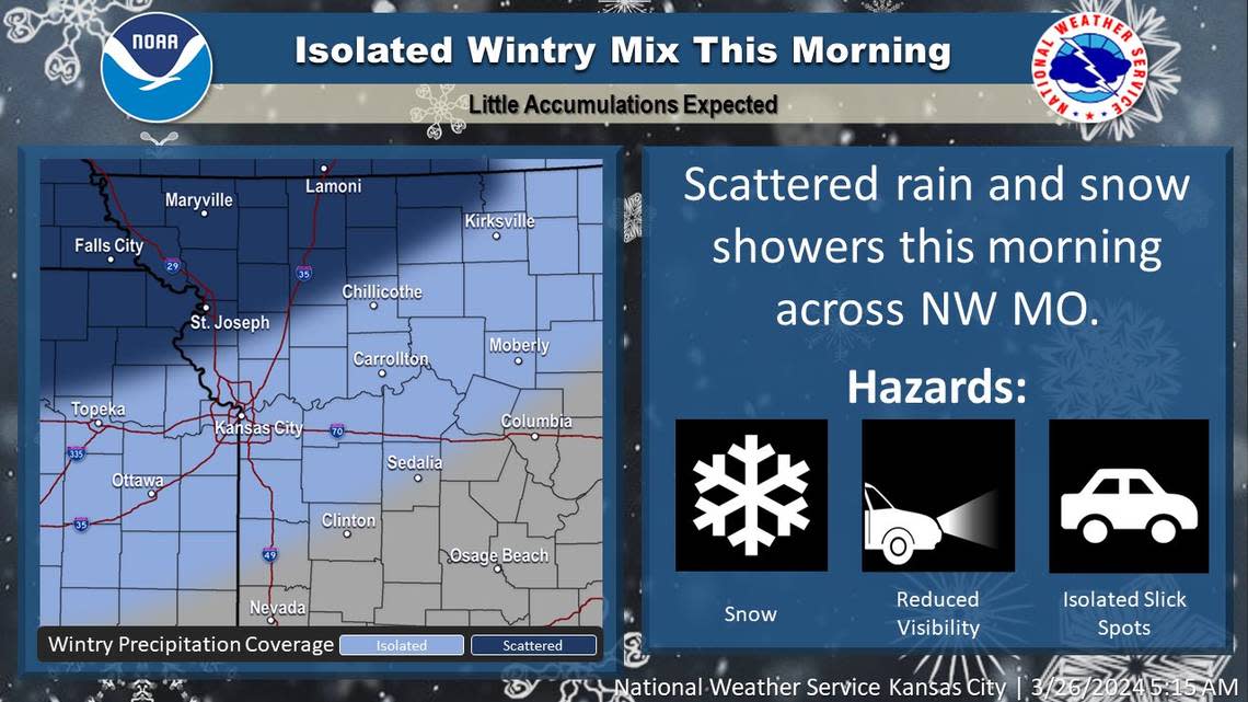
‘That is snow.’ Slick spots may appear as scattered rain, wintry mix falls in KC area
The weather might have some folks in the Kansas City area doing a double-take when they peek out their windows Tuesday morning.
“Your eyes do not deceive you, that is snow,” the National Weather Service said X, formerly Twitter.
Snowflakes mixing with scattered rain may linger through the morning, with light to no accumulation possible primarily on metal and grassy surfaces.
“There may be some slick spots out on the roads this morning so exercise caution when traveling,” the weather service said.
Areas north of Kansas City were more likely to see snowflakes, although an isolated wintry mix was possible in the metro area.
Cold air is expected to filter in as the storm system moves away from the region. The temperature in Kansas City is expected to reach a high of 43 degrees. That’s a 20 degree difference from Monday, which saw the temperature reach 65 degrees at Kansas City International Airport. Temperatures typically are 59 degrees this time of year in Kansas City.
Hard freeze expected
Overnight temperatures will tumble into the lower to mid-20s across much of the Kansas City area.
“This will result in a hard freeze across the area,” the weather service said in its forecast discussion. “It is still early in the growing season but we are several weeks ahead of normal. So folks with sensitive vegetation will need to take precautions from these unseasonably cold temperatures.”
While warmer weather is coming, temperatures will rebound only to the low 50s on Wednesday.
Opening day for the Kansas City Royals is expected to be sunny, with temperatures in the mid-60s. Winds will be light, with gusts up to 20 mph.
Temperatures heading into the Easter holiday weekend will return above average, climbing into the mid-70s on Friday and near 70 on Saturday and Sunday.
